MyTopo
Mount Pittsburg Colorado US Topo Map
Couldn't load pickup availability
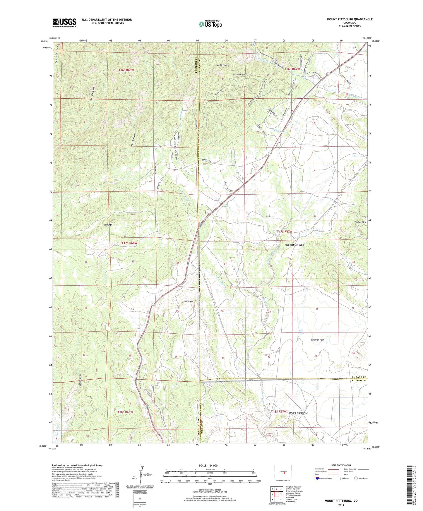
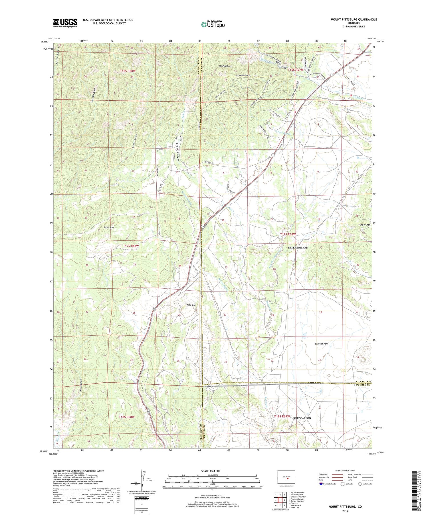
2022 topographic map quadrangle Mount Pittsburg in the state of Colorado. Scale: 1:24000. Based on the newly updated USGS 7.5' US Topo map series, this map is in the following counties: Fremont, El Paso, Pueblo. The map contains contour data, water features, and other items you are used to seeing on USGS maps, but also has updated roads and other features. This is the next generation of topographic maps. Printed on high-quality waterproof paper with UV fade-resistant inks.
Quads adjacent to this one:
West: Phantom Canyon
Northwest: Big Bull Mountain
North: Mount Big Chief
Northeast: Cheyenne Mountain
East: Timber Mountain
Southeast: Stone City
South: Pierce Gulch
Southwest: Florence
This map covers the same area as the classic USGS quad with code o38104e8.
Contains the following named places: Booth Gulch Pit, East Fork Red Creek, East Mill Gulch, Ford Ranch Quarry, Fords Mountaindale Ranch, Fort Carson Fire and Emergency Services Station 34, Mount Pittsburg, Patton Canyon, Pinehurst Ranch, Red Creek Canyon, Red Creek Ranch, Salt Creek Mine, Southwest Highway 115 Fire Protection District, Strobel Ditch, Sullivan Park, Table Mountain, Timber Mountain, Turkey Canyon, Turkey Creek Ranch, West Fork Red Creek, Wild Mountain