
MyTopo
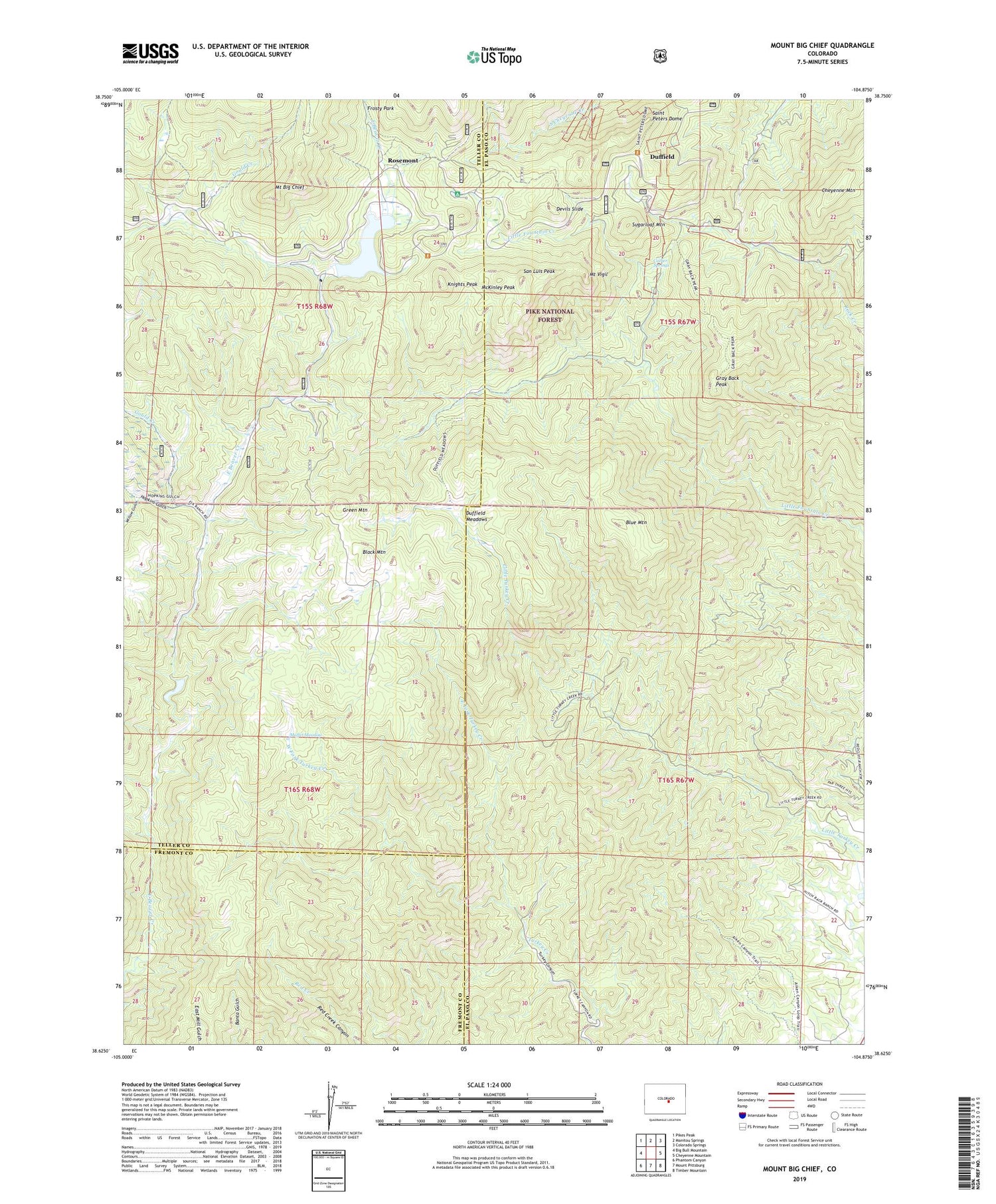
Mount Big Chief Colorado US Topo Map
Couldn't load pickup availability
Also explore the Mount Big Chief Forest Service Topo of this same quad for updated USFS data
2022 topographic map quadrangle Mount Big Chief in the state of Colorado. Scale: 1:24000. Based on the newly updated USGS 7.5' US Topo map series, this map is in the following counties: El Paso, Teller, Fremont. The map contains contour data, water features, and other items you are used to seeing on USGS maps, but also has updated roads and other features. This is the next generation of topographic maps. Printed on high-quality waterproof paper with UV fade-resistant inks.
Quads adjacent to this one:
West: Big Bull Mountain
Northwest: Pikes Peak
North: Manitou Springs
Northeast: Colorado Springs
East: Cheyenne Mountain
Southeast: Timber Mountain
South: Mount Pittsburg
Southwest: Phantom Canyon
This map covers the same area as the classic USGS quad with code o38104f8.
Contains the following named places: Black Mountain, Blue Mountain, Broadmoor Lodge, Cather Springs, Cheyenne Mountain, Cheyenne Mountain Division, Comanche Group Mine, Devils Slide, Duffield, Duffield Meadows, East Fork Turkey Creek, Emerald Valley Boys Camp, Emerald Valley Ranch, Glen Cairn Dam, Glen Cairn Reservoir, Gould Creek, Gray Back Peak, Green Mountain, Heavy Stone Lode, Hopkins Gulch, Knights Peak, McKinley Peak, Moffet Meadow, Mount Big Chief, Mount Vigil, Pecks Camp, Penrose-Rosemont Dam, Penrose-Rosemont Reservoir, Rosemont, Saint Peters Dome, Saint Peters Dome Mine, San Luis Peak, Stage Road Picnic Ground, Sugarloaf Mountain, Timberline Mine, Turkey Canyon Ranch, West Fork Turkey Creek, Willow Gulch, Winfield Scott Stratton Mine, Wye Campground, ZIP Code: 80926


