MyTopo
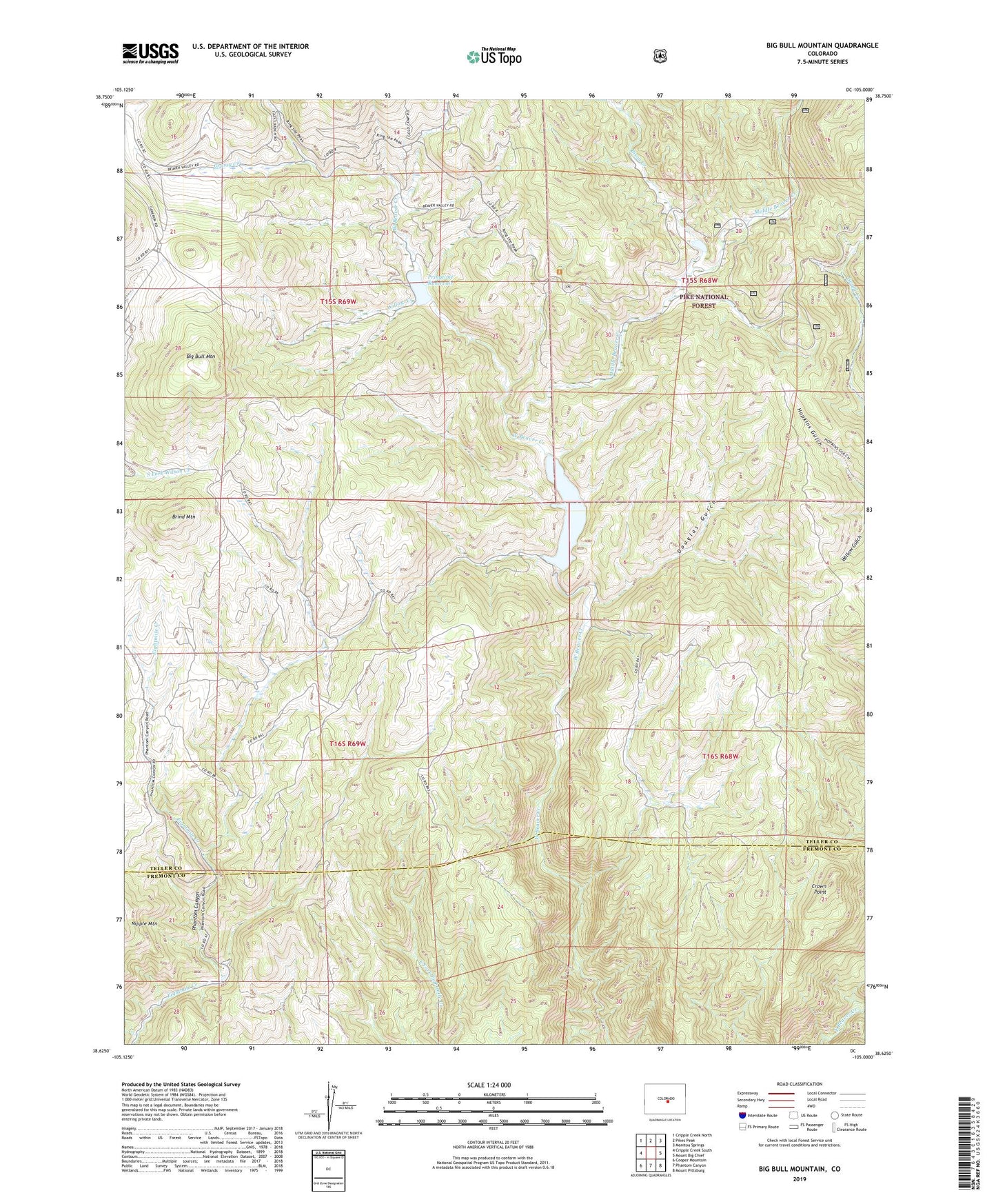
Big Bull Mountain Colorado US Topo Map
Couldn't load pickup availability
Also explore the Big Bull Mountain Forest Service Topo of this same quad for updated USFS data
2022 topographic map quadrangle Big Bull Mountain in the state of Colorado. Scale: 1:24000. Based on the newly updated USGS 7.5' US Topo map series, this map is in the following counties: Teller, Fremont. The map contains contour data, water features, and other items you are used to seeing on USGS maps, but also has updated roads and other features. This is the next generation of topographic maps. Printed on high-quality waterproof paper with UV fade-resistant inks.
Quads adjacent to this one:
West: Cripple Creek South
Northwest: Cripple Creek North
North: Pikes Peak
Northeast: Manitou Springs
East: Mount Big Chief
Southeast: Mount Pittsburg
South: Phantom Canyon
Southwest: Cooper Mountain
This map covers the same area as the classic USGS quad with code o38105f1.
Contains the following named places: Beaver Creek State Wildlife Area, Big Bull Mountain, Bison Creek, Brind Mountain, Brown Mine, Cathedral Park, Clyde, Clyde Campground, Crown Point, Douglas Gulch, Gold Knob Mine, Grassy Creek, Homestake Mine, Little May Mine, Lower Beaver Park, Middle Beaver Creek, Middle Cottonwood Creek, North Cascade Mine, Pringtime Dam, Pringtime Reservoir, Skaguay Dam, Skagway Reservoir, Triumph Mine, Victor Mine, Willow Creek, ZIP Code: 80860