MyTopo
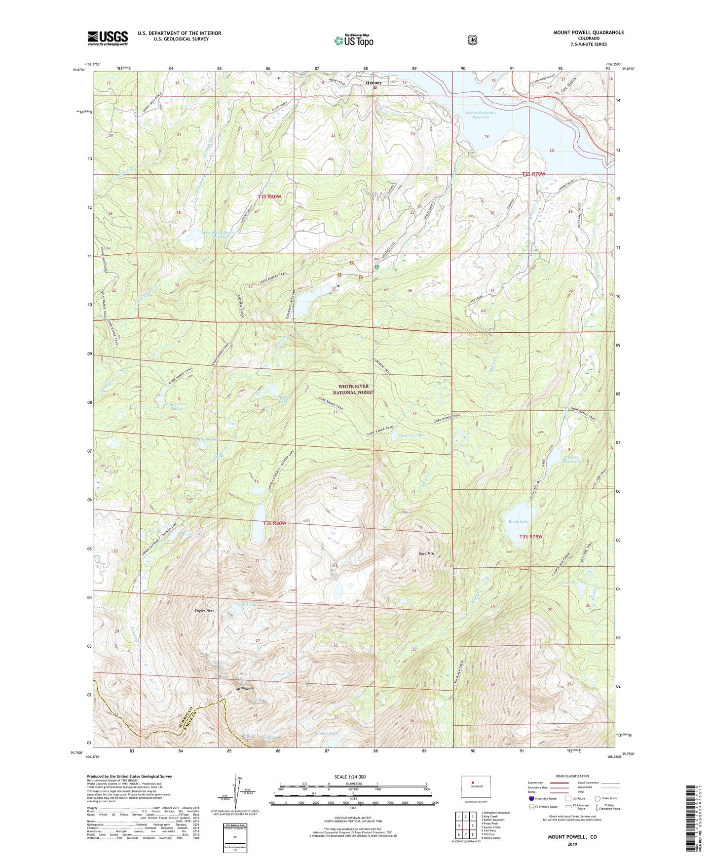
Mount Powell Colorado US Topo Map
Couldn't load pickup availability
Also explore the Mount Powell Forest Service Topo of this same quad for updated USFS data
2022 topographic map quadrangle Mount Powell in the state of Colorado. Scale: 1:24000. Based on the newly updated USGS 7.5' US Topo map series, this map is in the following counties: Summit, Eagle. The map contains contour data, water features, and other items you are used to seeing on USGS maps, but also has updated roads and other features. This is the next generation of topographic maps. Printed on high-quality waterproof paper with UV fade-resistant inks.
Quads adjacent to this one:
West: Piney Peak
Northwest: Sheephorn Mountain
North: King Creek
Northeast: Battle Mountain
East: Squaw Creek
Southeast: Willow Lakes
South: Vail East
Southwest: Vail West
This map covers the same area as the classic USGS quad with code o39106g3.
Contains the following named places: Black Creek, Black Creek Dam, Black Creek Reservoir, Black Lake, Bubble Lake, Cat Lake, Cataract Creek, Cliff Lake, Cottonwood Gulch, Cox Gulch, Doig Lake, Dora Lake, Dora Mountain, Duck Lake, Eagles Nest, Eaglesmere Lakes, Eaglesmere Trail, Gore Range, Green Mountain Reservoir, Griffith Lake, Guthrie Thomas Ditch, Heeney, Heeney Census Designated Place, Hoagland Number 1 Dam, Hoagland Reservoir Number 1, Lakeside Hall, Lost Lake, Lost Lake Dam, Lost Lake Trail, Lower Blue Fire Protection District, Lower Cataract Lake, Martin Creek, Mirror Lake, Mount Powell, North Fork Elliott Creek, Otter Creek, Surprise Lake, Surprise Trail, Tipperary Lake, Upper Cataract Lake