MyTopo
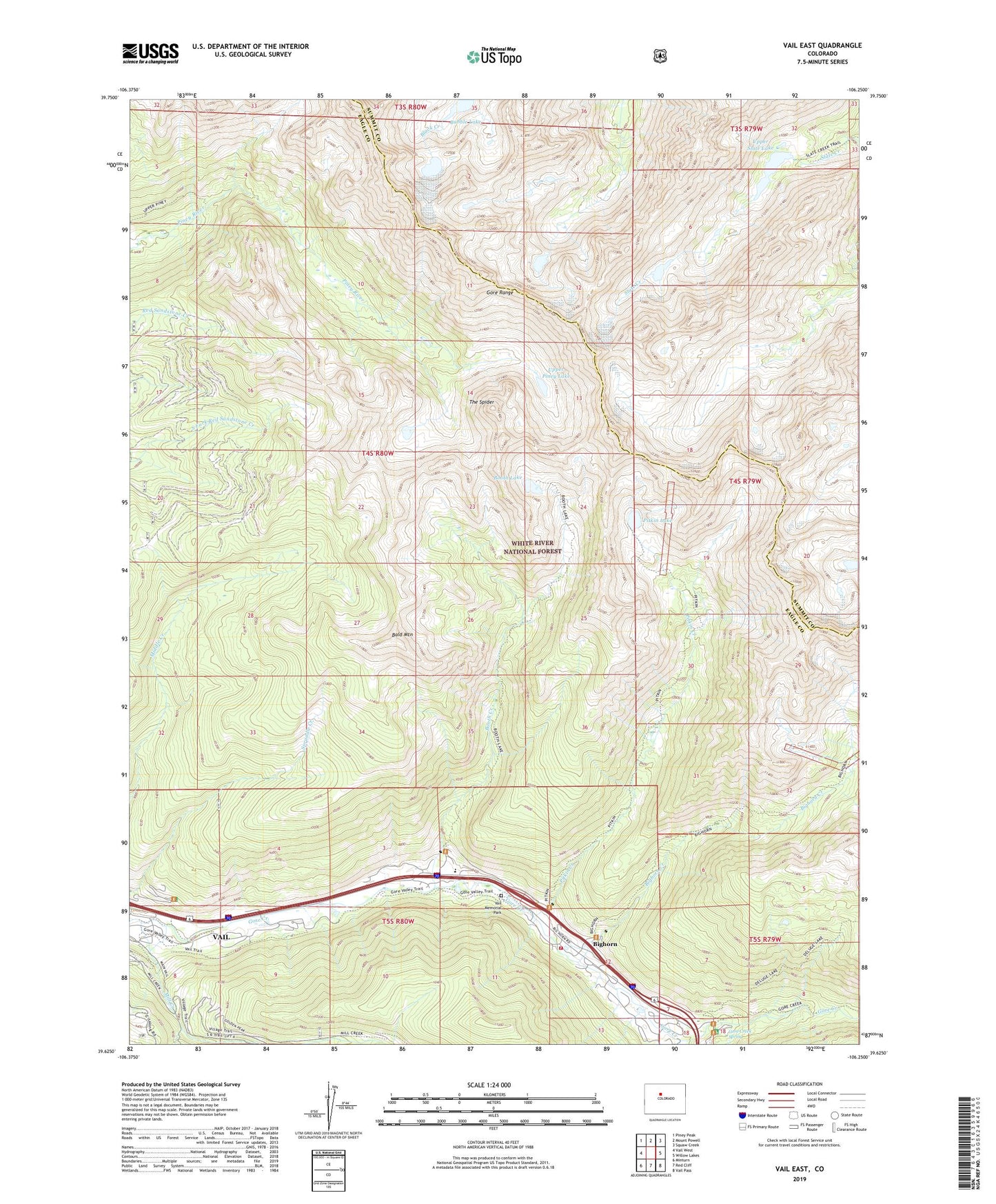
Vail East Colorado US Topo Map
Couldn't load pickup availability
Also explore the Vail East Forest Service Topo of this same quad for updated USFS data
2022 topographic map quadrangle Vail East in the state of Colorado. Scale: 1:24000. Based on the newly updated USGS 7.5' US Topo map series, this map is in the following counties: Eagle, Summit. The map contains contour data, water features, and other items you are used to seeing on USGS maps, but also has updated roads and other features. This is the next generation of topographic maps. Printed on high-quality waterproof paper with UV fade-resistant inks.
Quads adjacent to this one:
West: Vail West
Northwest: Piney Peak
North: Mount Powell
Northeast: Squaw Creek
East: Willow Lakes
Southeast: Vail Pass
South: Red Cliff
Southwest: Minturn
This map covers the same area as the classic USGS quad with code o39106f3.
Contains the following named places: Bald Mountain, Bighorn, Bighorn Creek, Black Gore Creek, Booth Creek, Booth Lake, Deluge Lake Trail, Eagles Nest Wilderness, Gore Creek Campground, Gore Creek Spring, Pitkin Creek, Pitkin Lake, The Spider, Town of Vail, Upper Piney Lake, Upper Slate Lake, Vail, Vail Fire Department Station 1, Vail Memorial Park, ZIP Codes: 80498, 81657