MyTopo
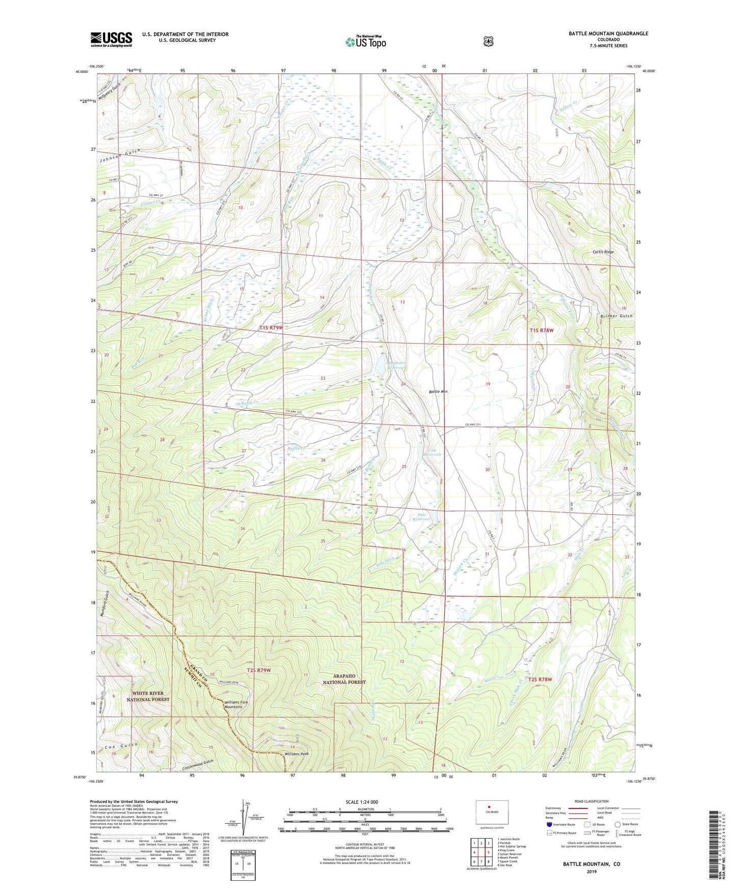
Battle Mountain Colorado US Topo Map
Couldn't load pickup availability
Also explore the Battle Mountain Forest Service Topo of this same quad for updated USFS data
2022 topographic map quadrangle Battle Mountain in the state of Colorado. Scale: 1:24000. Based on the newly updated USGS 7.5' US Topo map series, this map is in the following counties: Grand, Summit. The map contains contour data, water features, and other items you are used to seeing on USGS maps, but also has updated roads and other features. This is the next generation of topographic maps. Printed on high-quality waterproof paper with UV fade-resistant inks.
Quads adjacent to this one:
West: King Creek
Northwest: Junction Butte
North: Parshall
Northeast: Hot Sulphur Springs
East: Sylvan Reservoir
Southeast: Ute Peak
South: Squaw Creek
Southwest: Mount Powell
This map covers the same area as the classic USGS quad with code o39106h2.
Contains the following named places: Battle Mountain, Brinker Gulch, Bull Run, Cole Dam, Cole Reservoir, Columbine School, Cow Creek, Curtis Ridge, Dale Dam, Dale Ditch, Dale Reservoir, Langholen Dam, Langholen Reservoir, Lost Creek, Mule Creek, North Battle Creek, North Skylark Ditch, Rohan Ditch, Skylark Creek, South Battle Creek, South Fork Mule Creek, Williams Peak, Williams Peak Trail, Willow View School