MyTopo
Steamboat Springs Colorado US Topo Map
Couldn't load pickup availability
Also explore the Steamboat Springs Forest Service Topo of this same quad for updated USFS data
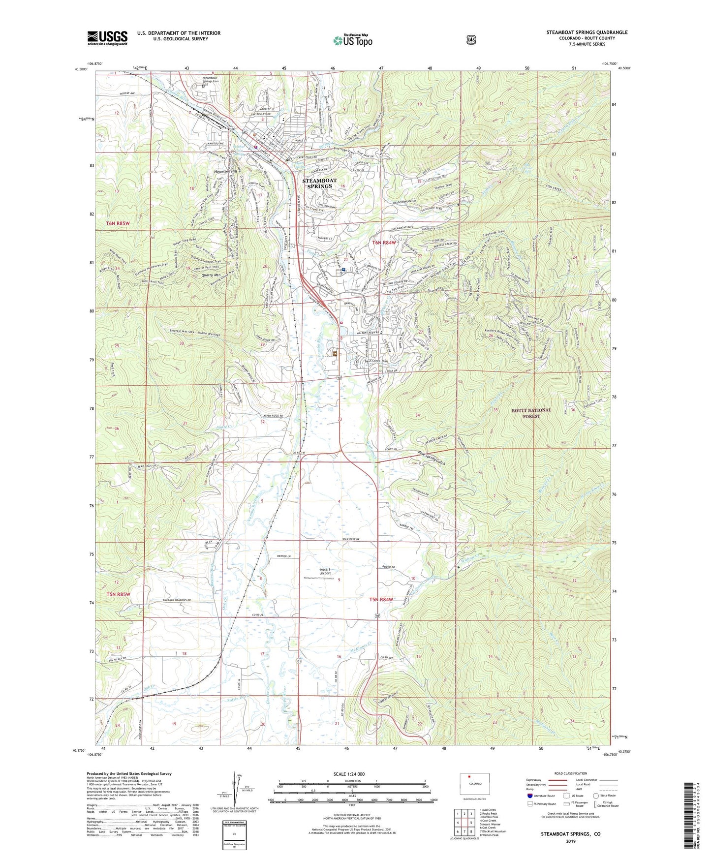
2022 topographic map quadrangle Steamboat Springs in the state of Colorado. Scale: 1:24000. Based on the newly updated USGS 7.5' US Topo map series, this map is in the following counties: Routt. The map contains contour data, water features, and other items you are used to seeing on USGS maps, but also has updated roads and other features. This is the next generation of topographic maps. Printed on high-quality waterproof paper with UV fade-resistant inks.
Quads adjacent to this one:
West: Cow Creek
Northwest: Mad Creek
North: Rocky Peak
Northeast: Buffalo Pass
East: Mount Werner
Southeast: Walton Peak
South: Blacktail Mountain
Southwest: Oak Creek
This map covers the same area as the classic USGS quad with code o40106d7.
Contains the following named places: Agate Creek, Batton Ditch, Batton Gulch, Baxter Ditch, Bear Creek, Beaver Creek, Burgess Creek, Butcherknife Creek, City of Steamboat Springs, Colorado Alpine College, Fair-U Mine, Fish Creek, Fish Creek Falls, Fish Creek Falls Picnic Area, Fish Creek Filtration Plant, Grouse Creek, Heart Spring, Howelsen Hill, Howelsen Hill Ski Area, KBCR-AM (Steamboat Springs), KSBS-TV (Steamboat Springs), KSBT-FM (Steamboat Springs), McKinnis Creek, Mesa 1 Airport, North Fork Fish Creek, Oak Creek, Pine Spring Gulch, Priest Creek, Quarry Mountain, Sidney, Site Two Forest Service Facility, Soda Creek, Spring Creek, Steamboat Ski Area, Steamboat Springs, Steamboat Springs Cemetery, Steamboat Springs Fire Rescue Ambulance / Search and Rescue Barn, Steamboat Springs Fire Rescue Central Fire Station, Steamboat Springs Fire Rescue Mountain Fire Station, Steamboat Springs Police Department, Steamboat Springs Post Office, Storm King Creek, Sulphur Cave Spring, Suttle Ditch, Walton Creek, Walton Creek Ditch, Yampa Valley Medical Center, ZIP Codes: 80477, 80488