MyTopo
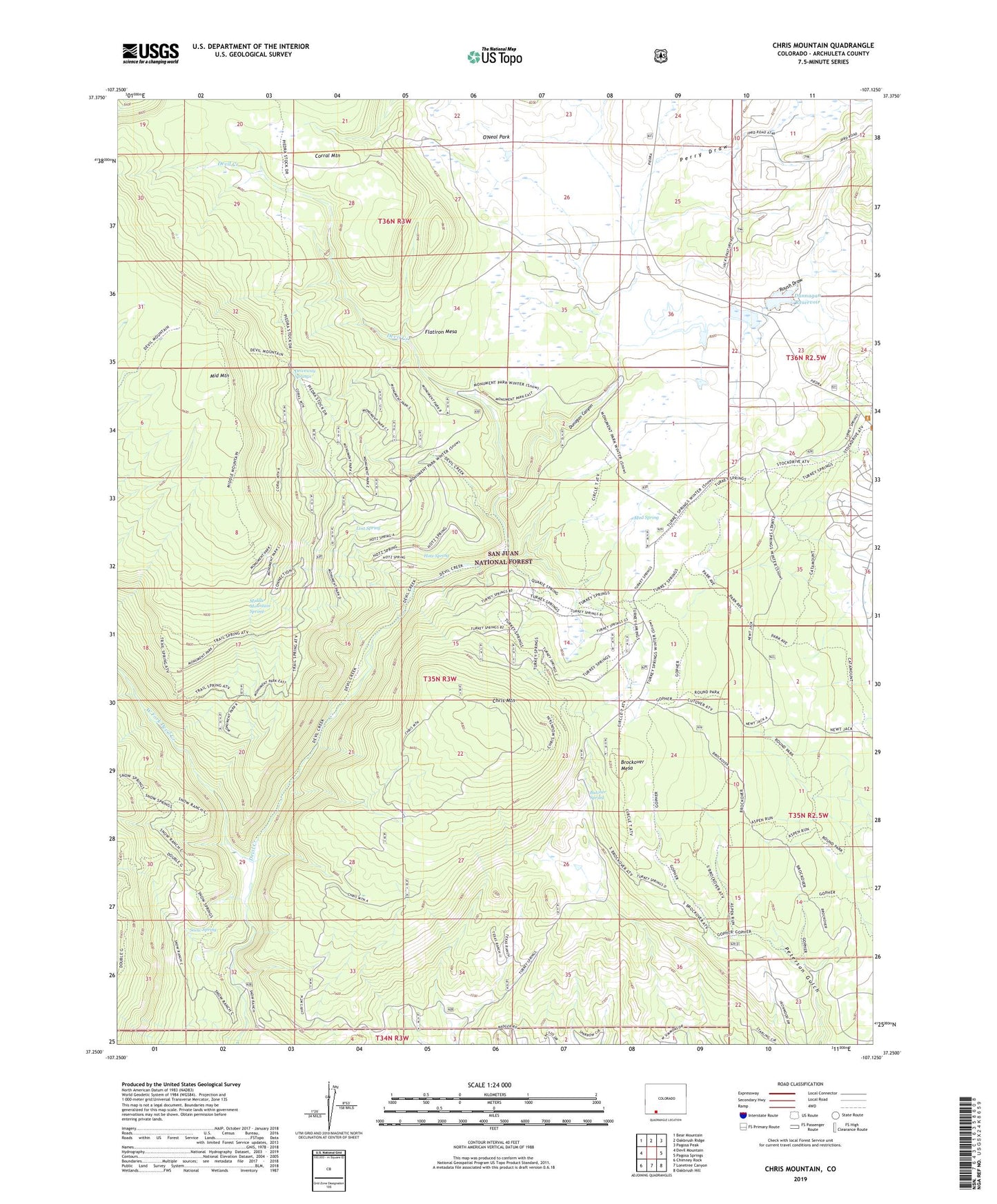
Chris Mountain Colorado US Topo Map
Couldn't load pickup availability
Also explore the Chris Mountain Forest Service Topo of this same quad for updated USFS data
2022 topographic map quadrangle Chris Mountain in the state of Colorado. Scale: 1:24000. Based on the newly updated USGS 7.5' US Topo map series, this map is in the following counties: Archuleta. The map contains contour data, water features, and other items you are used to seeing on USGS maps, but also has updated roads and other features. This is the next generation of topographic maps. Printed on high-quality waterproof paper with UV fade-resistant inks.
Quads adjacent to this one:
West: Devil Mountain
Northwest: Bear Mountain
North: Oakbrush Ridge
Northeast: Pagosa Peak
East: Pagosa Springs
Southeast: Oakbrush Hill
South: Lonetree Canyon
Southwest: Chimney Rock
This map covers the same area as the classic USGS quad with code o37107c2.
Contains the following named places: Brockover Mesa, Butcher Spring, Chris Mountain, Driveway Springs, Dunagan Canyon, Dunnagan Dam, Dunnagan Reservoir, Flatiron Mesa, Fourmile Stock Trail, Gopher Reservoir, Hotz Spring, Lost Spring, Middle Mountain, Middle Mountain Spring, Middle Mountain Trail, Mud Spring, Newt Jack Spring Reservoir, O'Neal Park, Osborn Reservoir Number 1, Osborn Reservoir Number 2, Park Reservoir, Perino Reservoir, Perry Draw, Piedra Stock Trail, Round Park Reservoir, Roush Draw, Sawmill Reservoir, Snow Angel Ranch, Snow Spring, Texas Ranch, Turkey Springs Campground, Turkey Springs Guard Station, Turkey Springs Reservoir, West Fork Devil Creek