
MyTopo
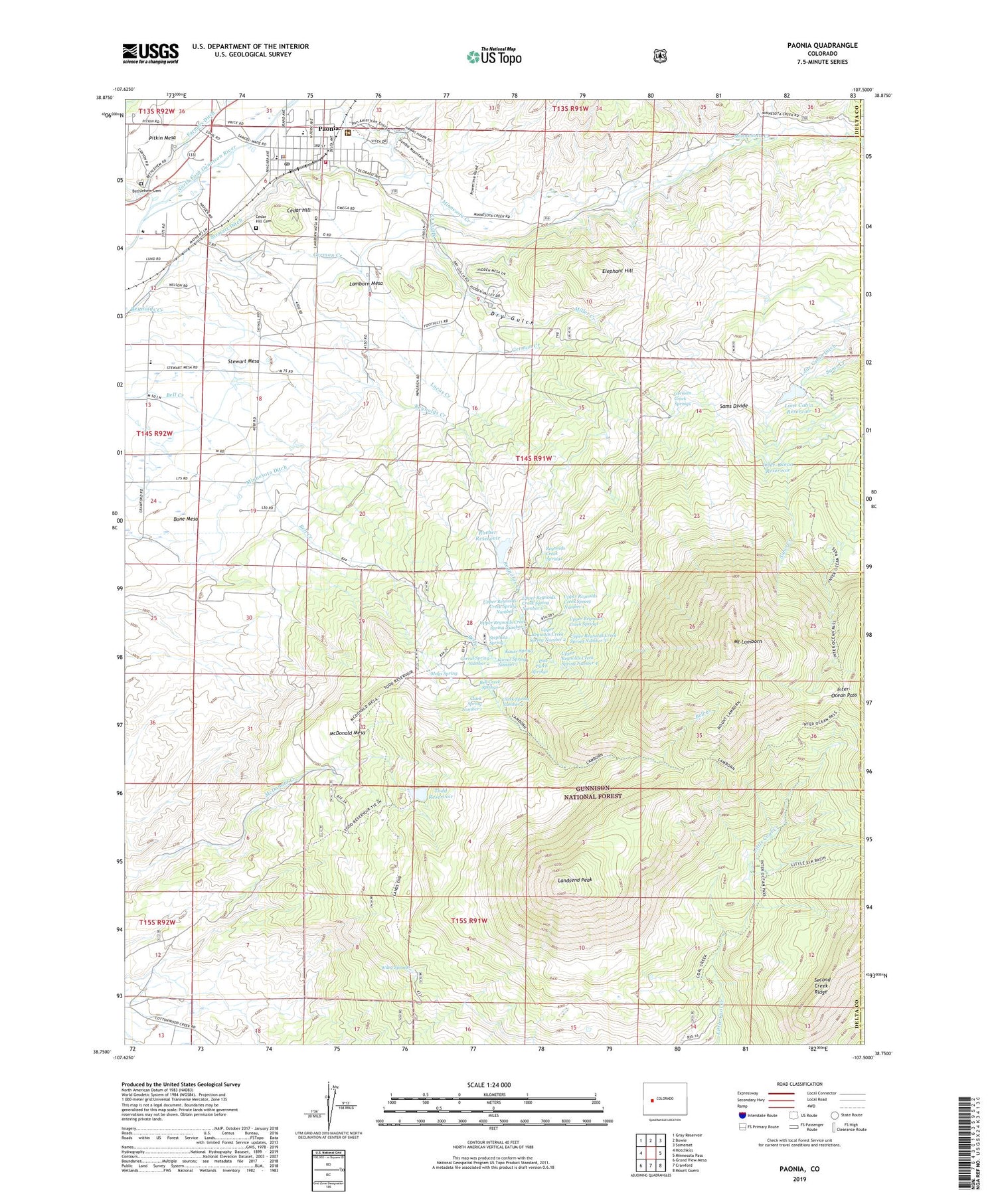
Paonia Colorado US Topo Map
Couldn't load pickup availability
Also explore the Paonia Forest Service Topo of this same quad for updated USFS data
2022 topographic map quadrangle Paonia in the state of Colorado. Scale: 1:24000. Based on the newly updated USGS 7.5' US Topo map series, this map is in the following counties: Delta, Gunnison. The map contains contour data, water features, and other items you are used to seeing on USGS maps, but also has updated roads and other features. This is the next generation of topographic maps. Printed on high-quality waterproof paper with UV fade-resistant inks.
Quads adjacent to this one:
West: Hotchkiss
Northwest: Gray Reservoir
North: Bowie
Northeast: Somerset
East: Minnesota Pass
Southeast: Mount Guero
South: Crawford
Southwest: Grand View Mesa
This map covers the same area as the classic USGS quad with code o38107g5.
Contains the following named places: Bell Creek Springs, Bethlehem Cemetery, Bible Center Church, Bone Mesa, Cedar Hill, Cedar Hill Cemetery, Church of Christ, Church of the Nazarene, Clark Spring Number 1, Clark Spring Number 2, Community Care Hospital of America, Corral Spring Number 1, Corral Spring Number 2, Dry Fork Minnesota Creek, Dry Gulch, Elephant Hill, First Christian Church, Friends Church, German Creek, German Creek Springs, Inter-Ocean Pass, Inter-Ocean Reservoir, Kauer Spring, Lamborn Mesa, Lamborn School, Landsend Peak, Lone Cabin Dam, Lone Cabin Reservoir, Lucas Creek, Mays Spring, McDonald Mesa, Miller Creek, Minnesota Ditch, Mount Lamborn, Needle Rock Ditch, North Fork Baptist Church, Northfork Miners Memorial, Paonia, Paonia Assembly of God, Paonia City Police Department, Paonia Elementary School, Paonia Fire Department, Paonia Middle School, Paonia Municipal and Community Center, Paonia Park, Paonia Post Office, Paonia Public Library, Paonia Volunteer Fire Department - Delta County Fire Protection District 2, Pole Patch Springs, Reynolds Creek Springs, Reynolds Dam, Reynolds Reservoir, Roatcap Creek, Roeber Reservoir, Sacred Heart Catholic Church, Saint Michaels Episcopal Church, Sams Divide, Seventh Day Adventist Church, Stephens Spring, Stewart Ditch, Stewart Mesa, Stewart Mesa School, The Church of Jesus Christ of Latter Day Saints - Paonia Ward, Todd Dam, Todd Reservoir, Town of Paonia, Turner Ditch, United Methodist Church, Upper Reynolds Creek Spring Number 1, Upper Reynolds Creek Spring Number 2, Upper Reynolds Creek Spring Number 3, Upper Reynolds Creek Spring Number 4, Upper Reynolds Creek Spring Number 5, Upper Reynolds Creek Spring Number 6, Upper Reynolds Creek Spring Number 7, Upper Reynolds Creek Springs, Wiley Springs


