MyTopo
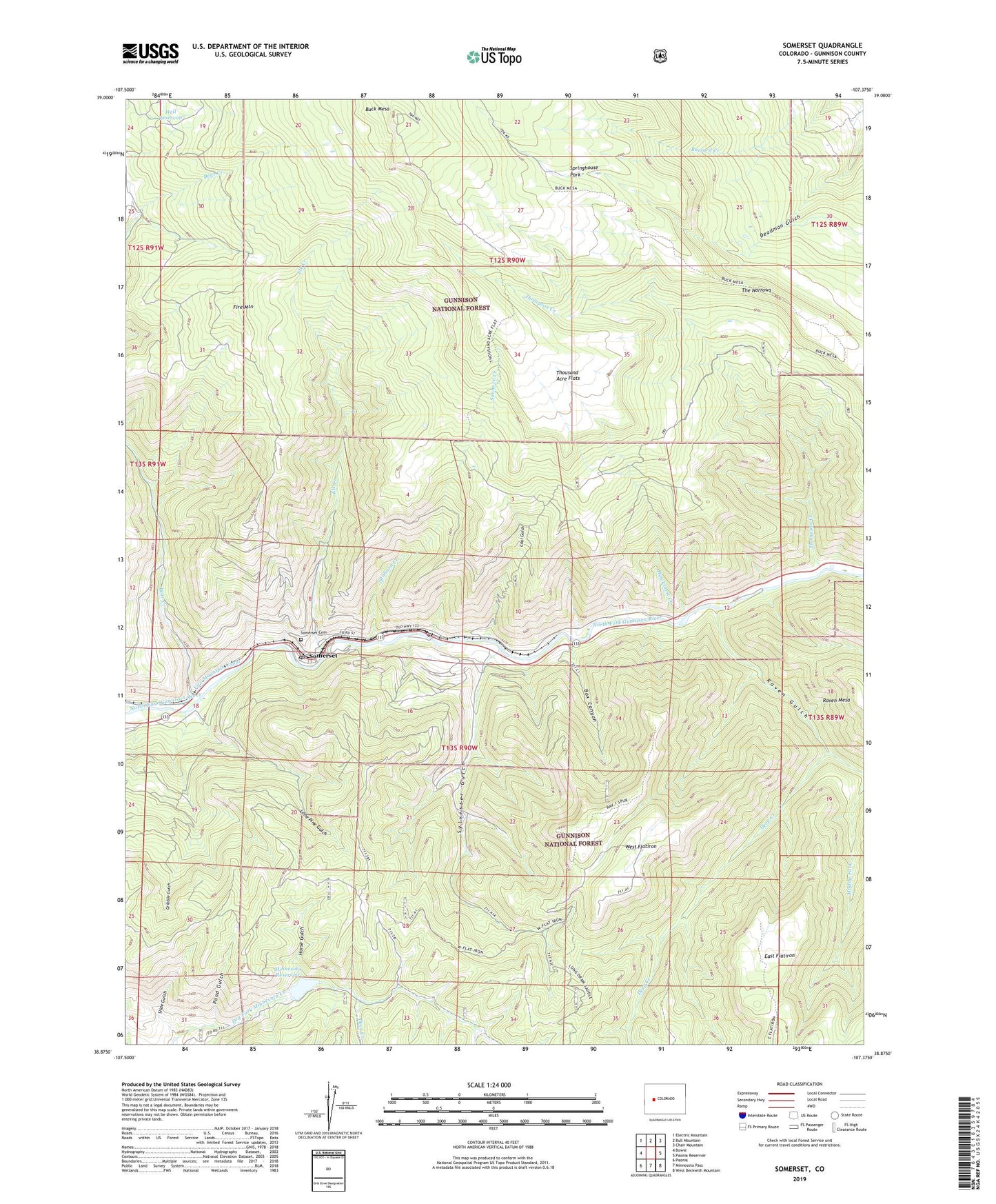
Somerset Colorado US Topo Map
Couldn't load pickup availability
Also explore the Somerset Forest Service Topo of this same quad for updated USFS data
2022 topographic map quadrangle Somerset in the state of Colorado. Scale: 1:24000. Based on the newly updated USGS 7.5' US Topo map series, this map is in the following counties: Gunnison. The map contains contour data, water features, and other items you are used to seeing on USGS maps, but also has updated roads and other features. This is the next generation of topographic maps. Printed on high-quality waterproof paper with UV fade-resistant inks.
Quads adjacent to this one:
West: Bowie
Northwest: Electric Mountain
North: Bull Mountain
Northeast: Chair Mountain
East: Paonia Reservoir
Southeast: West Beckwith Mountain
South: Minnesota Pass
Southwest: Paonia
This map covers the same area as the classic USGS quad with code o38107h4.
Contains the following named places: Axelson Mine, Bear Creek, Bear Mine, Box Canyon, Buck Mesa, Clark Mine, Coal Gulch, Deep Creek, Deer Creek, Dry Fork Cow Camp, East Flatiron, Elk Creek, Fire Mountain, Gribble Gulch, Hall Reservoir, Hawksnest Creek, Hawksnest Mine, Horse Gulch, Hubbard Mine, Kaiser Mine, Lone Pine Gulch, Minnesota Reservoir, Monument Dam, Mount Gunnison Number One Mine, O.C. Mine Number Two, Oliver Mine, Oliver Power Plant, Paonia Coal Drilling Project Mine, Pond Gulch, Raven Gulch, Sanborn Creek, Slide Gulch, Somerset, Somerset B Seam and C Seam Mine, Somerset Cemetery, Somerset Census Designated Place, Somerset Mine, Somerset Post Office, Springhouse Park, Sylvester Gulch, The Narrows, Thompson Creek, Thousand Acre Flats, West Flatiron, ZIP Code: 81434