MyTopo
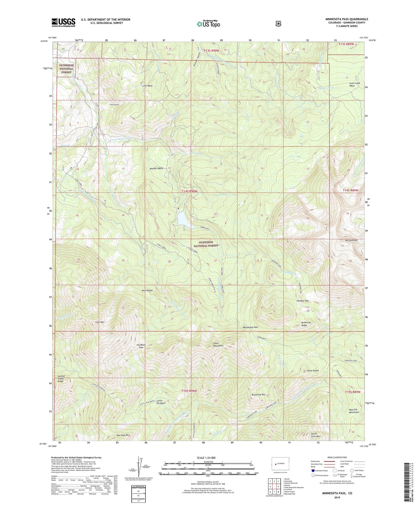
Minnesota Pass Colorado US Topo Map
Couldn't load pickup availability
Also explore the Minnesota Pass Forest Service Topo of this same quad for updated USFS data
2022 topographic map quadrangle Minnesota Pass in the state of Colorado. Scale: 1:24000. Based on the newly updated USGS 7.5' US Topo map series, this map is in the following counties: Gunnison. The map contains contour data, water features, and other items you are used to seeing on USGS maps, but also has updated roads and other features. This is the next generation of topographic maps. Printed on high-quality waterproof paper with UV fade-resistant inks.
Quads adjacent to this one:
West: Paonia
Northwest: Bowie
North: Somerset
Northeast: Paonia Reservoir
East: West Beckwith Mountain
Southeast: Big Soap Park
South: Mount Guero
Southwest: Crawford
This map covers the same area as the classic USGS quad with code o38107g4.
Contains the following named places: Beaver Dam, Beaver Reservoir, Browning Creek, Browning Mountain, Browning Ridge, Chain Mountains, Coal Creek Mesa, Coal Mountain, Deep Creek Ditch, East Fork Minnesota Creek, Elk Basin Pass, Hammond Trail, Hoodoo Creek, Hoodoo Gap, Horse Creek, Lake Fork, Lake Fork Minnesota Creek, Lick Creek, Lion Gulch, Lion Mesa, Little Elk Basin, Lone Cabin Ditch, Minnesota Cow Camp, Minnesota Pass, Minnesota Pass Trail, Mount Gunnison, Poison Gulch, Sams Creek, Second Creek Ridge, South Fork Minnesota Creek, South Prong, Spruce Creek, Sunset Trail, Three Knobs, Through Line Trail, Twin Knobs, Upper Cow Camp, Wooten Mesa