MyTopo
Pleasant View Colorado US Topo Map
Couldn't load pickup availability
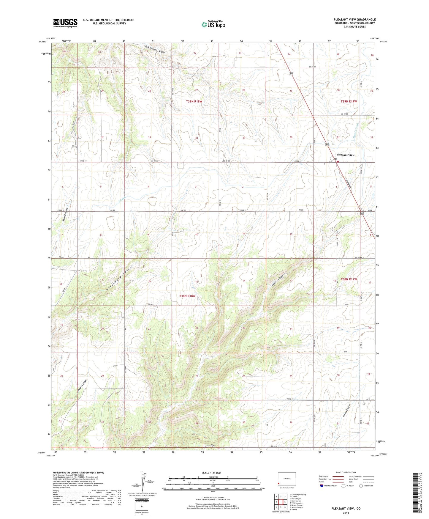
2022 topographic map quadrangle Pleasant View in the state of Colorado. Scale: 1:24000. Based on the newly updated USGS 7.5' US Topo map series, this map is in the following counties: Montezuma. The map contains contour data, water features, and other items you are used to seeing on USGS maps, but also has updated roads and other features. This is the next generation of topographic maps. Printed on high-quality waterproof paper with UV fade-resistant inks.
Quads adjacent to this one:
West: Ruin Canyon
Northwest: Champagne Spring
North: Cahone
Northeast: Doe Canyon
East: Yellow Jacket
Southeast: Arriola
South: Woods Canyon
Southwest: Negro Canyon
This map covers the same area as the classic USGS quad with code o37108e7.
Contains the following named places: Cliff House Group Mine, Dove Creek Canal, Pleasant View, Pleasant View Division, Pleasant View Fire Department, Pleasant View Post Office, Pleasant View Pumping Station, Ruin Canyon Pumping Station, South Canal