MyTopo
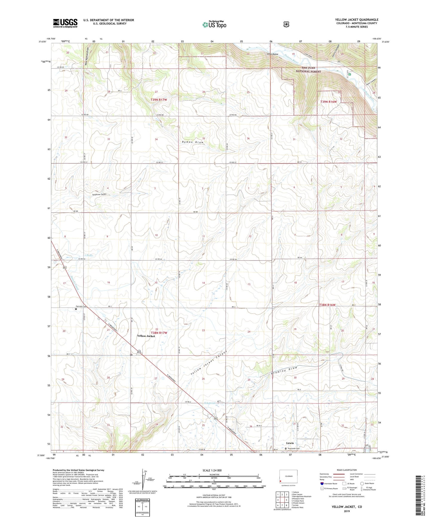
Yellow Jacket Colorado US Topo Map
Couldn't load pickup availability
Also explore the Yellow Jacket Forest Service Topo of this same quad for updated USFS data
2022 topographic map quadrangle Yellow Jacket in the state of Colorado. Scale: 1:24000. Based on the newly updated USGS 7.5' US Topo map series, this map is in the following counties: Montezuma. The map contains contour data, water features, and other items you are used to seeing on USGS maps, but also has updated roads and other features. This is the next generation of topographic maps. Printed on high-quality waterproof paper with UV fade-resistant inks.
Quads adjacent to this one:
West: Pleasant View
Northwest: Cahone
North: Doe Canyon
Northeast: Narraguinnep Mountain
East: Trimble Point
Southeast: Dolores West
South: Arriola
Southwest: Woods Canyon
This map covers the same area as the classic USGS quad with code o37108e6.
Contains the following named places: Dolores River State Wildlife Area, Emmanuel Church, Fairview Cemetery, Ferris Canyon, Lewis - Arriola Fire Protection District Lewis, Lewis Census Designated Place, Lone Dome, Lone Dome Recreation Area, Pleasant View Heliport, Salter Canyon, Sunnyside Cemetery, U Lateral, Yellow Jacket, Yellow Jacket Post Office, ZIP Code: 81327