MyTopo
Champagne Spring Colorado US Topo Map
Couldn't load pickup availability
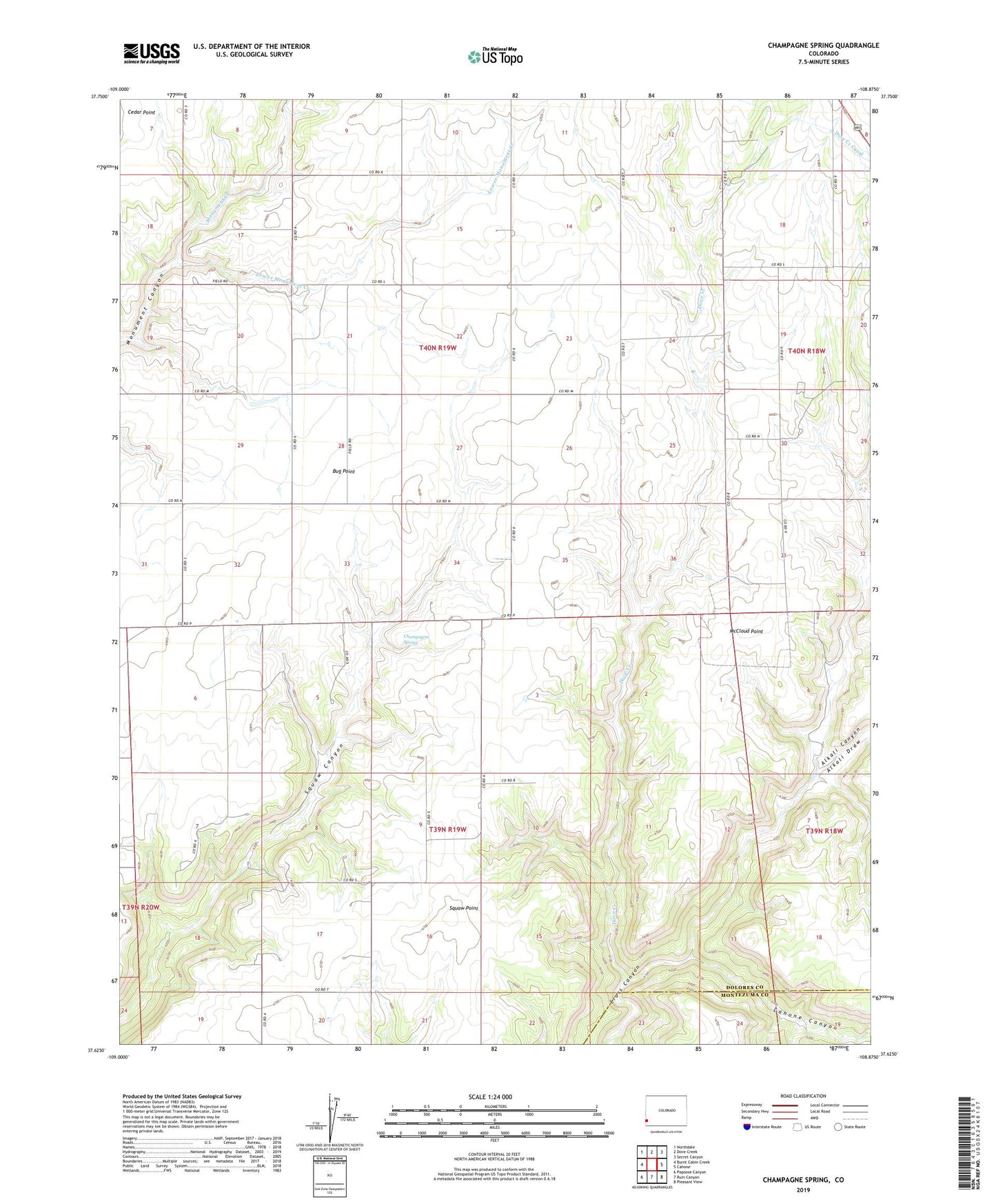
2023 topographic map quadrangle Champagne Spring in the state of Colorado. Scale: 1:24000. Based on the newly updated USGS 7.5' US Topo map series, this map is in the following counties: Dolores, Montezuma. The map contains contour data, water features, and other items you are used to seeing on USGS maps, but also has updated roads and other features. This is the next generation of topographic maps. Printed on high-quality waterproof paper with UV fade-resistant inks.
Quads adjacent to this one:
West: Burnt Cabin Creek
Northwest: Northdale
North: Dove Creek
Northeast: Secret Canyon
East: Cahone
Southeast: Pleasant View
South: Ruin Canyon
Southwest: Papoose Canyon
This map covers the same area as the classic USGS quad with code o37108f8.
Contains the following named places: Alkali Canyon, Alkali Draw, Cahone Canyon, Champagne Spring, Dove Creek, Dove Creek Division, Dove Creek Pumping Station, Lower Monument Creek, McCloud Point, Squaw Point