MyTopo
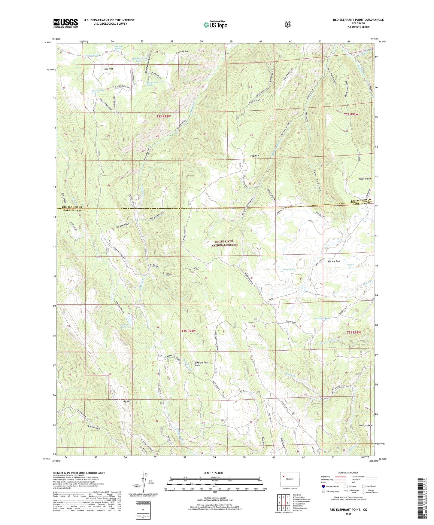
Red Elephant Point Colorado US Topo Map
Couldn't load pickup availability
Also explore the Red Elephant Point Forest Service Topo of this same quad for updated USFS data
2022 topographic map quadrangle Red Elephant Point in the state of Colorado. Scale: 1:24000. Based on the newly updated USGS 7.5' US Topo map series, this map is in the following counties: Garfield, Rio Blanco. The map contains contour data, water features, and other items you are used to seeing on USGS maps, but also has updated roads and other features. This is the next generation of topographic maps. Printed on high-quality waterproof paper with UV fade-resistant inks.
Quads adjacent to this one:
West: Thirteenmile Creek
Northwest: LO 7 Hill
North: Veatch Gulch
Northeast: Big Beaver Reservoir
East: Triangle Park
Southeast: Rifle Falls
South: Horse Mountain
Southwest: Rio Blanco
This map covers the same area as the classic USGS quad with code o39107g7.
Contains the following named places: Bar H L Guard Station, Bar H L Park, Big Mountain, Bloodsworth Pond, Bloodsworth Spring, Buckskin Gulch, Buckskin Lake, Finley Spring, Fourmile Creek, Hay Flat, Hay Flat Trail, Howey Reservoir, Howey Reservoir Dam, Indian Spring, Janes Spring, Machine Spring, Middle Miller Creek, Middle Mountain, Miller Creek Cow Camp, Red Canyon, Red Elephant Point, Rifle Creek Cow Camp, T I Cow Camp, Trojan Lake, Ute Stock Driveway