MyTopo
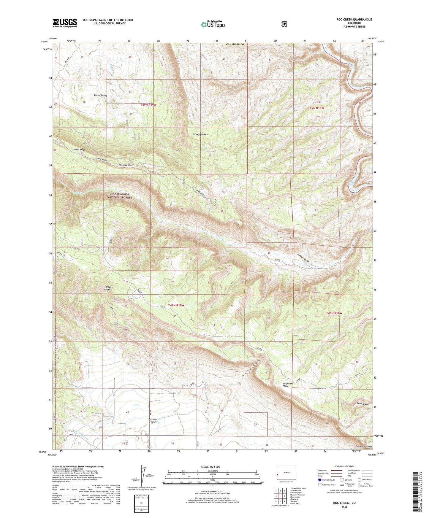
Roc Creek Colorado US Topo Map
Couldn't load pickup availability
Also explore the Roc Creek Forest Service Topo of this same quad for updated USFS data
2022 topographic map quadrangle Roc Creek in the state of Colorado. Scale: 1:24000. Based on the newly updated USGS 7.5' US Topo map series, this map is in the following counties: Montrose, Mesa. The map contains contour data, water features, and other items you are used to seeing on USGS maps, but also has updated roads and other features. This is the next generation of topographic maps. Printed on high-quality waterproof paper with UV fade-resistant inks.
Quads adjacent to this one:
West: Buckeye Reservoir
Northwest: Dolores Point South
North: Juanita Arch
Northeast: Calamity Mesa
East: Red Canyon
Southeast: Davis Mesa
South: Paradox
Southwest: Ray Mesa
This map covers the same area as the classic USGS quad with code o38108d8.
Contains the following named places: A and H Mine, Belle of Montrose Mine, Big Chief Mine, Buckhorn Mine, Carpenter Flats, Cedar Group Mine, Copper Jack Mine, Eclipse Mine, Fairview Mine, Garvey Gulch, Hog Trough, Hot Dog Mine, Judy Ann Mine, Little Buckhorn Mine, Little Fawn Mine, Lone Pine Mine, Mesa Two Mine, Pace Ranch, Radium Cycle Mine, Rajah Mine, Red Beds Mine, Red Hill Group Mine, Redbird Mine, Roc Creek Mine, Rogers Mine, Sewemup Mesa, Shadow Mine, Shadow Rock Mine, Shamrock Mine, Shuffle Mine, Sinbad Group Mine, Sunrise Canyon, Sunrise Mine, Three Musketeers Mine, Twin Sisters Mine, Uranium, Waterloo Mine, Woodchuck Mine, Zella Mine