MyTopo
Paradox Colorado US Topo Map
Couldn't load pickup availability
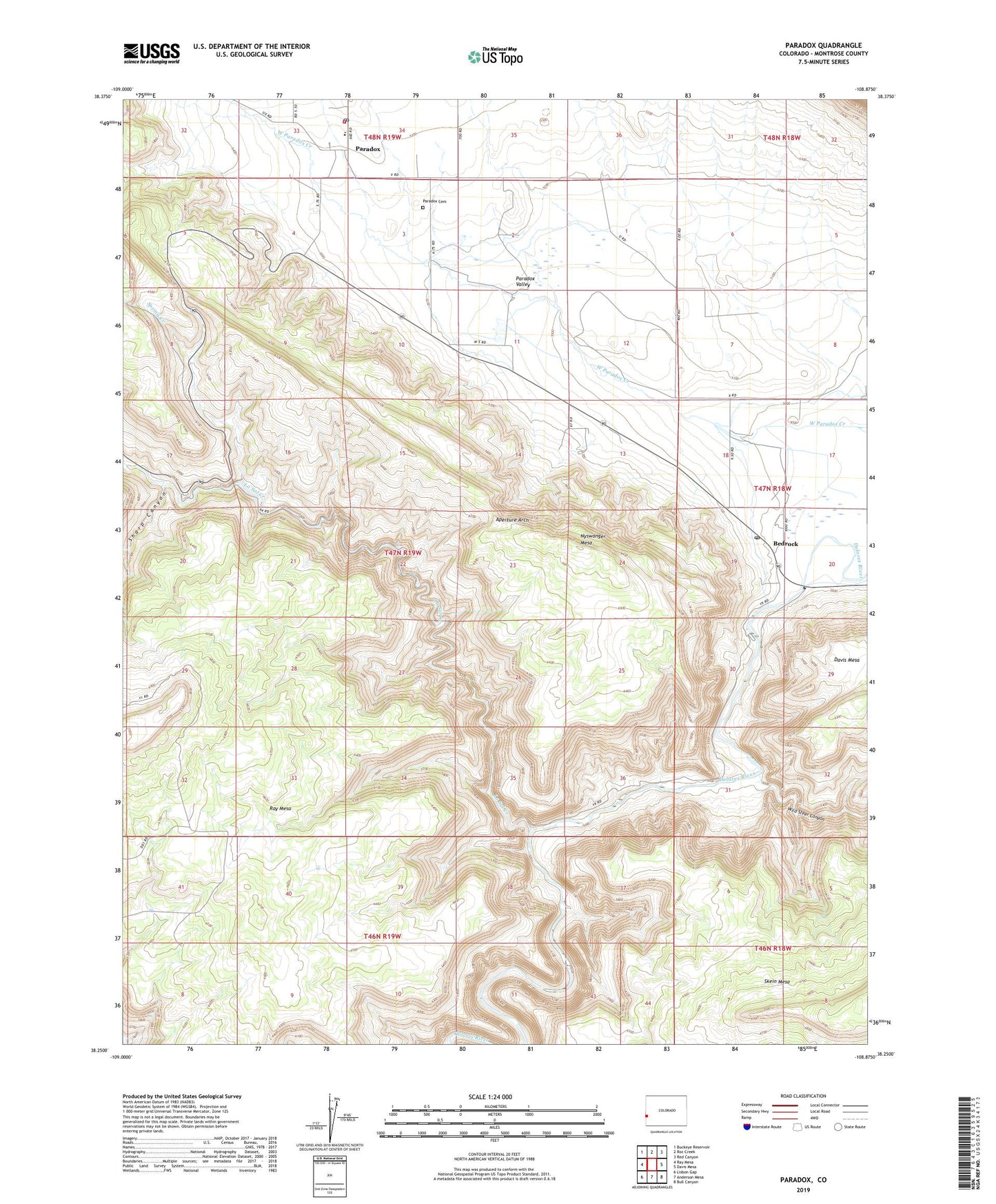
2022 topographic map quadrangle Paradox in the state of Colorado. Scale: 1:24000. Based on the newly updated USGS 7.5' US Topo map series, this map is in the following counties: Montrose. The map contains contour data, water features, and other items you are used to seeing on USGS maps, but also has updated roads and other features. This is the next generation of topographic maps. Printed on high-quality waterproof paper with UV fade-resistant inks.
Quads adjacent to this one:
West: Ray Mesa
Northwest: Buckeye Reservoir
North: Roc Creek
Northeast: Red Canyon
East: Davis Mesa
Southeast: Bull Canyon
South: Anderson Mesa
Southwest: Lisbon Gap
This map covers the same area as the classic USGS quad with code o38108c8.
Contains the following named places: Aperture Arch, Bedrock, Bedrock Post Office, Cashin Mine, Cliff Dweller Mine, Cliff Willow Mine, Cliffdweller Mine, Denver Mine, Ketchumup Stock Trail, La Sal Creek, Long Park Mine, Mesa Three Mine, Morning Glory Mine, Nyswonger Mesa, Nyswonger Trail, Paradox, Paradox Cemetery, Paradox Post Office, Paradox Valley Fire Department, Radium King Mine, Saint Patrick Mine, Sego Lily Lou Mine, Sharp Canyon, Sharp Canyon Stock Trail, Skein Mesa, Spring Creek, Wild Steer Canyon, ZIP Codes: 81411, 81429