MyTopo
Red Canyon Colorado US Topo Map
Couldn't load pickup availability
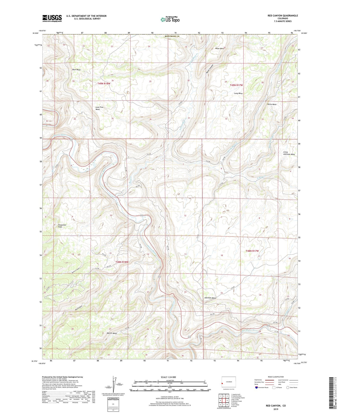
2022 topographic map quadrangle Red Canyon in the state of Colorado. Scale: 1:24000. Based on the newly updated USGS 7.5' US Topo map series, this map is in the following counties: Montrose, Mesa. The map contains contour data, water features, and other items you are used to seeing on USGS maps, but also has updated roads and other features. This is the next generation of topographic maps. Printed on high-quality waterproof paper with UV fade-resistant inks.
Quads adjacent to this one:
West: Roc Creek
Northwest: Juanita Arch
North: Calamity Mesa
Northeast: Uncompahgre Butte
East: Atkinson Creek
Southeast: Uravan
South: Davis Mesa
Southwest: Paradox
This map covers the same area as the classic USGS quad with code o38108d7.
Contains the following named places: Abajo One-five Mine, Adak Mine, Alta Mine, Atkinson Creek, Bauer Mine, Beehive Canyon, Belva Mine, Betty Jean Mine, Big Dick Mine, Black Rock Mine, Bluebird Mine, Bowen Mine, Buckhorn Mine, Cliff Dweller Mine, Club Ranch, Club Sandwich Mine, Dolores Mine, Dolores Mines, Dry Fork Mesa Creek, East Mesa Creek, Eulla Belle Mine, Farmer Girl Mine, Foster Mine, Fox Mine, Golden Cycle Mine, Horse Mesa, Index Mine, Jo Anne Mine, Joe Mine, King Solomon Mine, Last Chance Mine, Little Buckhorn Mine, Little Dick Mine, Lone Tree Mesa, Long Shot Mine, Lucky Dog Mine, Margie Mine, Margie Two Mine, Mesa Creek, Moon Canyon, North Fork Mesa Creek, North Star Mine, Nucle Mine, Ophir Mine, Outlet Mine, Pablo Mine, Piper Mine, Radium King Mine, Radium Queen Mine, Radium Trail, Ravin Mine, Red Canyon, Red Canyon Mine, Red Rock Number 2 Mine, Red Rock Number 5 Mine, Red Sox Mine, Roc Creek, San Miguel River, Sandy Mine, Sewemup Stock Trail, Shamrock Mine, Shamrock Mines, South Fork Mesa Creek, Sunbeam Group Mines, Town House Mine, Tuesday Mine, Wildcat Number 3 Mine, Wildcat Number 8 Mine, Worcester Mine, Yankee Mine