MyTopo
San Luis Colorado US Topo Map
Couldn't load pickup availability
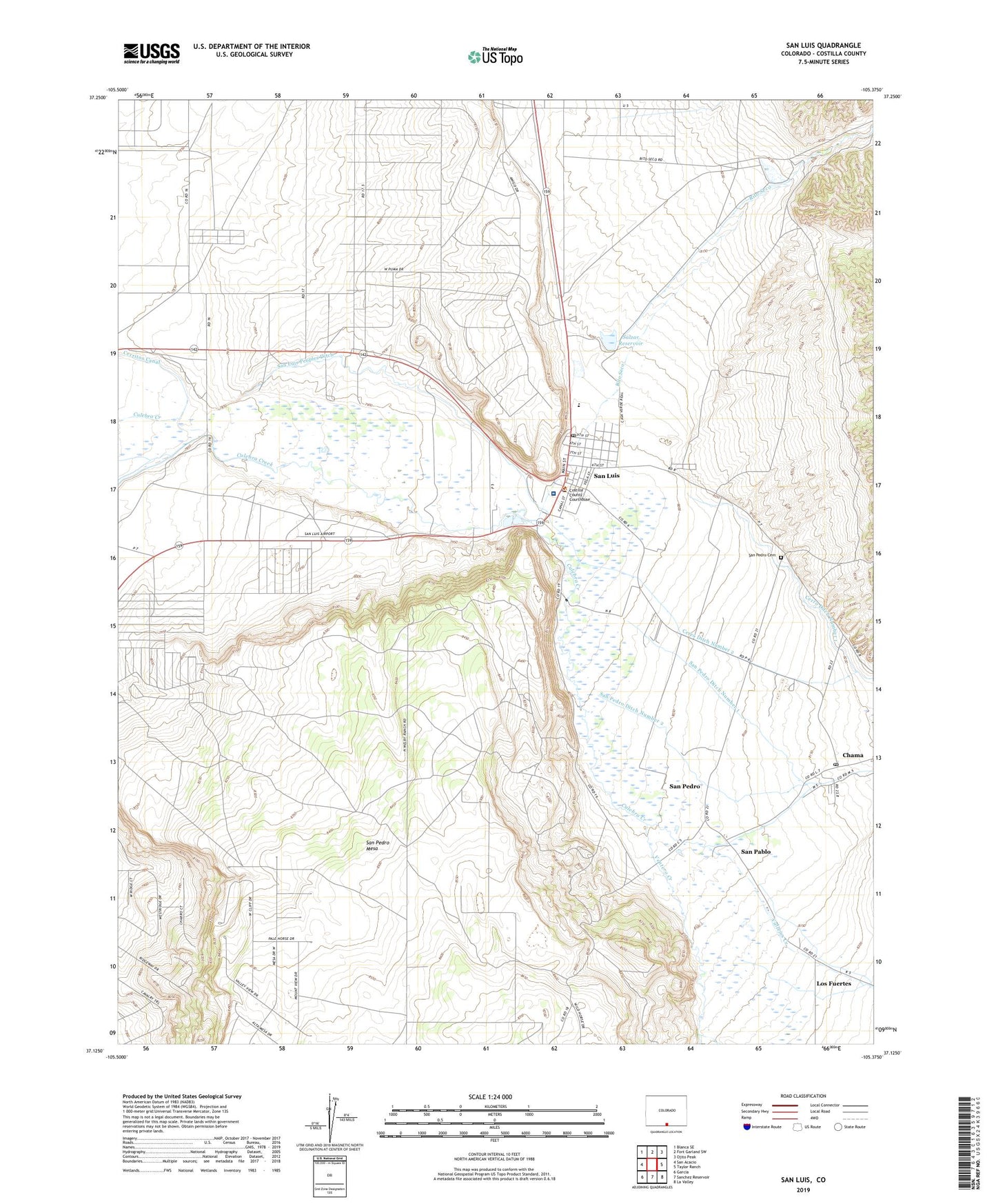
2022 topographic map quadrangle San Luis in the state of Colorado. Scale: 1:24000. Based on the newly updated USGS 7.5' US Topo map series, this map is in the following counties: Costilla. The map contains contour data, water features, and other items you are used to seeing on USGS maps, but also has updated roads and other features. This is the next generation of topographic maps. Printed on high-quality waterproof paper with UV fade-resistant inks.
Quads adjacent to this one:
West: San Acacio
Northwest: Blanca SE
North: Fort Garland SW
Northeast: Ojito Peak
East: Taylor Ranch
Southeast: La Valley
South: Sanchez Reservoir
Southwest: Garcia
This map covers the same area as the classic USGS quad with code o37105b4.
Contains the following named places: Centennial Schools, Cerro Ditch Number 1, Cerro Ditch Number 2, Chama, Chama Post Office, Church of Jesus Christ of Latter - day Saints, Costilla County Fire Protection District San Luis Fire Department, Costilla County Sheriff's Office, Costilla Emergency Medical Services, Kingdom Hall of Jehovah's Witnesses, Los Fuertes, Rito Seco, Salazar Number 1 Dam, Salzar Reservoir, San Francisco Creek, San Luis, San Luis Airport, San Luis Division, San Luis Health Center, San Luis High School, San Luis Peoples Ditch, San Luis Post Office, San Pablo, San Pedro, San Pedro Cemetery, San Pedro Ditch Number 1, San Pedro Ditch Number 2, Sangre De Cristo Catholic Church, Sangre de Cristo Grant, Stations of the Cross, Town of San Luis, Vallejos Creek, Ventero Creek