MyTopo
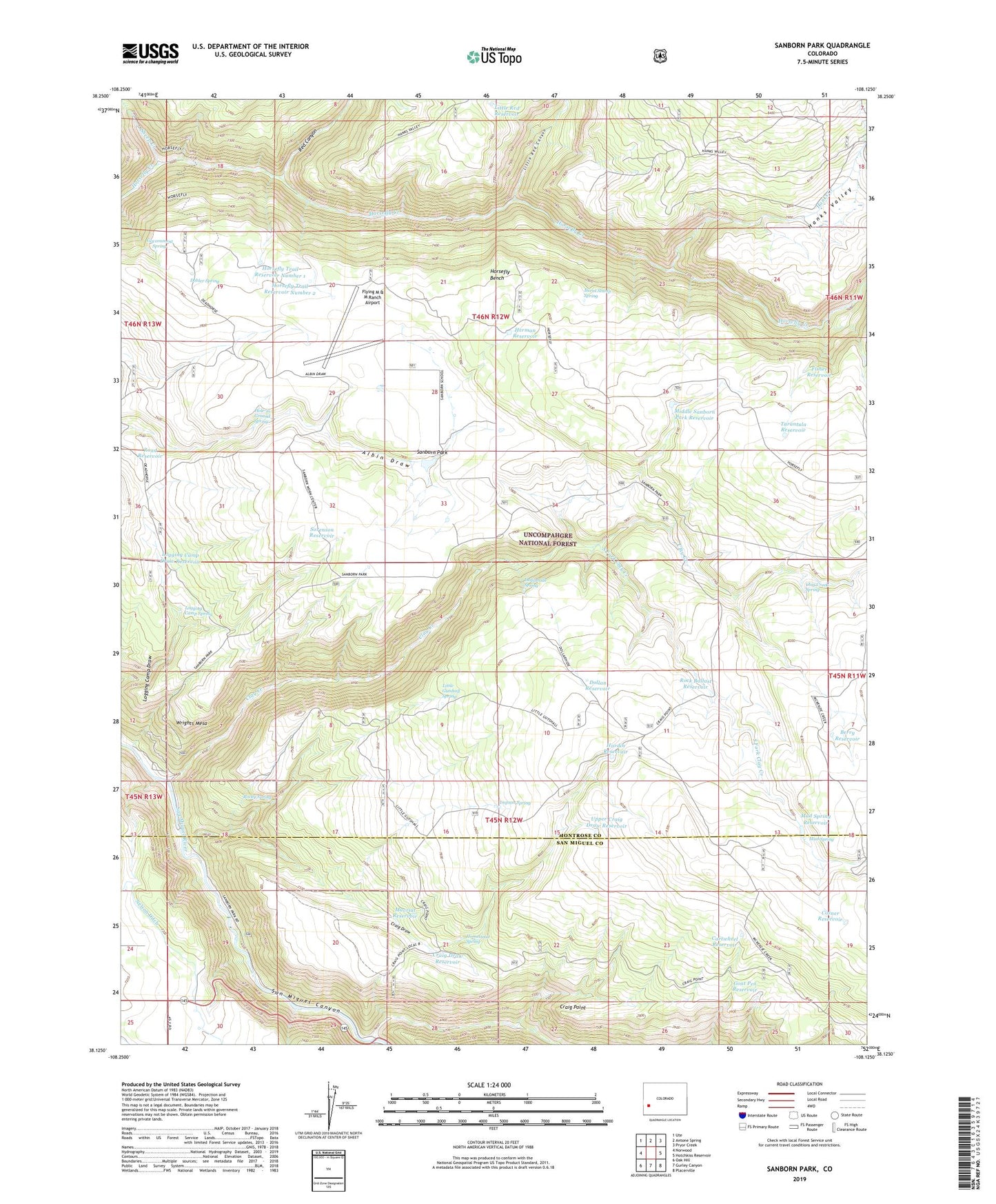
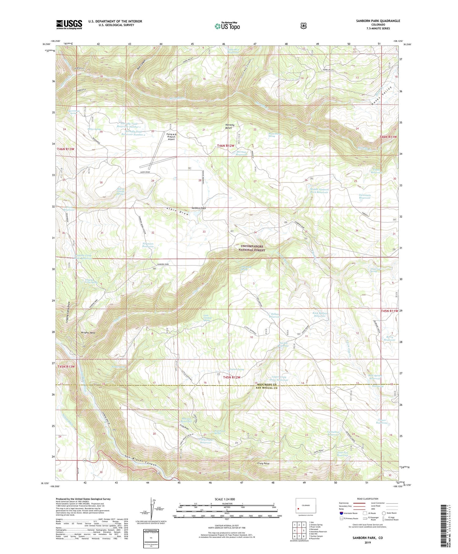
Sanborn Park Colorado US Topo Map
Couldn't load pickup availability
Also explore the Sanborn Park Forest Service Topo of this same quad for updated USFS data
2022 topographic map quadrangle Sanborn Park in the state of Colorado. Scale: 1:24000. Based on the newly updated USGS 7.5' US Topo map series, this map is in the following counties: Montrose, San Miguel. The map contains contour data, water features, and other items you are used to seeing on USGS maps, but also has updated roads and other features. This is the next generation of topographic maps. Printed on high-quality waterproof paper with UV fade-resistant inks.
Quads adjacent to this one:
West: Norwood
Northwest: Ute
North: Antone Spring
Northeast: Pryor Creek
East: Hotchkiss Reservoir
Southeast: Placerville
South: Gurley Canyon
Southwest: Oak Hill
This map covers the same area as the classic USGS quad with code o38108b2.
Contains the following named places: Berry Reservoir, Big Red Reservoir, Bolinger Ditch, Burnt Stump Spring, Cartwheel Reservoir, Clay Creek, Clay Creek Spring, Corner Reservoir, Craig Draw, Craig Draw Reservoir, Craig Point, Dobler Spring, Dollan Reservoir, Dollarhide Spring, Fisher Reservoir, Flying M & M Ranch Airport, Goat Pen Reservoir, Government Spring, Hanks Creek, Hanks Valley, Hardin Reservoir, Herman Reservoir, Hole-in-Ground Spring, Homestead Spring, Horsefly Bench, Horsefly Trail, Horsefly Trail Reservoir Number 1, Horsefly Trail Reservoir Number 2, Impson Spring, Little Gutshall Spring, Little Red Canyon, Little Red Reservoir, Logging Camp Draw Reservoir, Logging Camp Spring, Mavriat Reservoir, McKeever Sawmill, McKenzie Creek, Middle Sanborn Park Reservoir, Mud Spring, Mud Spring Reservoir, Red Canyon, Road Reservoir, Rock Ballast Reservoir, Rocky Spring, Sanborn Park, Sanborn School, Sanborn Work Center, Sheep Creek, Sorenson Reservoir, South Fork Clay Creek, Tarantula Reservoir, Upper Craig Draw Reservoir