MyTopo
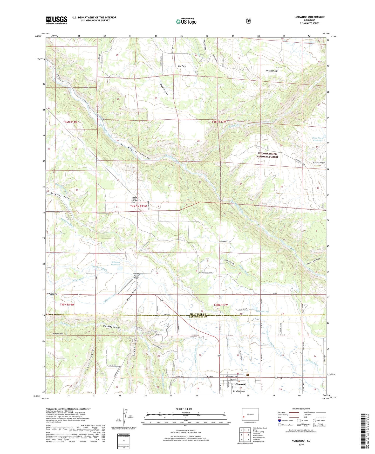
Norwood Colorado US Topo Map
Couldn't load pickup availability
Also explore the Norwood Forest Service Topo of this same quad for updated USFS data
2022 topographic map quadrangle Norwood in the state of Colorado. Scale: 1:24000. Based on the newly updated USGS 7.5' US Topo map series, this map is in the following counties: Montrose, San Miguel. The map contains contour data, water features, and other items you are used to seeing on USGS maps, but also has updated roads and other features. This is the next generation of topographic maps. Printed on high-quality waterproof paper with UV fade-resistant inks.
Quads adjacent to this one:
West: Redvale
Northwest: Big Bucktail Creek
North: Ute
Northeast: Antone Spring
East: Sanborn Park
Southeast: Gurley Canyon
South: Oak Hill
Southwest: Barkelew Draw
This map covers the same area as the classic USGS quad with code o38108b3.
Contains the following named places: Albin Draw, Big Mack Mine, Browning Ditch, Burn Canyon, Coventry, Coventry Hill, Dead Horse Reservoir, Dearborn Ditch, Dry Park, Elder Mine, Horsefly Creek, Issac Grey Ditch, Keck-Reliance Mine, Logging Camp Draw, Mad Jack Number One Mine, Manly Draw, McKee Draw, Mineral Mine, Nelson Ditch, Norwood, Norwood Airport, Norwood Cemetery, Norwood Fire Protection District, Norwood Marshal's Office, Norwood Post Office, Palmers Lake, Patterson Mountain, Smugglers Ditch, Stink Hole Draw, Sullivan Ditch, Town of Norwood, Upper Mailbox Park, Williams Ditch, Williams Ranch Airport, Williams Reservoir, Williams Truax Ditch, Wrights Mesa