
MyTopo
Antone Spring Colorado US Topo Map
Couldn't load pickup availability
Also explore the Antone Spring Forest Service Topo of this same quad for updated USFS data
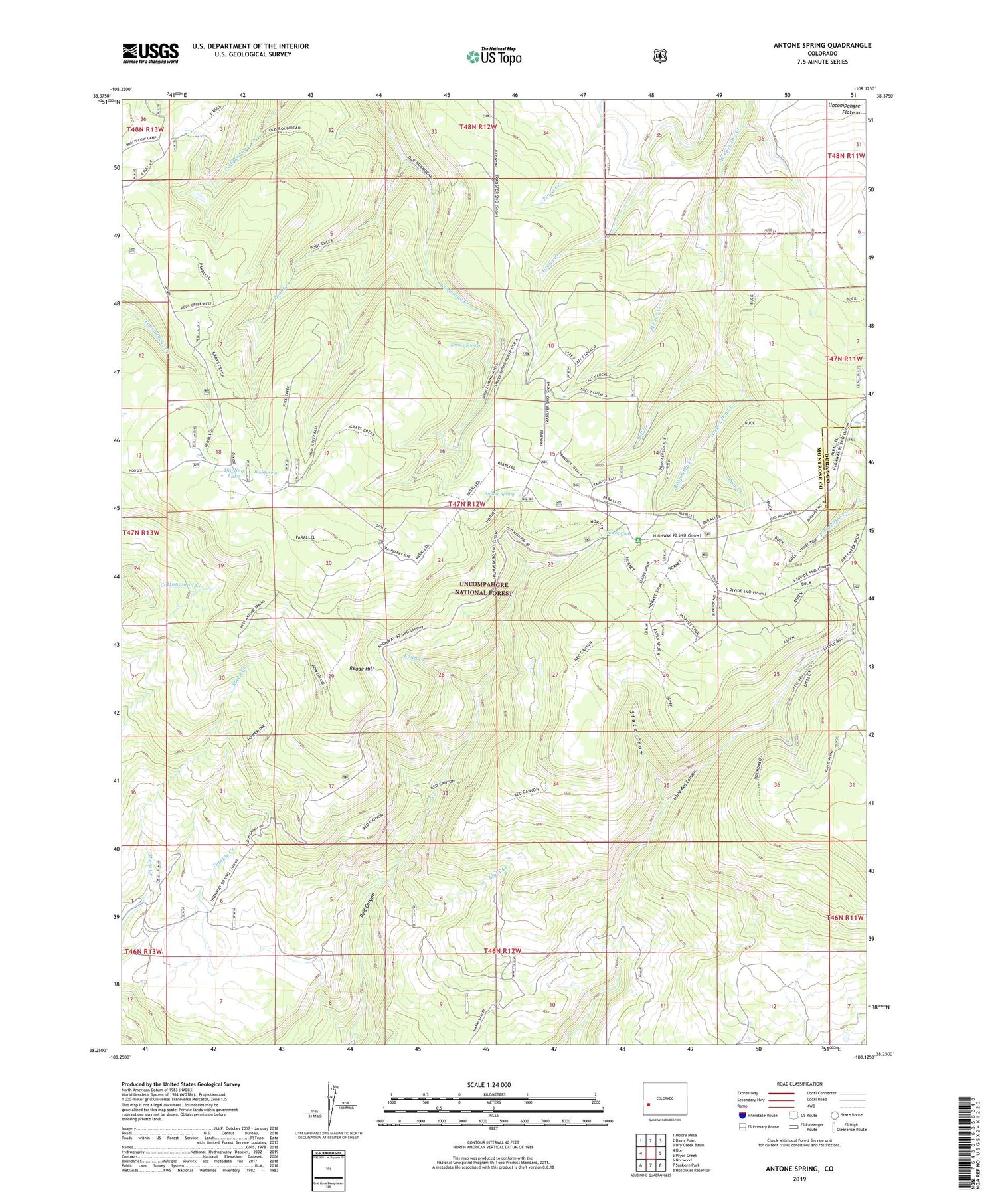
2022 topographic map quadrangle Antone Spring in the state of Colorado. Scale: 1:24000. Based on the newly updated USGS 7.5' US Topo map series, this map is in the following counties: Montrose, Ouray. The map contains contour data, water features, and other items you are used to seeing on USGS maps, but also has updated roads and other features. This is the next generation of topographic maps. Printed on high-quality waterproof paper with UV fade-resistant inks.
Quads adjacent to this one:
West: Ute
Northwest: Moore Mesa
North: Davis Point
Northeast: Dry Creek Basin
East: Pryor Creek
Southeast: Hotchkiss Reservoir
South: Sanborn Park
Southwest: Norwood
This map covers the same area as the classic USGS quad with code o38108c2.
Contains the following named places: Antone Spring, Antone Spring Campground, Bear Creek, Big A Creek, Box Spring, Darling Lake, Gray Cow Camp, Hanks Valley Trail, Iron Spring, Iron Spring Campground, Kelly Creek, Lazy Y Cow Camp, Mill Creek, Pool Creek, Pool Creek Trail, Raspberry Creek, Raspberry Heliport, Reade Hill, Silesca Guard Station, Spruce Creek, Spruce Spring, State Draw, Too High Mine


