MyTopo
Sedalia Colorado US Topo Map
Couldn't load pickup availability
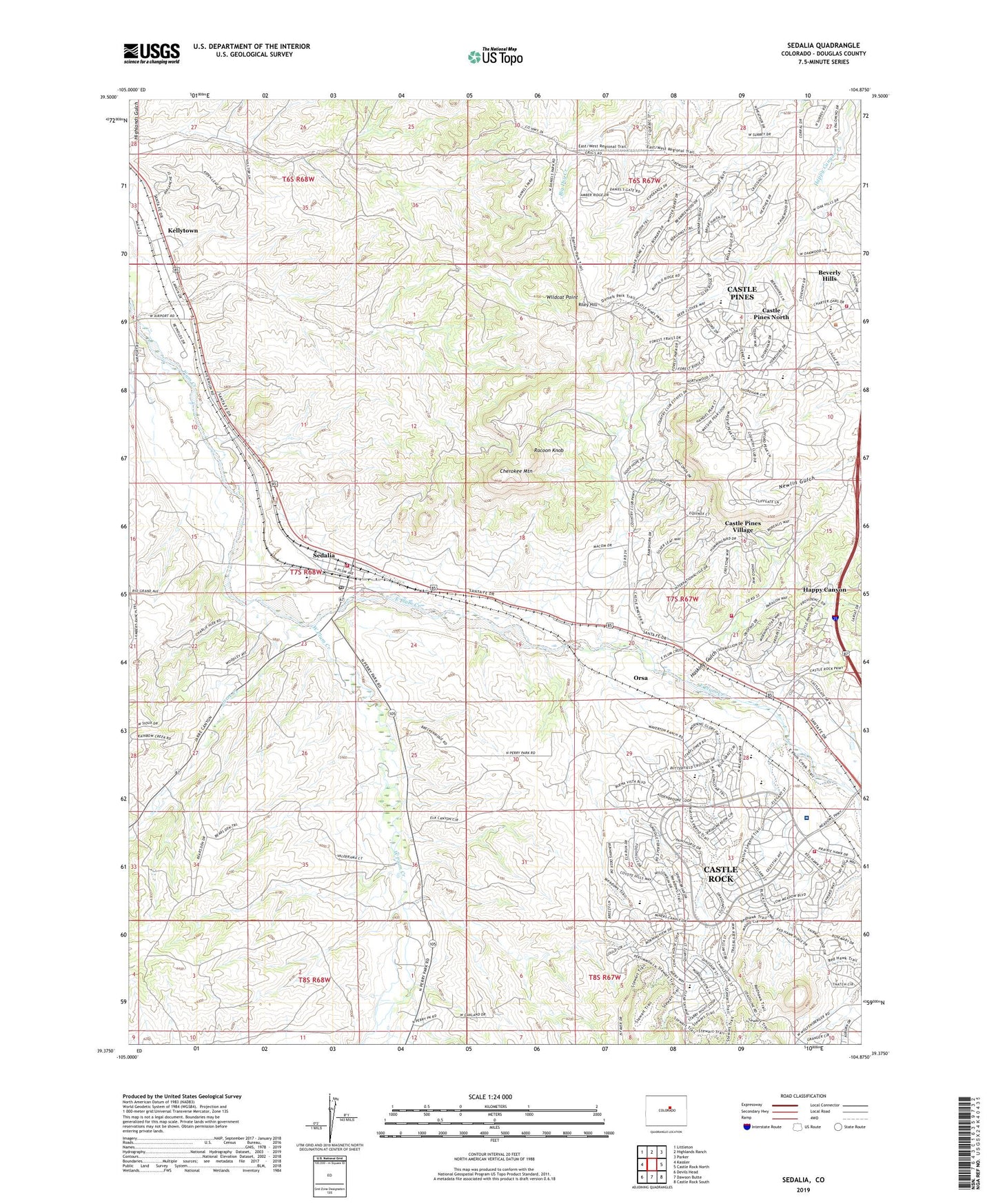
2022 topographic map quadrangle Sedalia in the state of Colorado. Scale: 1:24000. Based on the newly updated USGS 7.5' US Topo map series, this map is in the following counties: Douglas. The map contains contour data, water features, and other items you are used to seeing on USGS maps, but also has updated roads and other features. This is the next generation of topographic maps. Printed on high-quality waterproof paper with UV fade-resistant inks.
Quads adjacent to this one:
West: Kassler
Northwest: Littleton
North: Highlands Ranch
Northeast: Parker
East: Castle Rock North
Southeast: Castle Rock South
South: Dawson Butte
Southwest: Devils Head
This map covers the same area as the classic USGS quad with code o39104d8.
Contains the following named places: Beverly Hills, Beverly Hills Census Designated Place, Buffalo Ridge Elementary School, Castle Pines, Castle Pines North, Castle Pines Village, Castle Pines Village Census Designated Place, Castle Rock Adventist Hospital, Castle Rock Fire and Rescue Department Station 154, Castle Rock Middle School, Castle View High School, Cherokee Mountain, Clear Sky Elementary School, Curtis Ditch, Daniels Park, Denver-Douglas Landing Strip, Douglas County Schools Montessori Charter School, East Plum Creek, Gann School, Happy Canyon Ranch, Haskings Gulch, Jarre Creek, Kellytown, Littleton-Sedalia Landing Area, Louviers Station, M Y M Mine, Meadow View Elementary School, Orsa, Racoon Knob, Riley Hill, Round Top School, Sacred Heart Retreat House, Sedalia, Sedalia Census Designated Place, Sedalia Elementary School, Sedalia Post Office, Soaring Hawk Elementary School, South Metro Fire Rescue Authority Station 36, South Metro Fire Rescue Authority Station 39, Surrey Ridge, Surrey Ridge Census Designated Place, Timber Trail Elementary School, Ute Mine, West Douglas County Fire Protection District - Station 134, West Plum Creek, Wildcat Point