
MyTopo
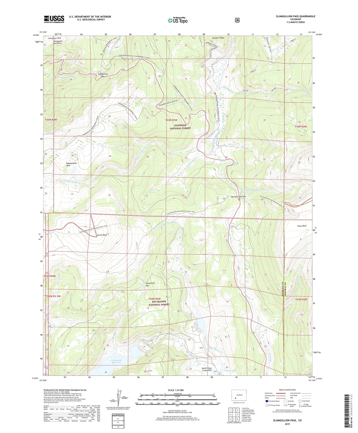
Slumgullion Pass Colorado US Topo Map
Couldn't load pickup availability
Also explore the Slumgullion Pass Forest Service Topo of this same quad for updated USFS data
2022 topographic map quadrangle Slumgullion Pass in the state of Colorado. Scale: 1:24000. Based on the newly updated USGS 7.5' US Topo map series, this map is in the following counties: Hinsdale, Mineral. The map contains contour data, water features, and other items you are used to seeing on USGS maps, but also has updated roads and other features. This is the next generation of topographic maps. Printed on high-quality waterproof paper with UV fade-resistant inks.
Quads adjacent to this one:
West: Lake San Cristobal
Northwest: Lake City
North: Cannibal Plateau
Northeast: Mineral Mountain
East: Baldy Cinco
Southeast: Bristol Head
South: Hermit Lakes
Southwest: Finger Mesa
This map covers the same area as the classic USGS quad with code o37107h2.
Contains the following named places: Continental Dam, Continental Reservoir, Deadman Creek, East Fork Cebolla Creek, Horsethief Mountain, Jarosa Mesa, Mesa Creek, Old Stage Station, Pointer Lake, Powderhorn Gulch, Rambouillet Creek, Rambouillet Park, Rito Hondo Creek, Rito Hondo Dam, Rito Hondo Reservoir, Slumgullion Pass, Slumgullion Pass Campground, Spring Creek Campground, Spring Creek Pass, Tumble Creek, West Fork Cebolla Creek, Windy Point Overlook


