MyTopo
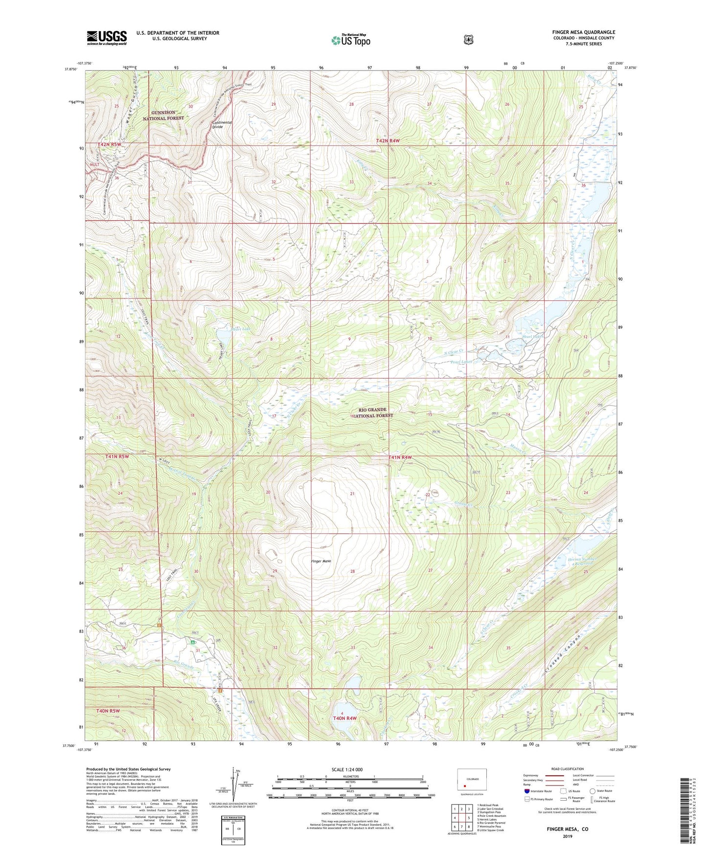
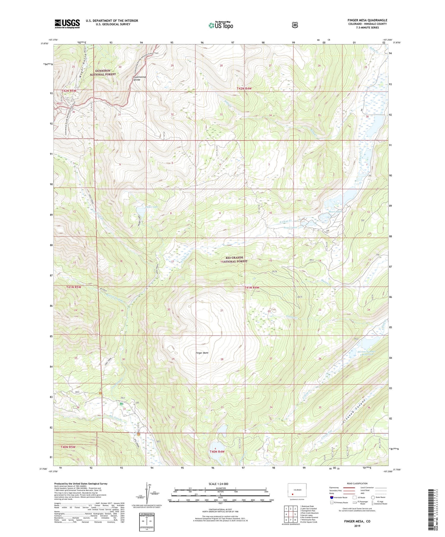
Finger Mesa Colorado US Topo Map
Couldn't load pickup availability
Also explore the Finger Mesa Forest Service Topo of this same quad for updated USFS data
2022 topographic map quadrangle Finger Mesa in the state of Colorado. Scale: 1:24000. Based on the newly updated USGS 7.5' US Topo map series, this map is in the following counties: Hinsdale. The map contains contour data, water features, and other items you are used to seeing on USGS maps, but also has updated roads and other features. This is the next generation of topographic maps. Printed on high-quality waterproof paper with UV fade-resistant inks.
Quads adjacent to this one:
West: Pole Creek Mountain
Northwest: Redcloud Peak
North: Lake San Cristobal
Northeast: Slumgullion Pass
East: Hermit Lakes
Southeast: Little Squaw Creek
South: Weminuche Pass
Southwest: Rio Grande Pyramid
This map covers the same area as the classic USGS quad with code o37107g3.
Contains the following named places: Carson, Castle Number 4 Dam, Castle Number 4 Reservoir, Castle Rock Lake, Finger Mesa, Grouse Creek, Heart Lake, Hermit number 3 Dam, Hermit Number 4 Dam, Hermit Number 4 Reservoir, Hermit Reservoir 3, Hinsdale County, Lake City Division, Lost Lake Reservoir Number 1, Lost Lakes, Lost Trail Campground, Lost Trail Creek, Lost Trail Ranch, Love Lake, Love Lake Dam, Pearl Lakes, Ski Hi Ranch, Ute Creek Trailhead, West Lost Trail Creek