
MyTopo
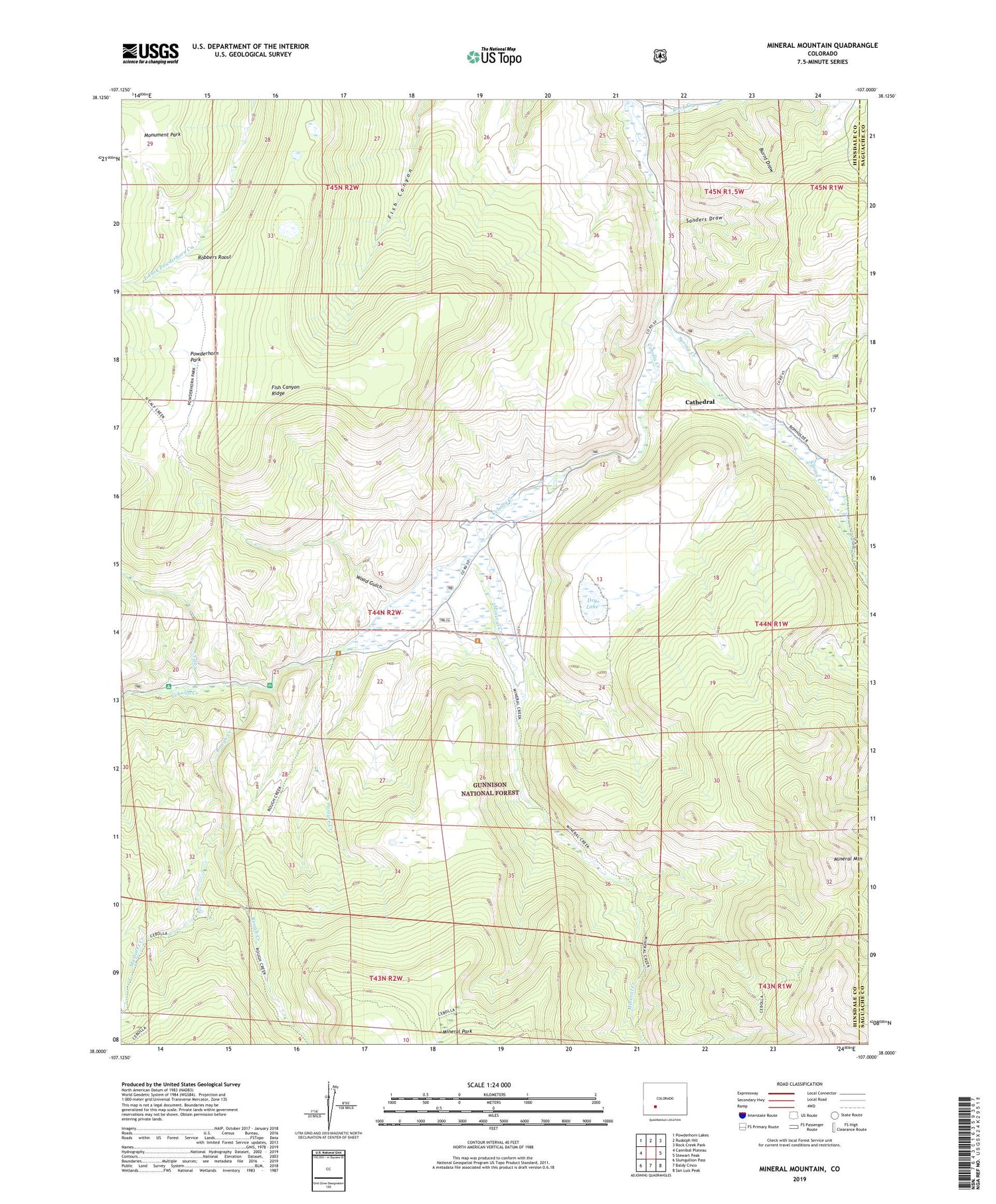
Mineral Mountain Colorado US Topo Map
Couldn't load pickup availability
Also explore the Mineral Mountain Forest Service Topo of this same quad for updated USFS data
2022 topographic map quadrangle Mineral Mountain in the state of Colorado. Scale: 1:24000. Based on the newly updated USGS 7.5' US Topo map series, this map is in the following counties: Hinsdale, Saguache. The map contains contour data, water features, and other items you are used to seeing on USGS maps, but also has updated roads and other features. This is the next generation of topographic maps. Printed on high-quality waterproof paper with UV fade-resistant inks.
Quads adjacent to this one:
West: Cannibal Plateau
Northwest: Powderhorn Lakes
North: Rudolph Hill
Northeast: Rock Creek Park
East: Stewart Peak
Southeast: San Luis Peak
South: Baldy Cinco
Southwest: Slumgullion Pass
This map covers the same area as the classic USGS quad with code o38107a1.
Contains the following named places: Burnt Draw, Calf Creek, Cathedral, Cathedral Census Designated Place, Cathedral Creek, Cebolla Campground, Cebolla Game Management Area, Cebolla Trail, Devils Hole Trail, Dry Lake, Fish Canyon Ridge, Martinez Creek, Mineral Creek, Mineral Creek Trailhead, Mineral Mountain, Mineral Park, Monument Park, Pasture Creek, Powderhorn Park, Robbers Roost, Rock Creek, Rough Creek, Rough Creek Trail, Rough Creek Trailhead, Sanders Draw, Spring Creek, Spruce Campground, Wood Gulch


