MyTopo
Smizer Gulch Colorado US Topo Map
Couldn't load pickup availability
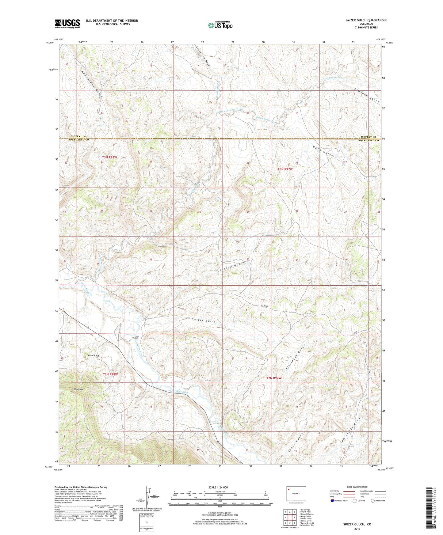
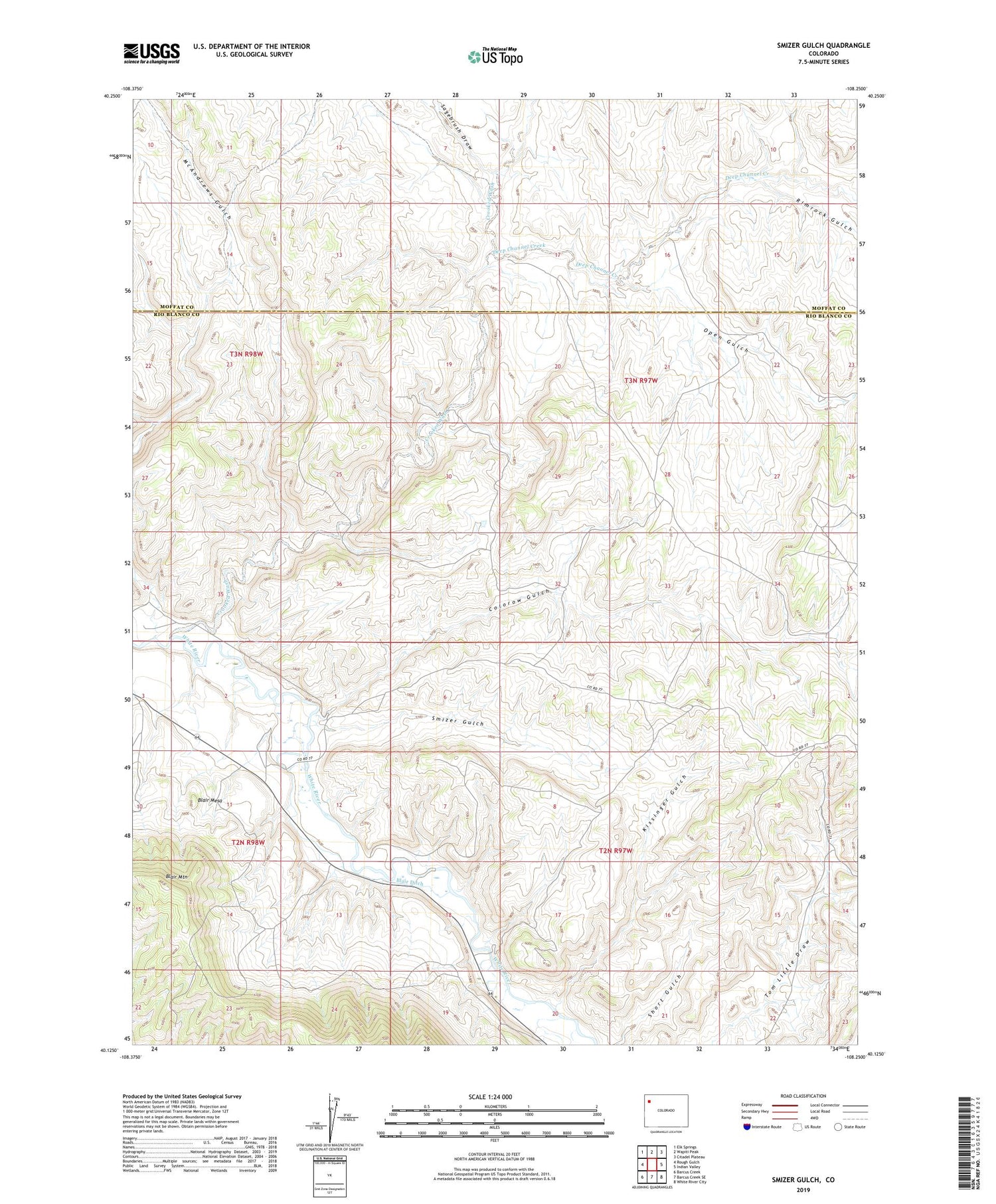
2022 topographic map quadrangle Smizer Gulch in the state of Colorado. Scale: 1:24000. Based on the newly updated USGS 7.5' US Topo map series, this map is in the following counties: Rio Blanco, Moffat. The map contains contour data, water features, and other items you are used to seeing on USGS maps, but also has updated roads and other features. This is the next generation of topographic maps. Printed on high-quality waterproof paper with UV fade-resistant inks.
Quads adjacent to this one:
West: Rough Gulch
Northwest: Elk Springs
North: Wapiti Peak
Northeast: Citadel Plateau
East: Indian Valley
Southeast: White River City
South: Barcus Creek SE
Southwest: Barcus Creek
This map covers the same area as the classic USGS quad with code o40108b3.
Contains the following named places: Blair Ditch, Blair Mesa, Blair Mountain, Colorow Gulch, Crooked Wash, Deep Channel Creek, Kissinger Gulch, McAndrews Gulch, Open Gulch, Rimrock Gulch, Sagebrush Draw, Smizer Gulch