
MyTopo
White River City Colorado US Topo Map
Couldn't load pickup availability
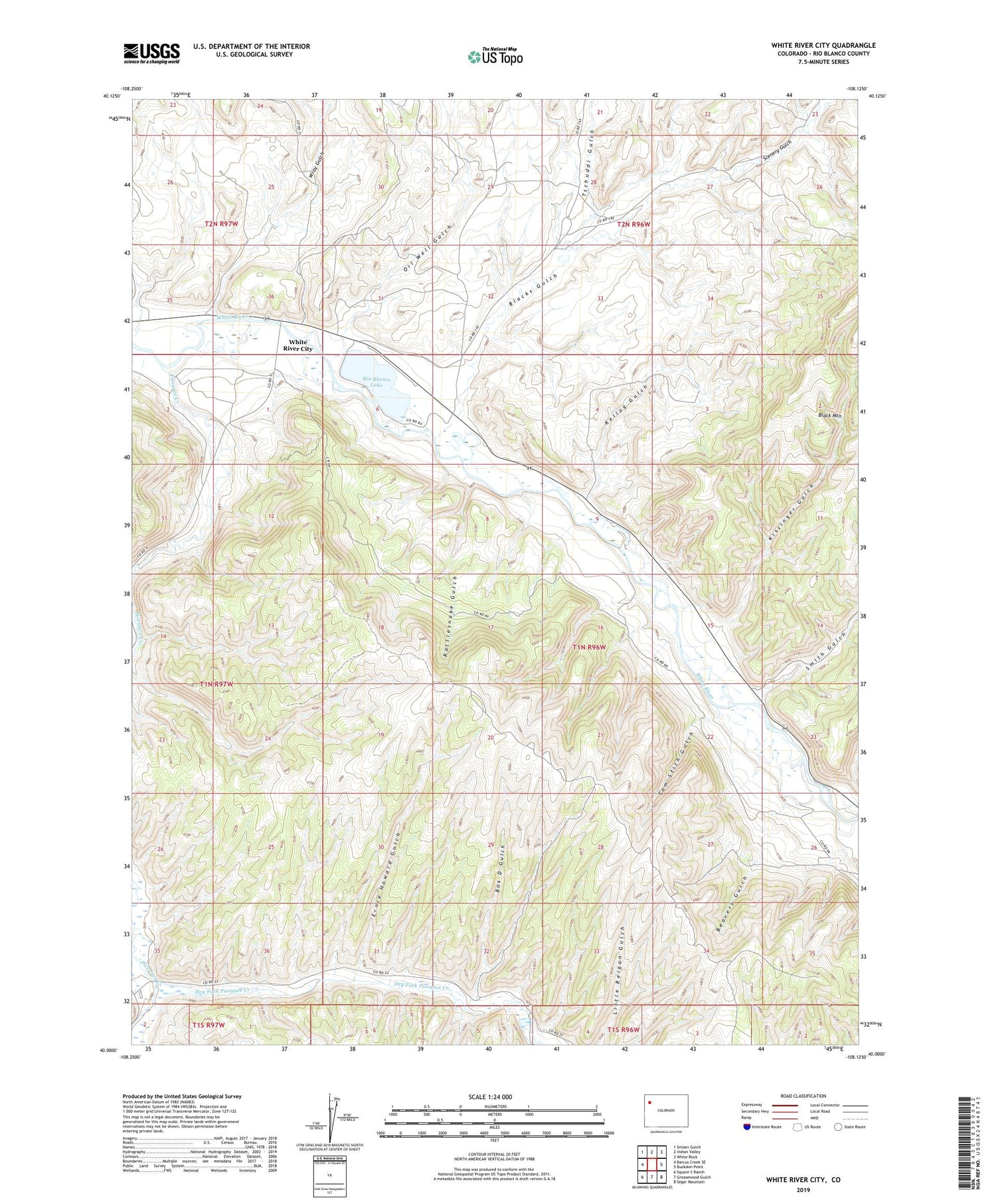
2022 topographic map quadrangle White River City in the state of Colorado. Scale: 1:24000. Based on the newly updated USGS 7.5' US Topo map series, this map is in the following counties: Rio Blanco. The map contains contour data, water features, and other items you are used to seeing on USGS maps, but also has updated roads and other features. This is the next generation of topographic maps. Printed on high-quality waterproof paper with UV fade-resistant inks.
Quads adjacent to this one:
West: Barcus Creek SE
Northwest: Smizer Gulch
North: Indian Valley
Northeast: White Rock
East: Buckskin Point
Southeast: Segar Mountain
South: Greasewood Gulch
Southwest: Square S Ranch
This map covers the same area as the classic USGS quad with code o40108a2.
Contains the following named places: Beavers Gulch, Beefsteak Gulch, Blacks Gulch, Box D Gulch, Dry Fork Piceance Creek, Ernie Howard Gulch, Johnnie Johnson Dam, Kellog Gulch, Kissinger Gulch, Little Hills Game Experiment Station, Oil Well Gulch, Piceance Creek, Rattlesnake Gulch, Rio Blanco Lake, Scenery Gulch, Smith Gulch, Tom Stith Gulch, Tschuddi Gulch, U.S.B.M. Number One Shaft, USBM Number One Shaft, White River City, Wray Gulch


