MyTopo
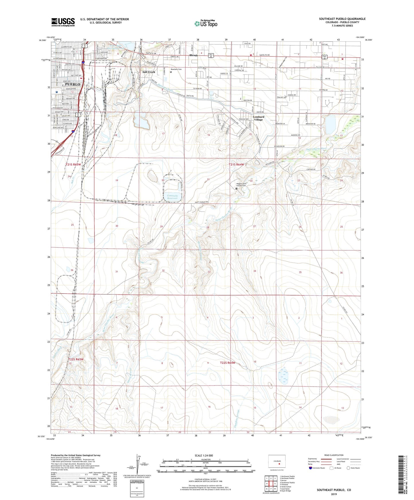
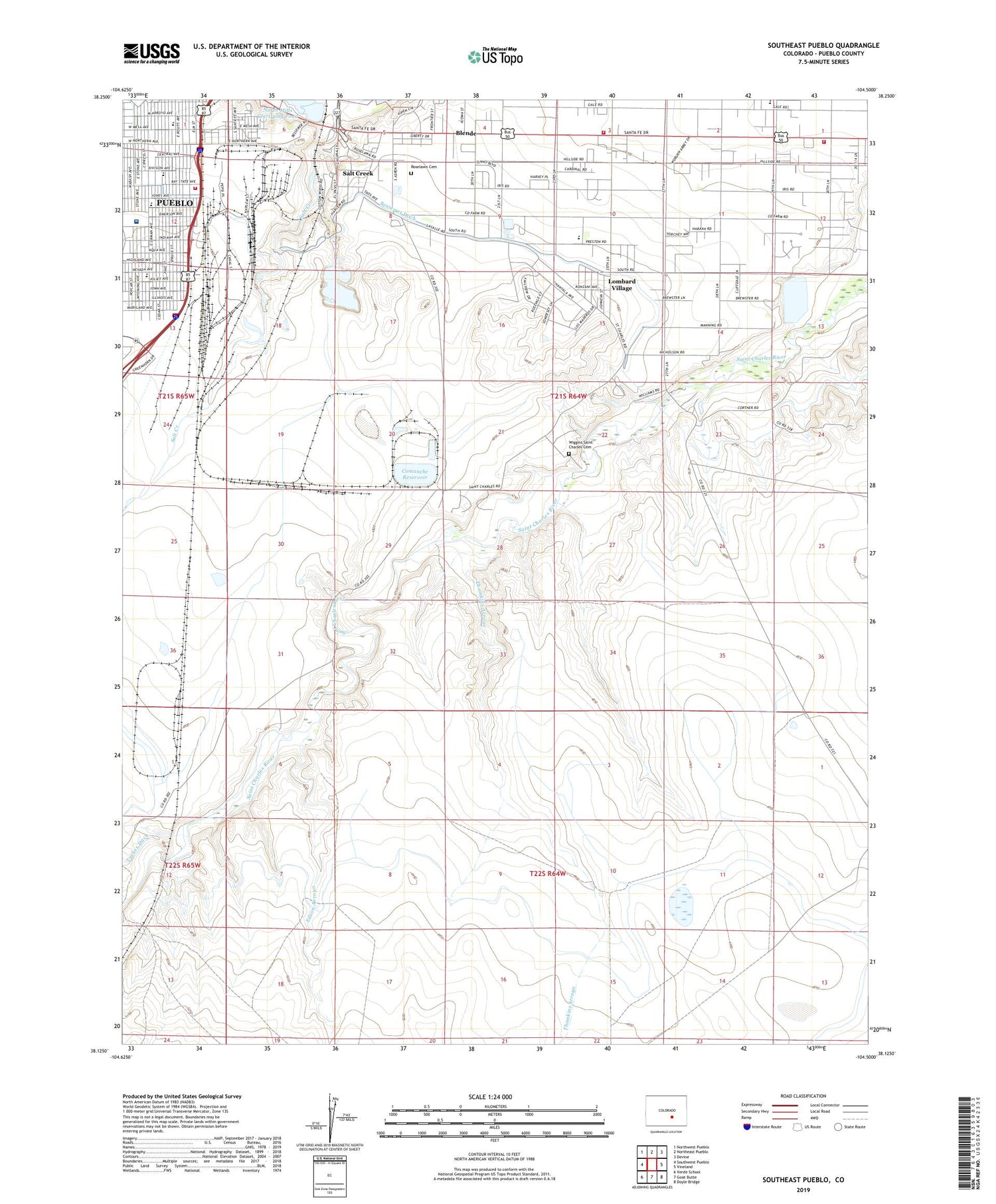
Southeast Pueblo Colorado US Topo Map
Couldn't load pickup availability
2022 topographic map quadrangle Southeast Pueblo in the state of Colorado. Scale: 1:24000. Based on the newly updated USGS 7.5' US Topo map series, this map is in the following counties: Pueblo. The map contains contour data, water features, and other items you are used to seeing on USGS maps, but also has updated roads and other features. This is the next generation of topographic maps. Printed on high-quality waterproof paper with UV fade-resistant inks.
Quads adjacent to this one:
West: Southwest Pueblo
Northwest: Northwest Pueblo
North: Northeast Pueblo
Northeast: Devine
East: Vineland
Southeast: Doyle Bridge
South: Goat Butte
Southwest: Verde School
This map covers the same area as the classic USGS quad with code o38104b5.
Contains the following named places: Bessemer Academy, Bessemer Ditch, Bessemer Park, Blende, Blende Census Designated Place, Comanche Dam, Comanche Reservoir, Edison School, Edson Arroyo, EVRAZ Rocky Mountain Steel Fire / EMS, Flight for Life Colorado 4 Medical Transport, Fulton Heights School, Grace Church, Lake View School, Lime, Lombard Village, North Mesa Elementary School, North Mills Clarifying Dam, Park School, Pueblo County, Pueblo Rural Fire District Station 1, Pueblo Rural Fire Protection District Station 2, Roselawn Cemetery, Saint Charles, Saint Charles Mesa Dam, Saint Charles Mesa Division, Saint Charles Mesa Number 2 Dam, Saint Charles Mesa Reservoir, Saint Charles Mesa Reservoir Number 2, Saint Mary - Corwin Medical Center, Saint Mary-Corwin Hospital Heliport, Salt Creek, Salt Creek Census Designated Place, South Mesa School, Thomkins Arroyo, Wiggins Saint Charles Cemetery