MyTopo
Gulnare Colorado US Topo Map
Couldn't load pickup availability
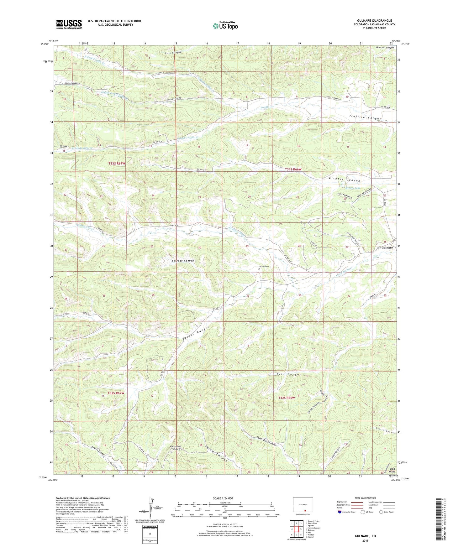
2022 topographic map quadrangle Gulnare in the state of Colorado. Scale: 1:24000. Based on the newly updated USGS 7.5' US Topo map series, this map is in the following counties: Las Animas. The map contains contour data, water features, and other items you are used to seeing on USGS maps, but also has updated roads and other features. This is the next generation of topographic maps. Printed on high-quality waterproof paper with UV fade-resistant inks.
Quads adjacent to this one:
West: Herlick Canyon
Northwest: Spanish Peaks
North: Santa Clara
Northeast: Aguilar
East: Delagua
Southeast: Madrid
South: Weston
Southwest: Vigil
This map covers the same area as the classic USGS quad with code o37104c7.
Contains the following named places: Apishapa Dam, Borrego Canyon, Cottontail Pass, Gulnare, Jarosa Canyon, Jarosa Cemetery, Jarosa Creek, Middle Fork Trujillo Creek, Mitotes Lake, North Fork Trujillo Creek, Northside Vigil Ditch, South Fork Trujillo Creek, Upper Reservoir Number 4, Upper Reservoir Number 4 Dam