MyTopo
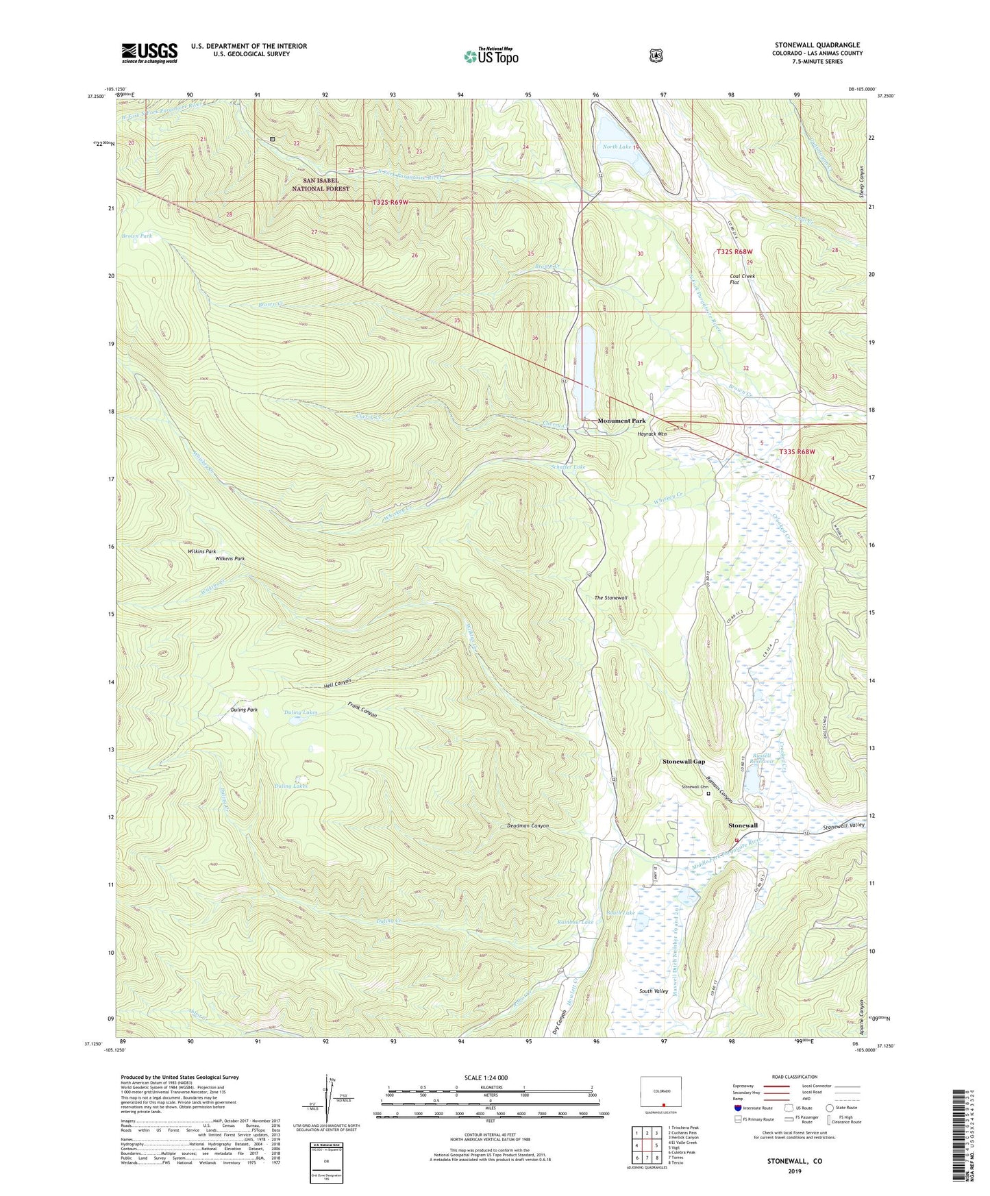
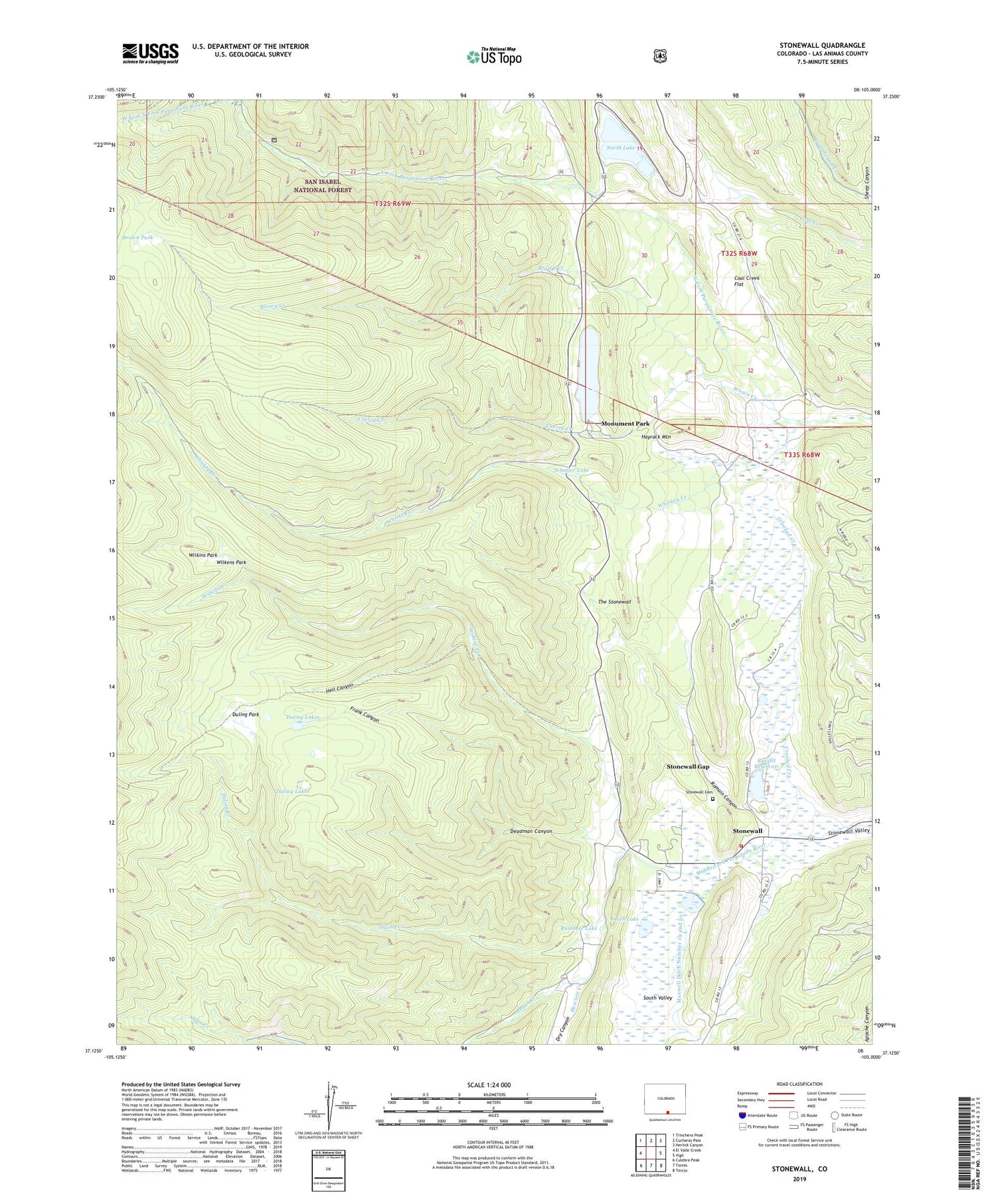
Stonewall Colorado US Topo Map
Couldn't load pickup availability
Also explore the Stonewall Forest Service Topo of this same quad for updated USFS data
2022 topographic map quadrangle Stonewall in the state of Colorado. Scale: 1:24000. Based on the newly updated USGS 7.5' US Topo map series, this map is in the following counties: Las Animas. The map contains contour data, water features, and other items you are used to seeing on USGS maps, but also has updated roads and other features. This is the next generation of topographic maps. Printed on high-quality waterproof paper with UV fade-resistant inks.
Quads adjacent to this one:
West: El Valle Creek
Northwest: Trinchera Peak
North: Cucharas Pass
Northeast: Herlick Canyon
East: Vigil
Southeast: Tercio
South: Torres
Southwest: Culebra Peak
This map covers the same area as the classic USGS quad with code o37105b1.
Contains the following named places: Abbot Creek, Brown Creek, Brown Lake, Brown Park, Cherry Creek, Coal Creek Flat, Crooked Creek, Deadman Canyon, Dry Canyon, Duling Creek, Duling Lakes, Duling Park, Frank Canyon, Hayrack Mountain, Hell Canyon, Howlett Creek, Monument Lake, Monument Lake Dam, Monument Park, North Lake, North Lake Dam, Rainbow Lake, Romain Canyon, Russell Dam, Russell Lake, Russell Reservoir, Schaffer Lake, Sheep Canyon, South Lake, South Valley, Stonewall, Stonewall Cemetery, Stonewall Fire Protection District Stonewall Station, Stonewall Gap, Stonewall Gap Census Designated Place, West Fork North Fork Purgatoire River, Whiskey Creek, Wilkens Park, Wilkins Creek, Wilkins Park