MyTopo
Torres Colorado US Topo Map
Couldn't load pickup availability
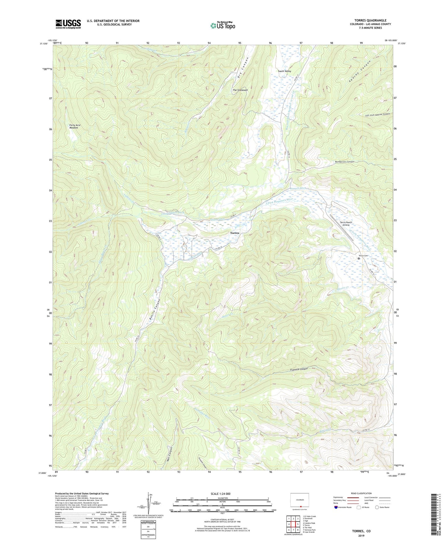
2022 topographic map quadrangle Torres in the state of Colorado. Scale: 1:24000. Based on the newly updated USGS 7.5' US Topo map series, this map is in the following counties: Las Animas. The map contains contour data, water features, and other items you are used to seeing on USGS maps, but also has updated roads and other features. This is the next generation of topographic maps. Printed on high-quality waterproof paper with UV fade-resistant inks.
Quads adjacent to this one:
West: Culebra Peak
Northwest: El Valle Creek
North: Stonewall
Northeast: Vigil
East: Tercio
Southeast: Casa Grande
South: Vermejo Park
Southwest: The Wall
This map covers the same area as the classic USGS quad with code o37105a1.
Contains the following named places: Bonito Canyon, Consolidated Ditch, Cornell Ditch, Cornell Mine, Davenport Cabin, Forty Acre Meadow, Johnson Creek, Maxwell Ditch Number 19 and 20, Quatro Creek, Quatro Ditch, Quatro Mine, Ryan Dam, Ryan Reservoir, Sierra Blanca Creek, Tercio Cemetery, Tercio Ranch Airstrip, The Little Wall, The Stonewall, Torres, Torres Ditch, Vallejos Creek