MyTopo
Trinchera Peak Colorado US Topo Map
Couldn't load pickup availability
Also explore the Trinchera Peak Forest Service Topo of this same quad for updated USFS data
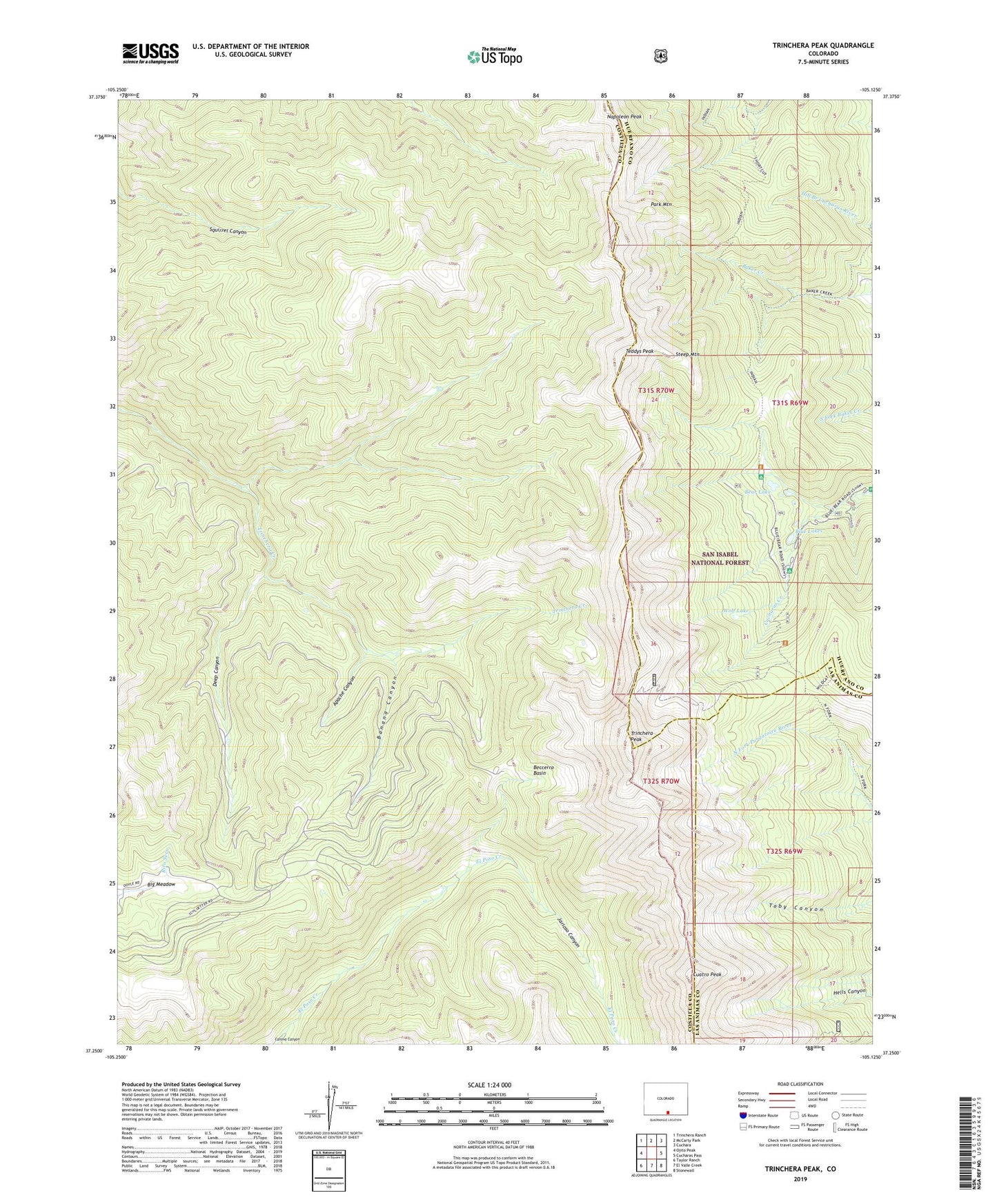
2022 topographic map quadrangle Trinchera Peak in the state of Colorado. Scale: 1:24000. Based on the newly updated USGS 7.5' US Topo map series, this map is in the following counties: Costilla, Huerfano, Las Animas. The map contains contour data, water features, and other items you are used to seeing on USGS maps, but also has updated roads and other features. This is the next generation of topographic maps. Printed on high-quality waterproof paper with UV fade-resistant inks.
Quads adjacent to this one:
West: Ojito Peak
Northwest: Trinchera Ranch
North: McCarty Park
Northeast: Cuchara
East: Cucharas Pass
Southeast: Stonewall
South: El Valle Creek
Southwest: Taylor Ranch
This map covers the same area as the classic USGS quad with code o37105c2.
Contains the following named places: Apache Canyon, Banana Canyon, Bear Lake, Bear Lake Campground, Beccerro Basin, Big Meadow, Blue Lakes, Blue Lakes Campground, Cuatro Peak, Cuchara Valley Ski Area, Deep Canyon, Indian Trail, Jarioso Canyon, Napoleon Peak, Park Mountain, Sangre de Cristo Conservation Area, Steep Mountain, Teddys Peak, Trinchera Peak, Wolf Lake