MyTopo
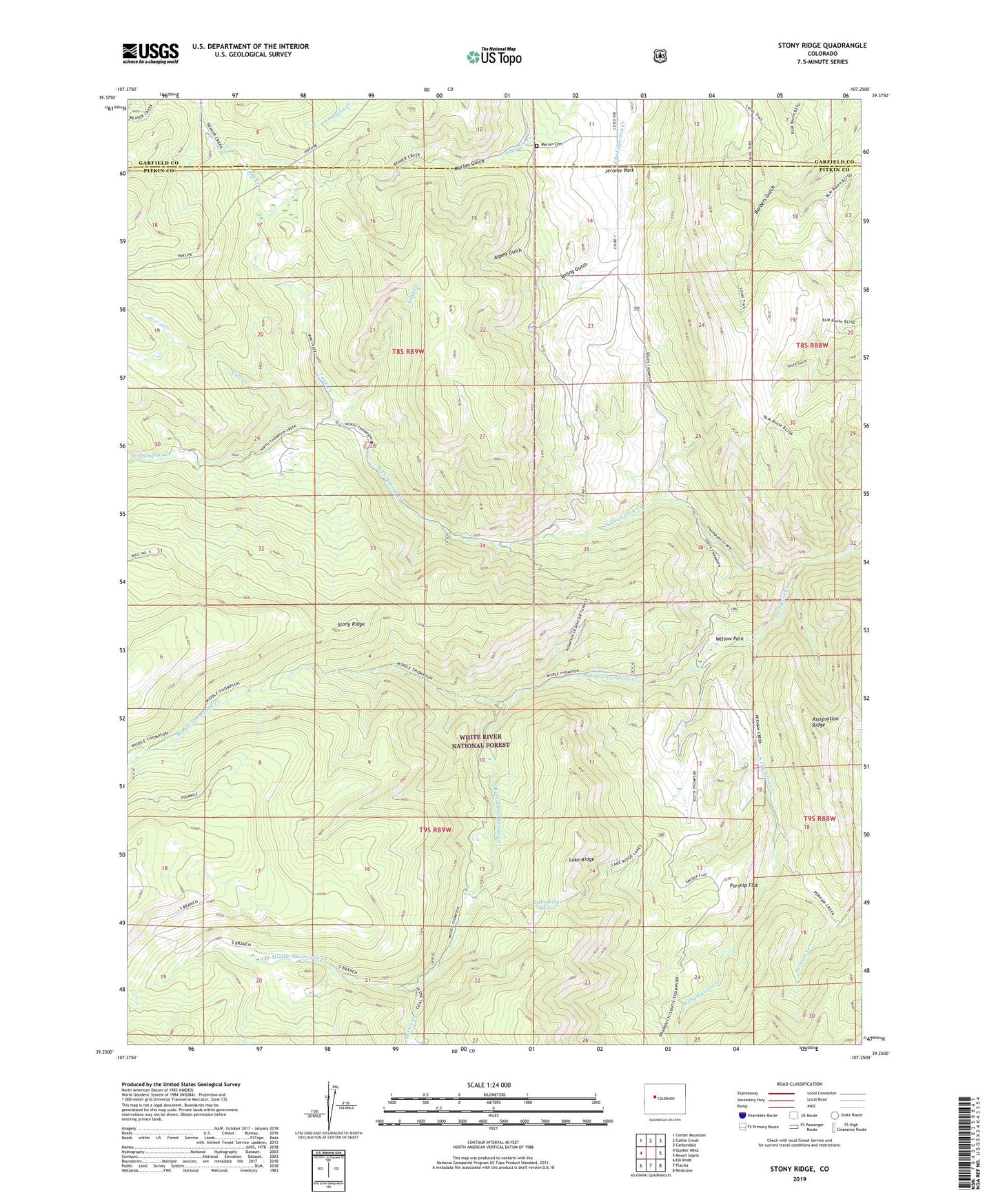
Stony Ridge Colorado US Topo Map
Couldn't load pickup availability
Also explore the Stony Ridge Forest Service Topo of this same quad for updated USFS data
2022 topographic map quadrangle Stony Ridge in the state of Colorado. Scale: 1:24000. Based on the newly updated USGS 7.5' US Topo map series, this map is in the following counties: Pitkin, Garfield. The map contains contour data, water features, and other items you are used to seeing on USGS maps, but also has updated roads and other features. This is the next generation of topographic maps. Printed on high-quality waterproof paper with UV fade-resistant inks.
Quads adjacent to this one:
West: Quaker Mesa
Northwest: Center Mountain
North: Cattle Creek
Northeast: Carbondale
East: Mount Sopris
Southeast: Redstone
South: Placita
Southwest: Elk Knob
This map covers the same area as the classic USGS quad with code o39107c3.
Contains the following named places: Anderson Mine, Aspen Gulch, Assignation Ridge, Calf Creek, Dexter Creek, Jerome Park, Lake Ridge Lakes, Lambert Place, Marion Cemetery, Marion Gulch, Marion Mine, Middle Thompson Creek, North Thompson Creek, Parsnip Flat, Sand Creek, South Branch Middle Thompson Creek, South Thompson Creek, South Thompson Creek Cow Camp, Spring Gulch, Spring Gulch Mine, Stony Ridge, Sunshine Mine, Thompson Creek Guard Station, Thompson Creek Mine, Thompson Creek Number One Mine, Thompson Creek Number Three Mine, Union Mine, Willow Park, Yank Creek, Yank Creek Cow Camp