MyTopo
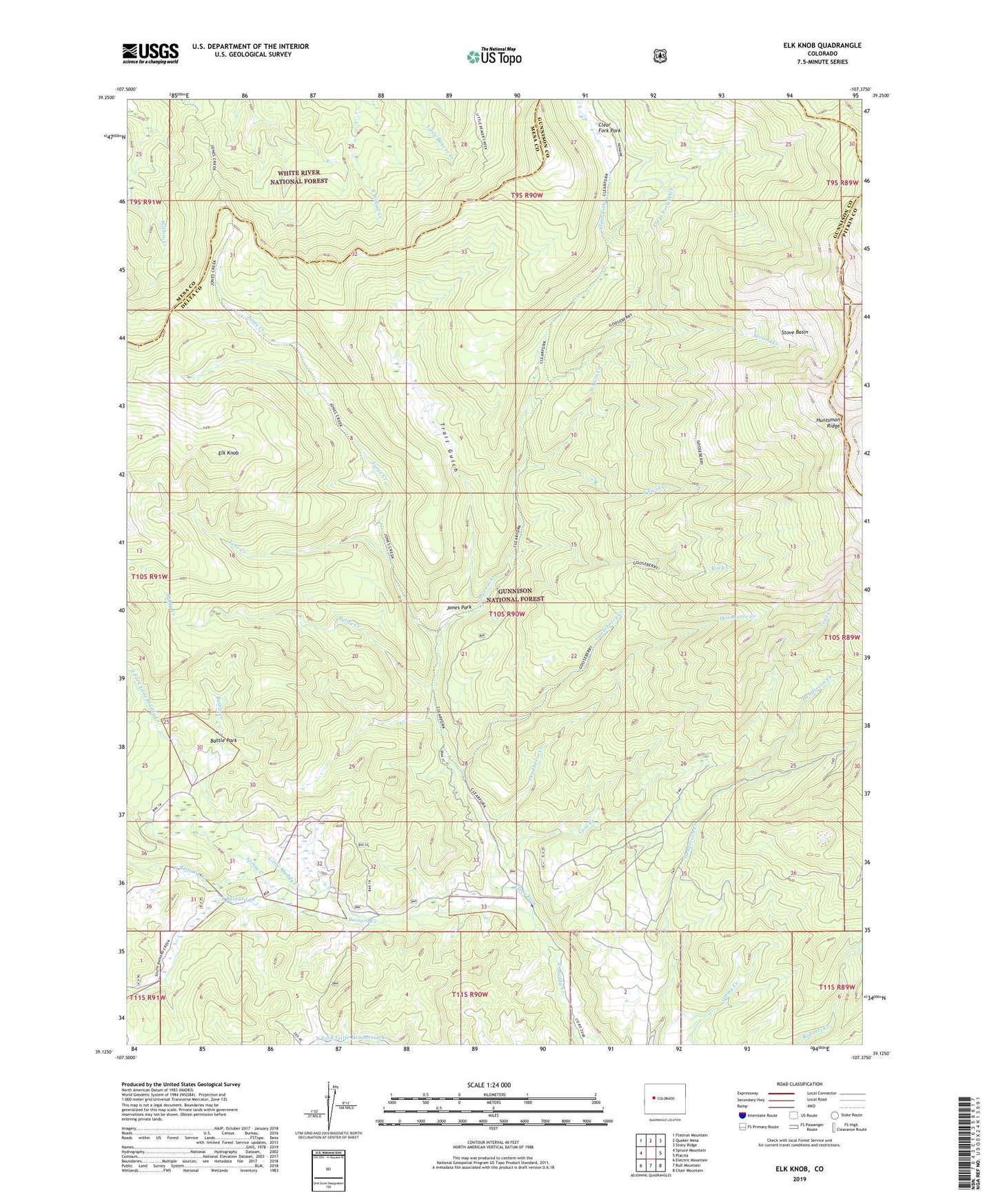
Elk Knob Colorado US Topo Map
Couldn't load pickup availability
Also explore the Elk Knob Forest Service Topo of this same quad for updated USFS data
2022 topographic map quadrangle Elk Knob in the state of Colorado. Scale: 1:24000. Based on the newly updated USGS 7.5' US Topo map series, this map is in the following counties: Gunnison, Mesa, Pitkin. The map contains contour data, water features, and other items you are used to seeing on USGS maps, but also has updated roads and other features. This is the next generation of topographic maps. Printed on high-quality waterproof paper with UV fade-resistant inks.
Quads adjacent to this one:
West: Spruce Mountain
Northwest: Flatiron Mountain
North: Quaker Mesa
Northeast: Stony Ridge
East: Placita
Southeast: Chair Mountain
South: Bull Mountain
Southwest: Electric Mountain
This map covers the same area as the classic USGS quad with code o39107b4.
Contains the following named places: Bainard Creek, Baldy Creek, Basin Creek, Battle Creek, Battle Park, Clear Fork, Clear Fork Park, Coal Creek, Deadhorse Creek, East Fork Little Muddy Creek, Elk Knob, Gooseberry Creek, Jones Creek, Jones Park, June Creek, Little Muddy Creek, North Bainard Creek, North Twin Creek, Olson Place, Rock Creek, Second Creek, South Bainard Creek, South Twin Creek, Spring Creek, Stove Basin, Tolan Place, Trail Gulch, Twin Creek