MyTopo
Carbondale Colorado US Topo Map
Couldn't load pickup availability
Also explore the Carbondale Forest Service Topo of this same quad for updated USFS data
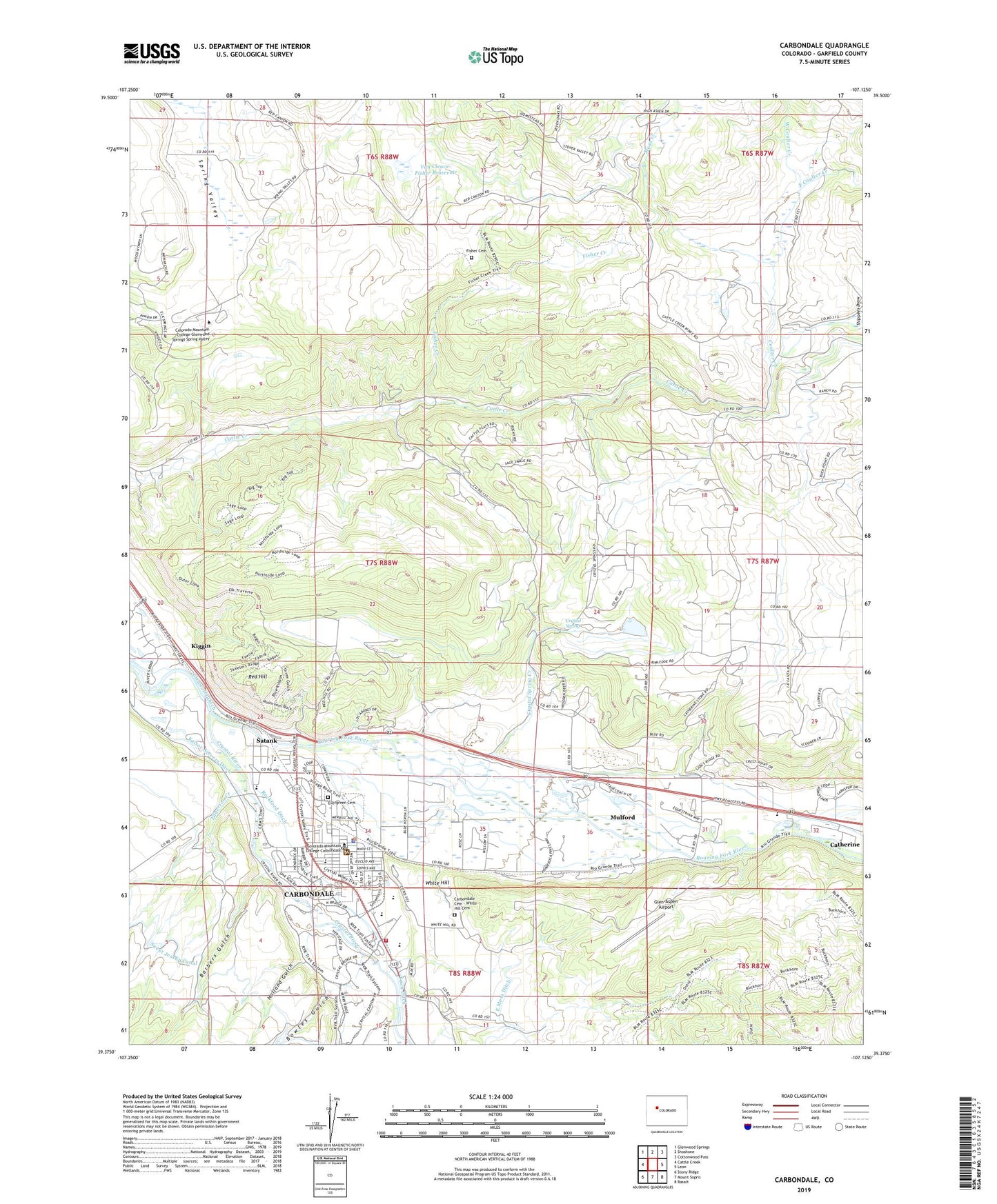
2022 topographic map quadrangle Carbondale in the state of Colorado. Scale: 1:24000. Based on the newly updated USGS 7.5' US Topo map series, this map is in the following counties: Garfield. The map contains contour data, water features, and other items you are used to seeing on USGS maps, but also has updated roads and other features. This is the next generation of topographic maps. Printed on high-quality waterproof paper with UV fade-resistant inks.
Quads adjacent to this one:
West: Cattle Creek
Northwest: Glenwood Springs
North: Shoshone
Northeast: Cottonwood Pass
East: Leon
Southeast: Basalt
South: Mount Sopris
Southwest: Stony Ridge
This map covers the same area as the classic USGS quad with code o39107d2.
Contains the following named places: Atkinson Ditch, Barbers Gulch, Bowles Gulch, Carbondale, Carbondale and Rural Fire Protection District Station 81, Carbondale and Rural Fire Protection District Station 85, Carbondale Cemetery - White Hill Cemetery, Carbondale Community School, Carbondale Community United Methodist Church, Carbondale Elementary School, Carbondale Middle School, Carbondale Police Department, Carbondale Post Office, Carbondale Town Hall, Catherine, Colorado Mountain College Glenwood Springs Spring Valley, Colorado Mountain College Lappala Center, Colorado Rocky Mountain School, Coulter Creek, Crystal River, Crystal River Baptist Church, Crystal Spring, Crystal Spring Creek, Crystal Village Plaza Shopping Center, East Coulter Creek, Edgerton Creek, Evergreen Cemetery, Fisher Cemetery, Fisher Creek, Glen-Aspen Airport, Gordon Cooper Branch Library, Hawk Ditch Dam, Hawk Ditch Reservoir, Holland Gulch, John M Fleet Municipal Pool, KDNK-FM (Carbondale), Kiggin, Mesa Creek, Midcontinent Limestone Quarry, Mulford, Mulford Census Designated Place, Red Hill, Roaring Fork High School, Rockford Ditch, Saint Mary of the Crown Catholic Church, Satank, Shippees Draw, Sobris District Ranger Station, Sopris Park, Sopris Shopping Center, Town Ditch, Town of Carbondale, Van Cleave-Fisher Reservoir, Van Cleve-Fisher Dam, West Coulter Creek, White Hill