MyTopo
Sunbeam Colorado US Topo Map
Couldn't load pickup availability
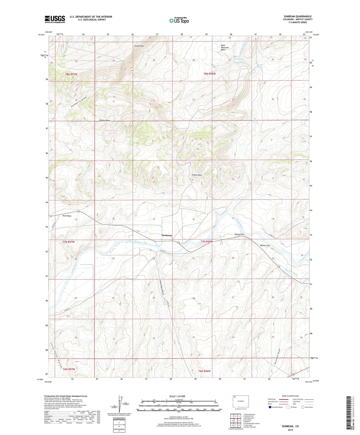
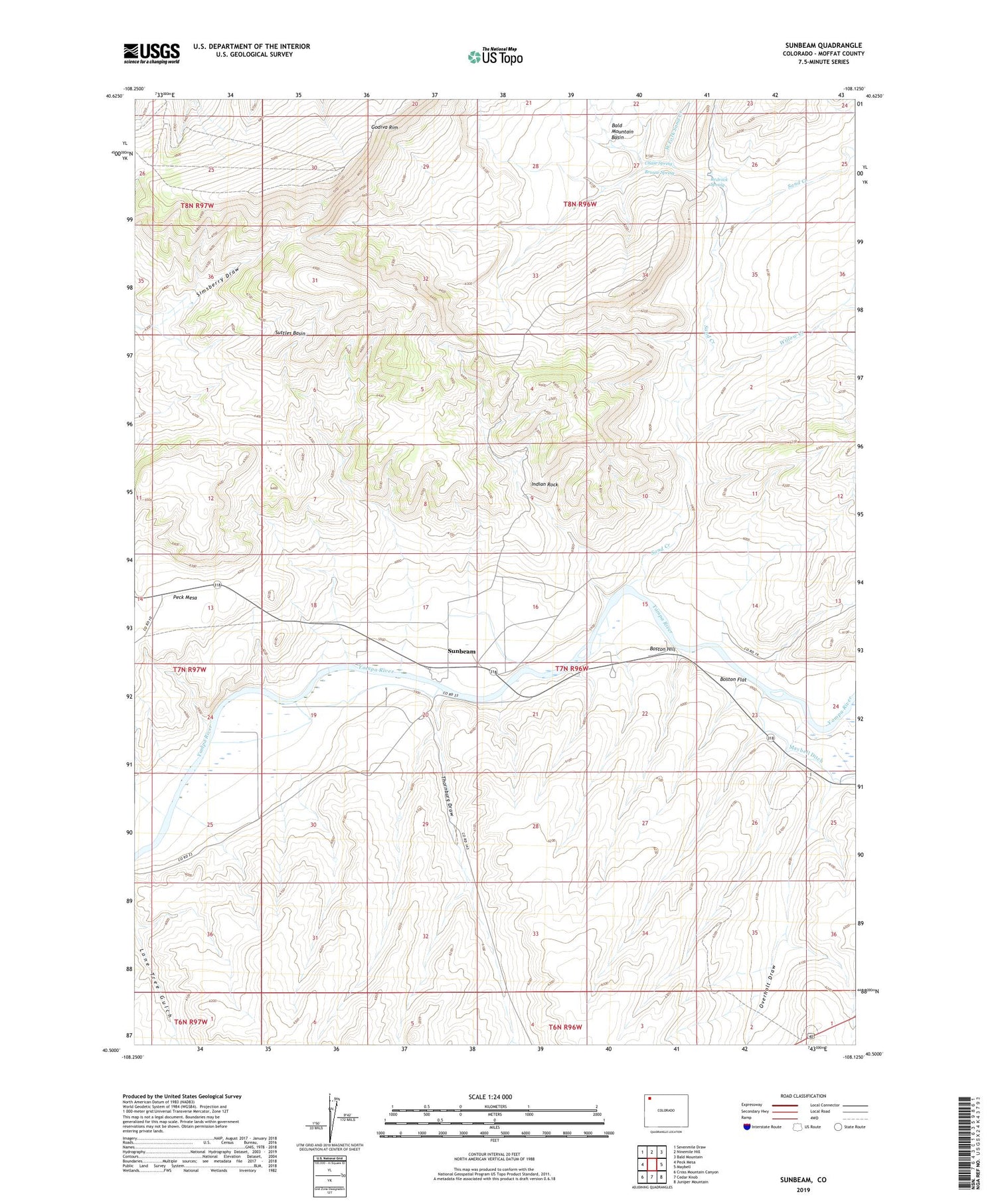
2022 topographic map quadrangle Sunbeam in the state of Colorado. Scale: 1:24000. Based on the newly updated USGS 7.5' US Topo map series, this map is in the following counties: Moffat. The map contains contour data, water features, and other items you are used to seeing on USGS maps, but also has updated roads and other features. This is the next generation of topographic maps. Printed on high-quality waterproof paper with UV fade-resistant inks.
Quads adjacent to this one:
West: Peck Mesa
Northwest: Sevenmile Draw
North: Ninemile Hill
Northeast: Bald Mountain
East: Maybell
Southeast: Juniper Mountain
South: Cedar Knob
Southwest: Cross Mountain Canyon
This map covers the same area as the classic USGS quad with code o40108e2.
Contains the following named places: Boston Flat, Boston Hill, Brouse Spring, Chase Spring, Indian Rock, Moffat County, Overholt Draw, Redrock Spring, Sand Creek, Sunbeam, Suttles Basin, Thornburg Draw, Thornburg Trail, Willow Creek