MyTopo
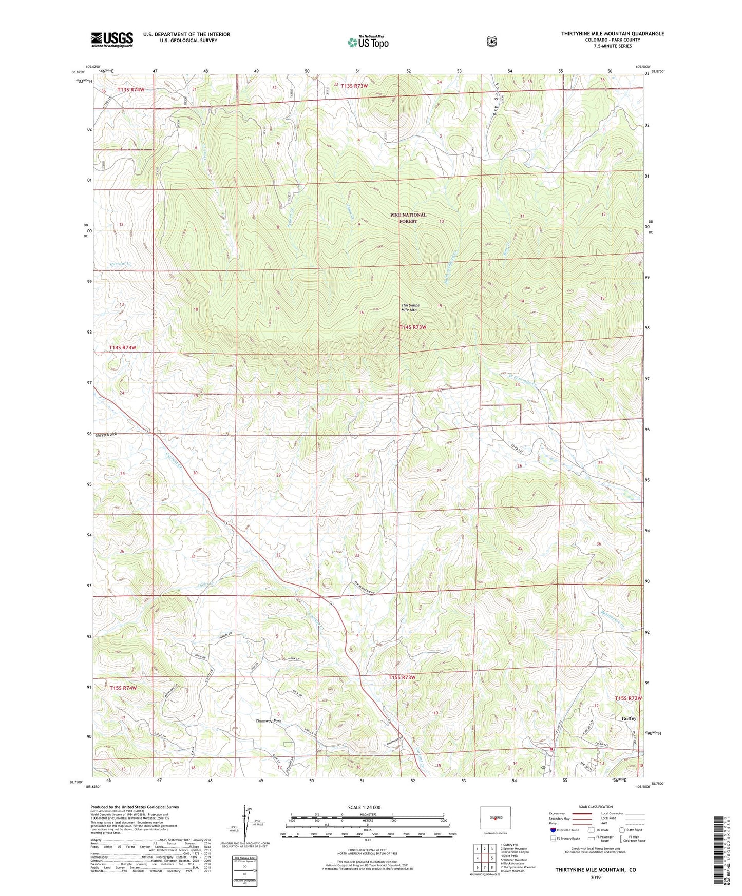
Thirtynine Mile Mountain Colorado US Topo Map
Couldn't load pickup availability
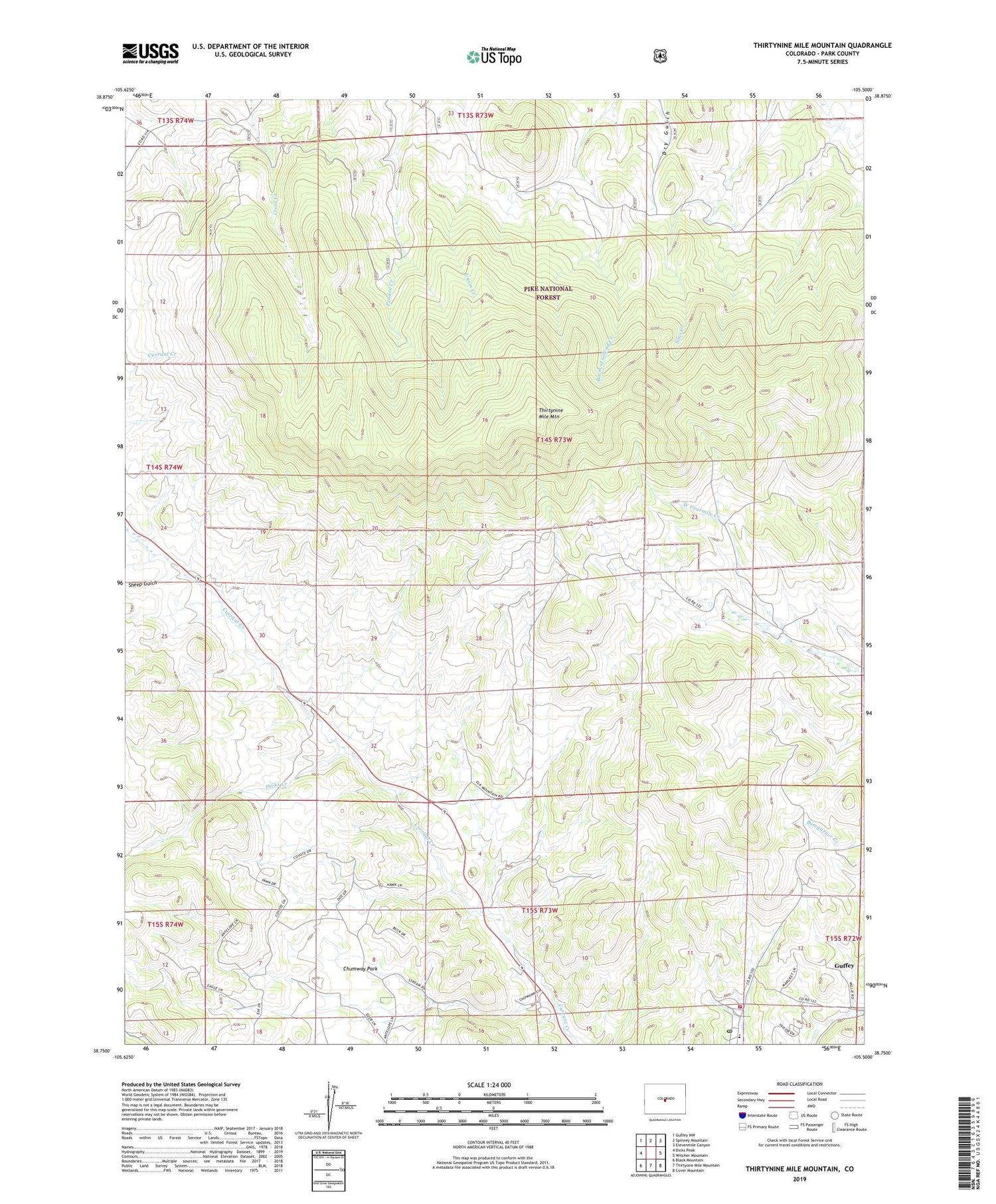
Also explore the Thirtynine Mile Mountain Forest Service Topo of this same quad for updated USFS data
2022 topographic map quadrangle Thirtynine Mile Mountain in the state of Colorado. Scale: 1:24000. Based on the newly updated USGS 7.5' US Topo map series, this map is in the following counties: Park. The map contains contour data, water features, and other items you are used to seeing on USGS maps, but also has updated roads and other features. This is the next generation of topographic maps. Printed on high-quality waterproof paper with UV fade-resistant inks.
Quads adjacent to this one:
West: Dicks Peak
Northwest: Guffey NW
North: Spinney Mountain
Northeast: Elevenmile Canyon
East: Witcher Mountain
Southeast: Cover Mountain
South: Thirtyone Mile Mountain
Southwest: Black Mountain
This map covers the same area as the classic USGS quad with code o38105g5.
Contains the following named places: Chumway Park, Dicks Creek, Guffey, Guffey Census Designated Place, Guffey Post Office, Sheep Gulch, Southern Park County Fire Protection District Station 1 Guffey, Thirtynine Mile Mountain, Wilson Ranch, ZIP Code: 80820