MyTopo
Thirtyone Mile Mountain Colorado US Topo Map
Couldn't load pickup availability
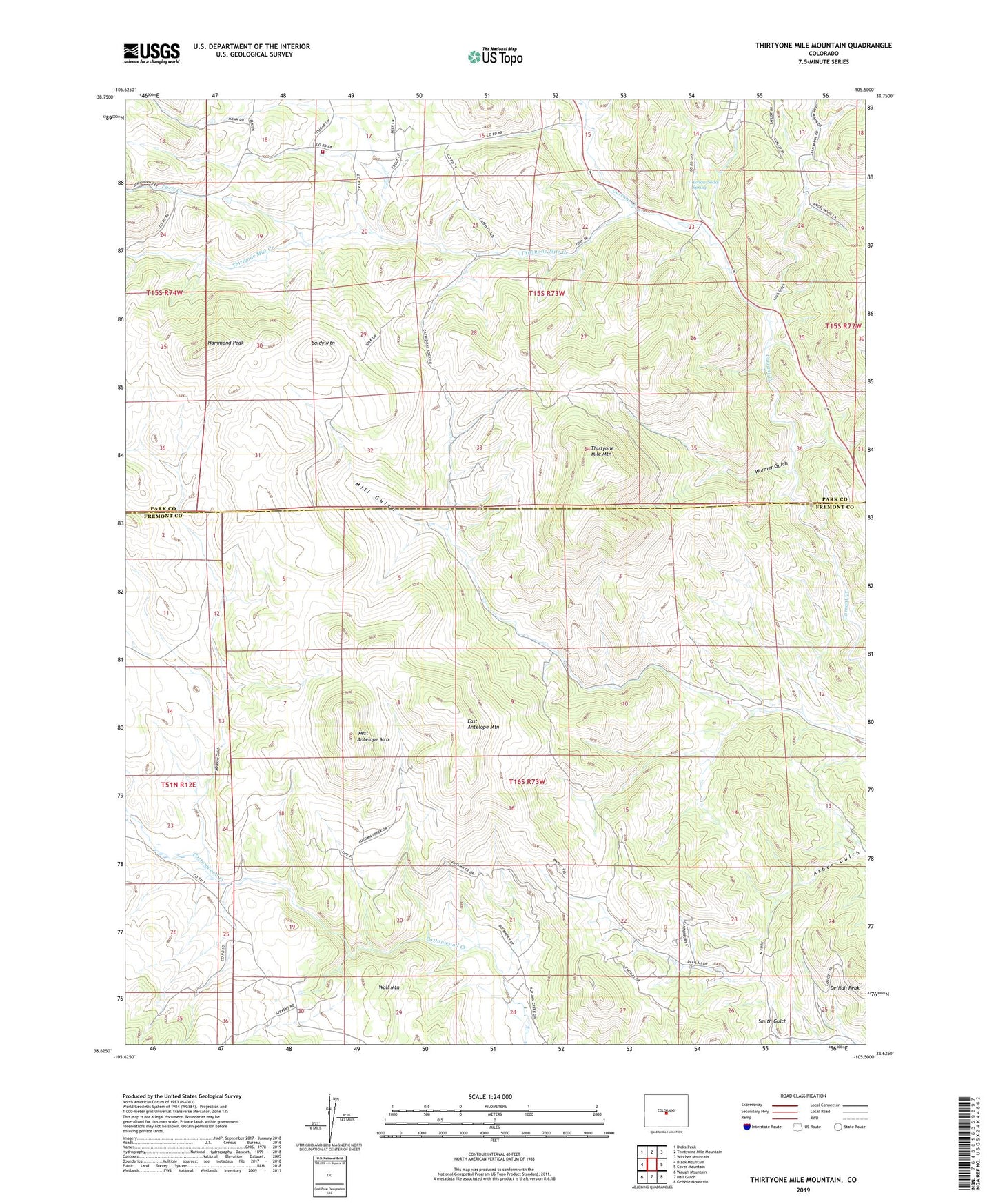
2022 topographic map quadrangle Thirtyone Mile Mountain in the state of Colorado. Scale: 1:24000. Based on the newly updated USGS 7.5' US Topo map series, this map is in the following counties: Fremont, Park. The map contains contour data, water features, and other items you are used to seeing on USGS maps, but also has updated roads and other features. This is the next generation of topographic maps. Printed on high-quality waterproof paper with UV fade-resistant inks.
Quads adjacent to this one:
West: Black Mountain
Northwest: Dicks Peak
North: Thirtynine Mile Mountain
Northeast: Witcher Mountain
East: Cover Mountain
Southeast: Gribble Mountain
South: Hall Gulch
Southwest: Waugh Mountain
This map covers the same area as the classic USGS quad with code o38105f5.
Contains the following named places: Baldy Mountain, Betty Mine, Cabin Gulch, Charlene Number One Mine, Delilah Peak, East Antelope Mountain, Freshwater Creek, Hammond Peak, I M Ranch, Louis Gulch, Meadow Gulch, Meyers Ranch Mine, Paris Creek, Southern Park County Fire Protection District Station 3 - Pike Trails, Thirtyone Mile Creek, Thirtyone Mile Mountain, Wall Mountain, Warmer Gulch, West Antelope Mountain, Yellow Soda Spring