MyTopo
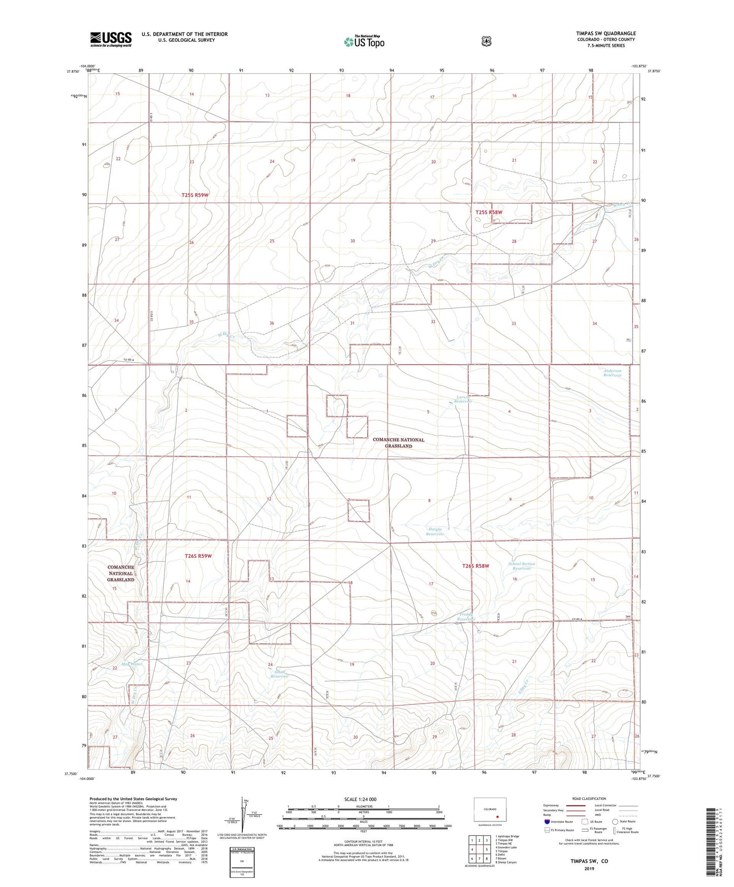
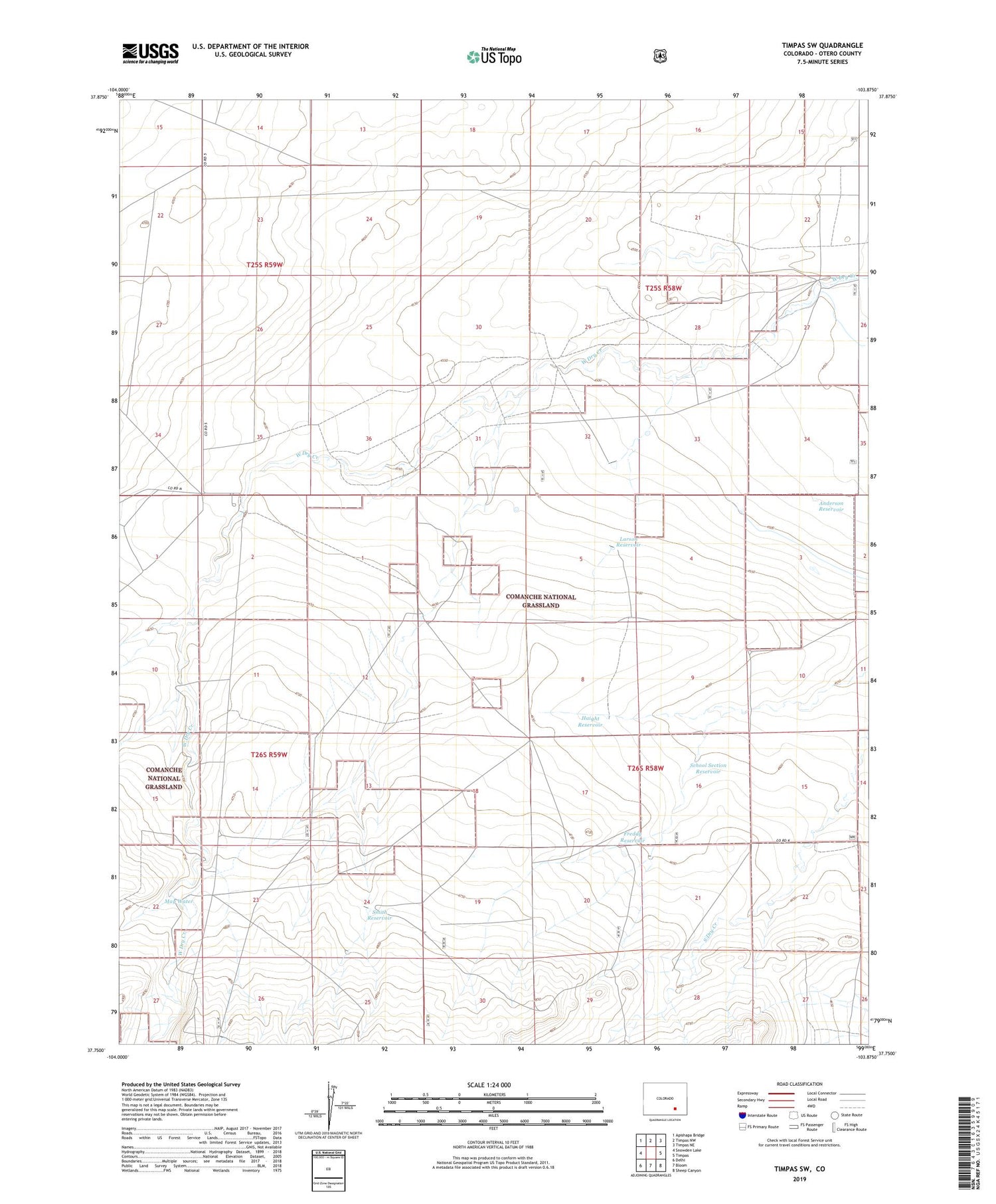
Timpas SW Colorado US Topo Map
Couldn't load pickup availability
Also explore the Timpas SW Forest Service Topo of this same quad for updated USFS data
2022 topographic map quadrangle Timpas SW in the state of Colorado. Scale: 1:24000. Based on the newly updated USGS 7.5' US Topo map series, this map is in the following counties: Otero. The map contains contour data, water features, and other items you are used to seeing on USGS maps, but also has updated roads and other features. This is the next generation of topographic maps. Printed on high-quality waterproof paper with UV fade-resistant inks.
Quads adjacent to this one:
West: Snowden Lake
Northwest: Apishapa Bridge
North: Timpas NW
Northeast: Timpas NE
East: Timpas
Southeast: Sheep Canyon
South: Bloom
Southwest: Delhi
This map covers the same area as the classic USGS quad with code o37103g8.
Contains the following named places: Anderson Reservoir, Dry Creek Camp, Freddy Reservoir, Haight Reservoir, Haight Wells, Larson Reservoir, May Water, Nemo Windmill, Reed Windmill, School Section Reservoir, Smith Reservoir, Swisher Windmill, Wilson Windmill