MyTopo
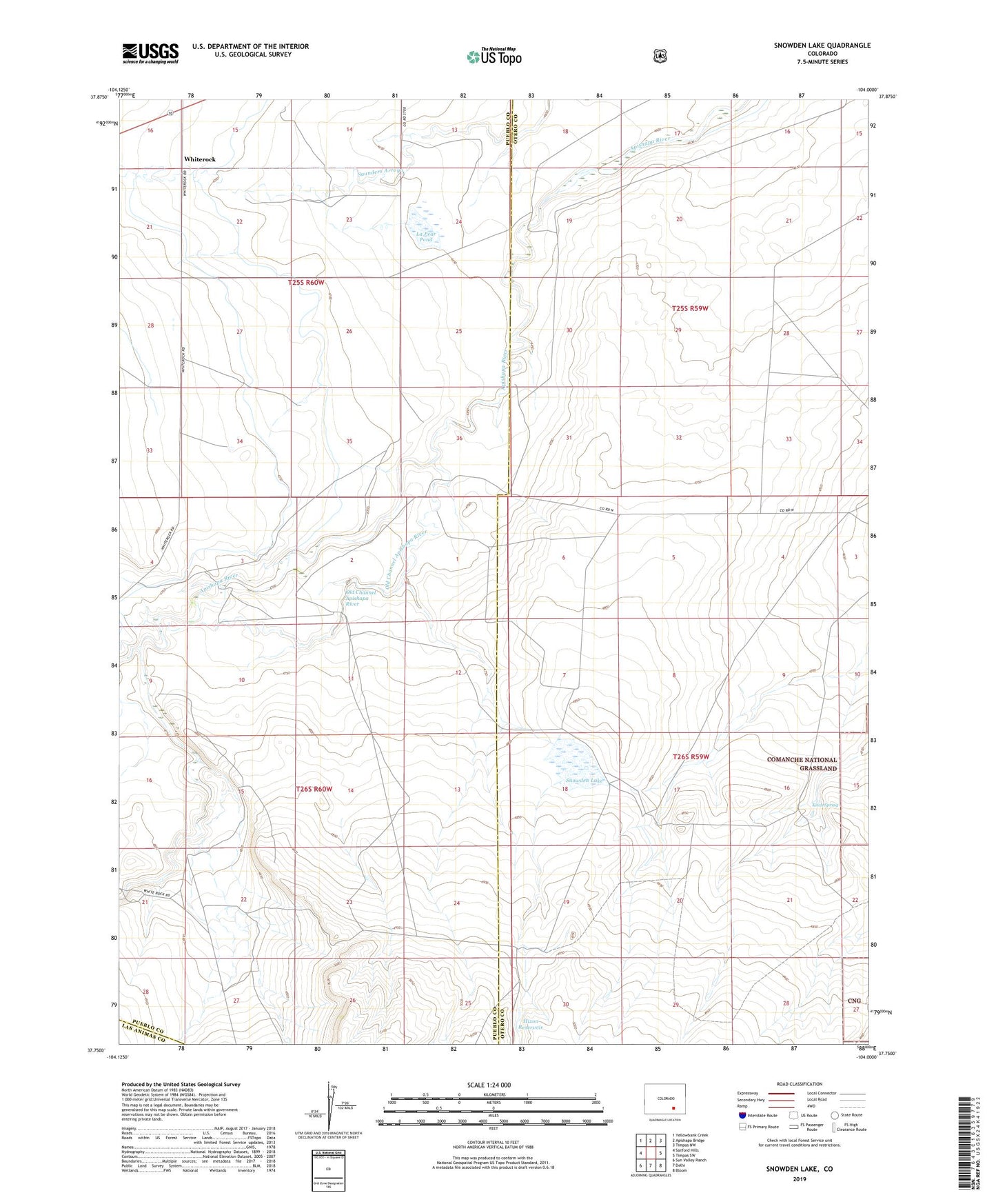
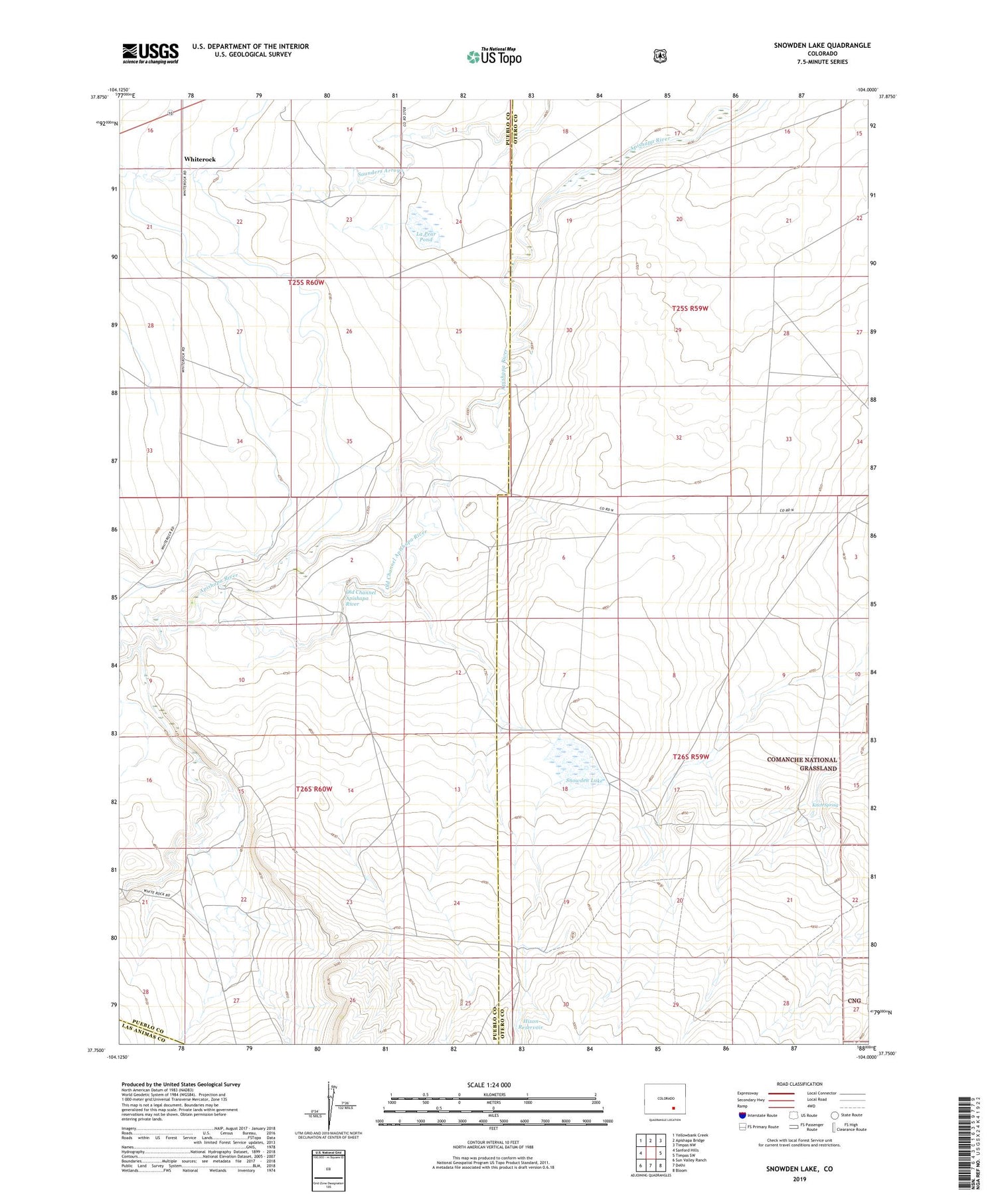
Snowden Lake Colorado US Topo Map
Couldn't load pickup availability
Also explore the Snowden Lake Forest Service Topo of this same quad for updated USFS data
2022 topographic map quadrangle Snowden Lake in the state of Colorado. Scale: 1:24000. Based on the newly updated USGS 7.5' US Topo map series, this map is in the following counties: Pueblo, Otero, Las Animas. The map contains contour data, water features, and other items you are used to seeing on USGS maps, but also has updated roads and other features. This is the next generation of topographic maps. Printed on high-quality waterproof paper with UV fade-resistant inks.
Quads adjacent to this one:
West: Sanford Hills
Northwest: Yellowbank Creek
North: Apishapa Bridge
Northeast: Timpas NW
East: Timpas SW
Southeast: Bloom
South: Delhi
Southwest: Sun Valley Ranch
This map covers the same area as the classic USGS quad with code o37104g1.
Contains the following named places: Buffalo Arroyo, Bull Pasture Windmill, Hixon Reservoir, Kitch Spring, La Pear Pond, North Hixon Well, Old Channel Apishapa River, Rock Crossing, Snowden Lake, Twomile Arroyo, Whiterock