MyTopo
Trinchera Ranch Colorado US Topo Map
Couldn't load pickup availability
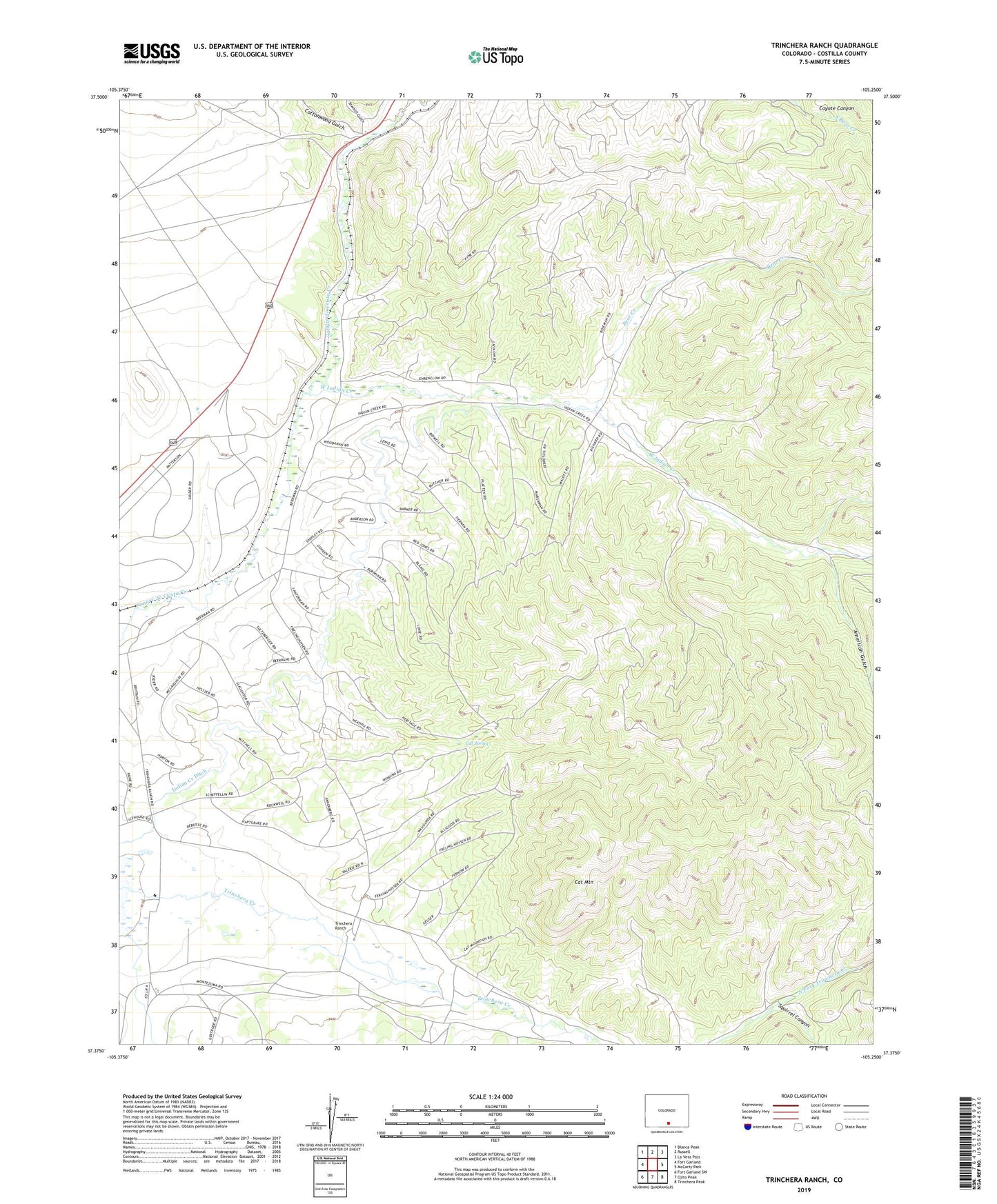
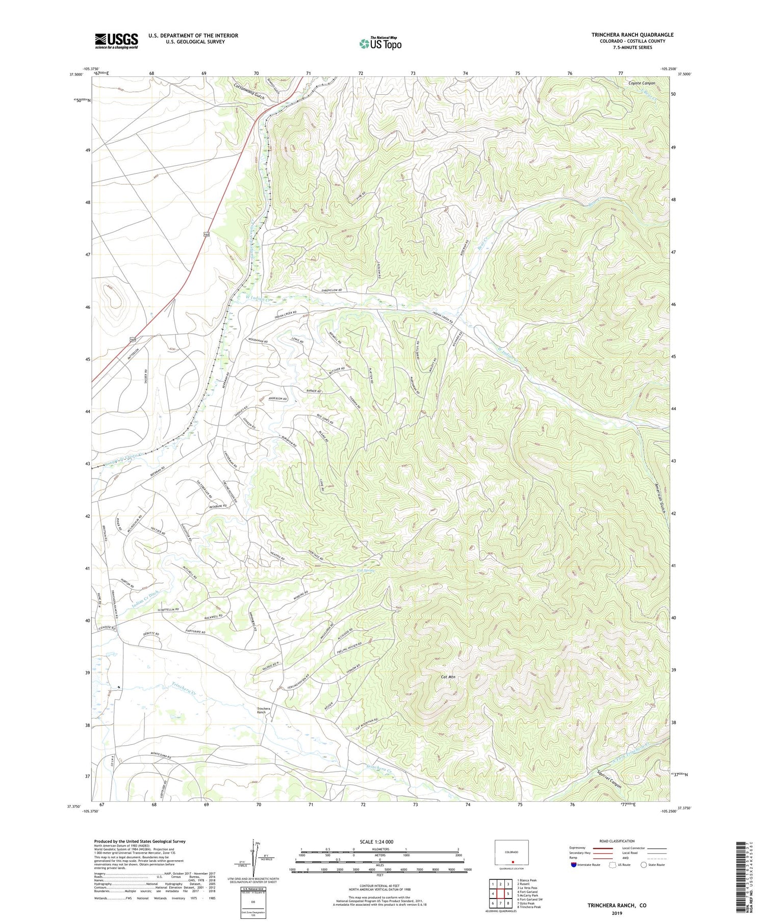
2022 topographic map quadrangle Trinchera Ranch in the state of Colorado. Scale: 1:24000. Based on the newly updated USGS 7.5' US Topo map series, this map is in the following counties: Costilla. The map contains contour data, water features, and other items you are used to seeing on USGS maps, but also has updated roads and other features. This is the next generation of topographic maps. Printed on high-quality waterproof paper with UV fade-resistant inks.
Quads adjacent to this one:
West: Fort Garland
Northwest: Blanca Peak
North: Russell
Northeast: La Veta Pass
East: McCarty Park
Southeast: Trinchera Peak
South: Ojito Peak
Southwest: Fort Garland SW
This map covers the same area as the classic USGS quad with code o37105d3.
Contains the following named places: Alamos Altos Ditch, American Gulch, Bear Creek, Cat Mountain, Cat Spring, Cottonwood Gulch, Garland City, Indian Creek Ditch, Mortimer, Sawmill Gulch, Squirrel Canyon, Trinchera Ranch, West Indian Creek, ZIP Code: 81133