MyTopo
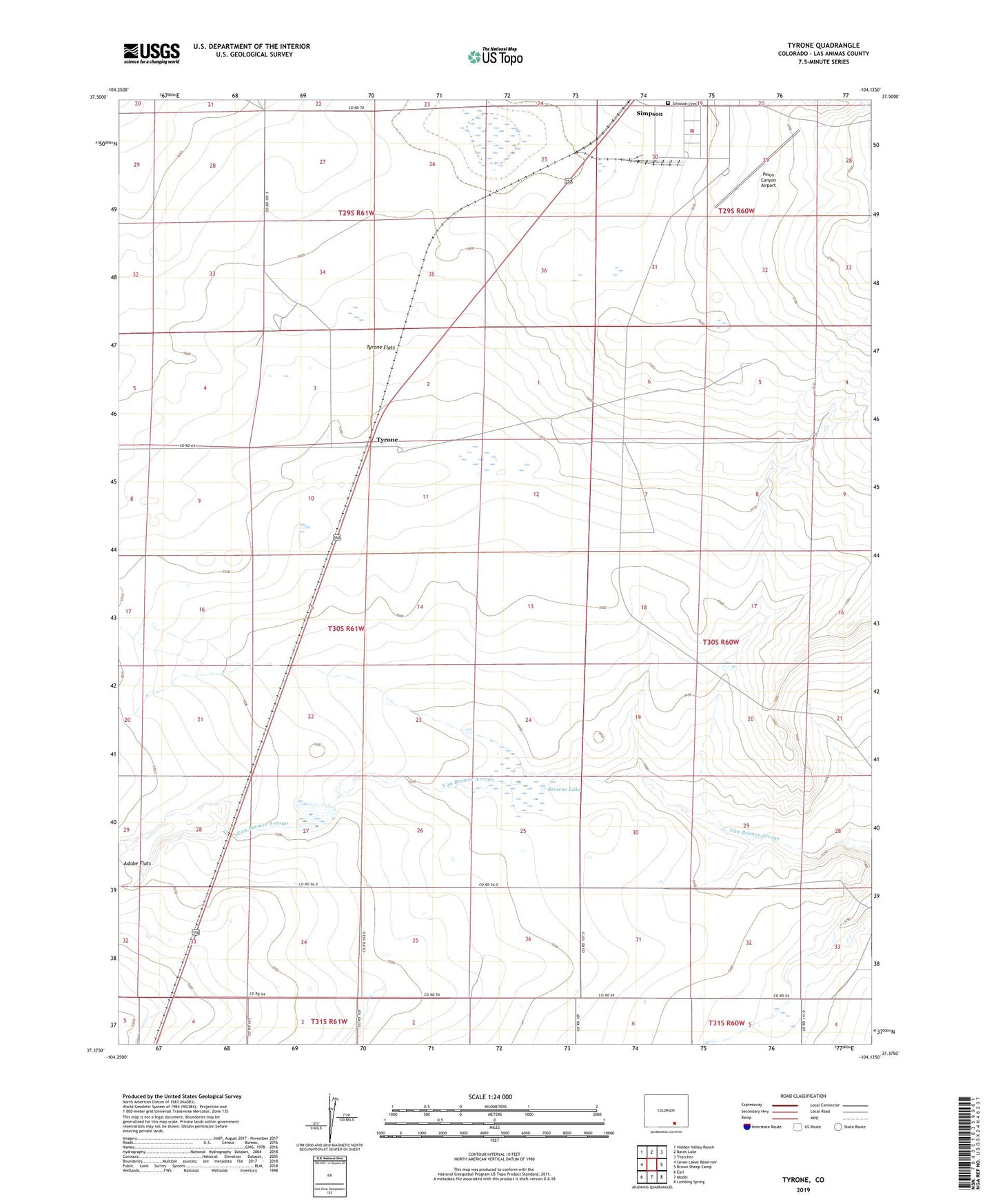
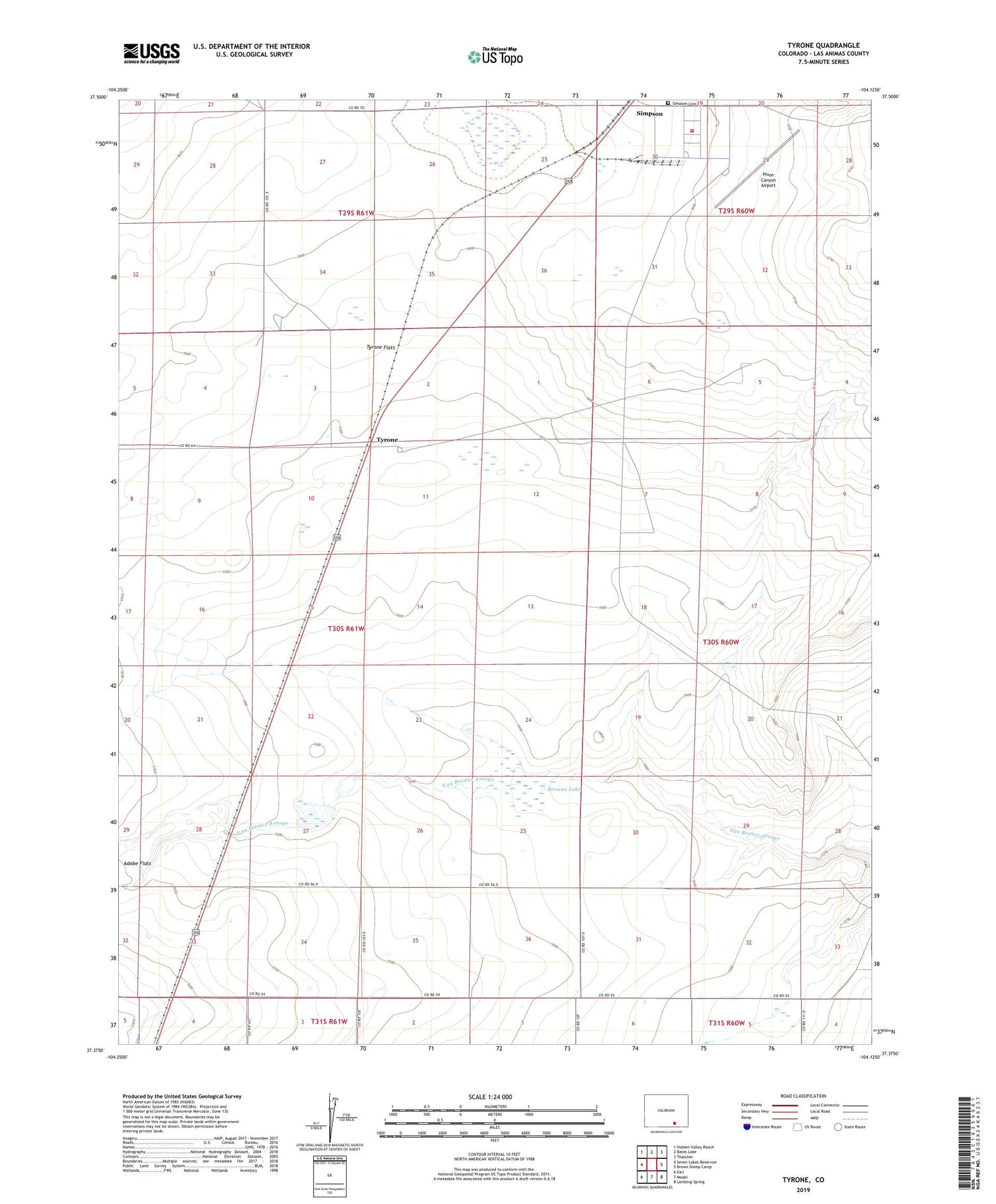
Tyrone Colorado US Topo Map
Couldn't load pickup availability
2022 topographic map quadrangle Tyrone in the state of Colorado. Scale: 1:24000. Based on the newly updated USGS 7.5' US Topo map series, this map is in the following counties: Las Animas. The map contains contour data, water features, and other items you are used to seeing on USGS maps, but also has updated roads and other features. This is the next generation of topographic maps. Printed on high-quality waterproof paper with UV fade-resistant inks.
Quads adjacent to this one:
West: Seven Lakes Reservoir
Northwest: Hidden Valley Ranch
North: Bates Lake
Northeast: Thatcher
East: Brown Sheep Camp
Southeast: Lambing Spring
South: Model
Southwest: Earl
This map covers the same area as the classic USGS quad with code o37104d2.
Contains the following named places: Adobe Flats, Brown Number 1 Dam, Brown Number 1 Reservoir, Browns Lake, Fort Carson Fire and Emergency Services Station 35, Gyurman Reservoir, Pinon Canyon Airport, Simpson, Simpson Cemetery, Simpson Lake, Tyrone, Van Bremer Number 1 Dam