
MyTopo
Vermillion Mesa Colorado US Topo Map
Couldn't load pickup availability
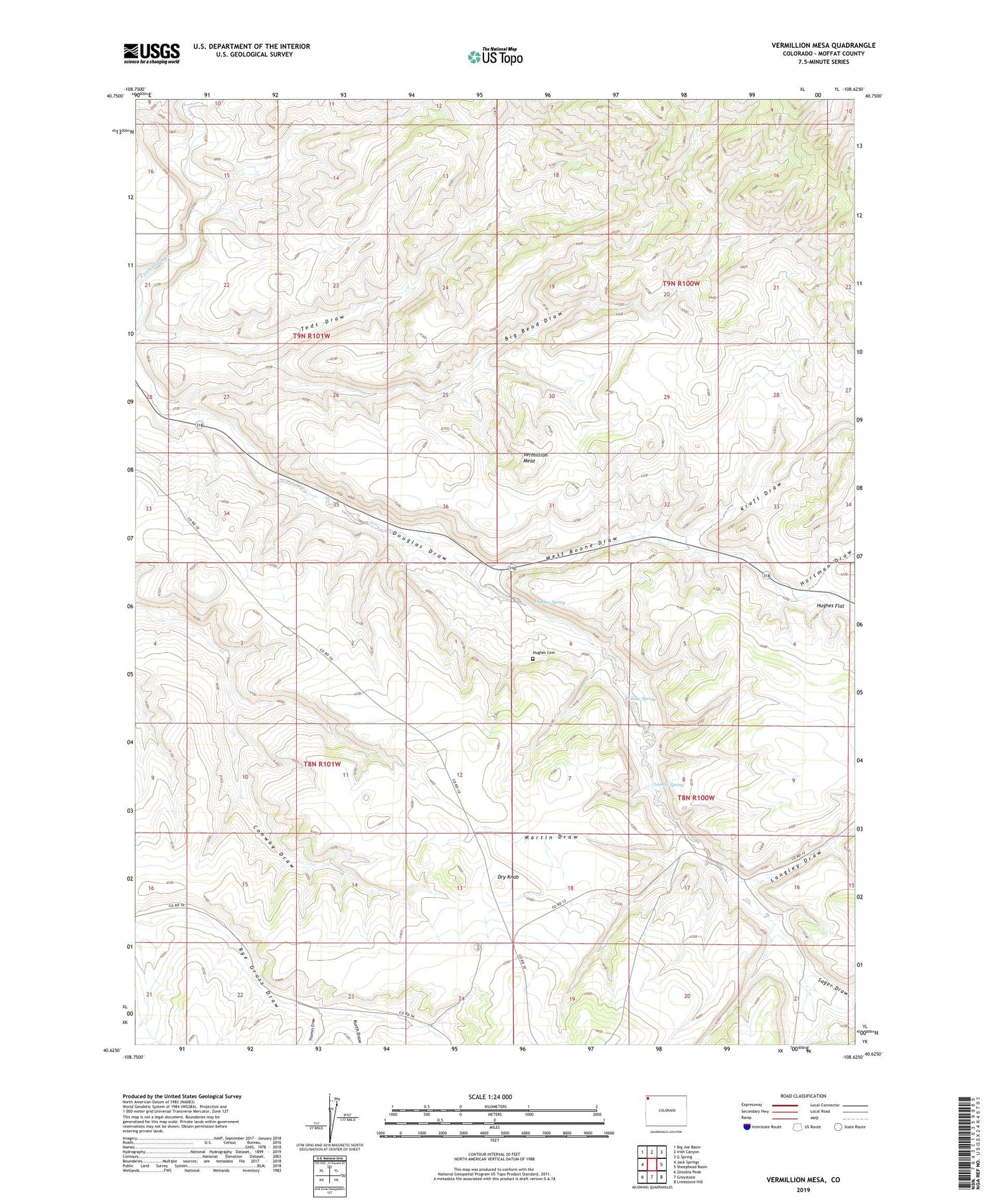
2022 topographic map quadrangle Vermillion Mesa in the state of Colorado. Scale: 1:24000. Based on the newly updated USGS 7.5' US Topo map series, this map is in the following counties: Moffat. The map contains contour data, water features, and other items you are used to seeing on USGS maps, but also has updated roads and other features. This is the next generation of topographic maps. Printed on high-quality waterproof paper with UV fade-resistant inks.
Quads adjacent to this one:
West: Jack Springs
Northwest: Big Joe Basin
North: Irish Canyon
Northeast: G Spring
East: Sheephead Basin
Southeast: Limestone Hill
South: Greystone
Southwest: Zenobia Peak
This map covers the same area as the classic USGS quad with code o40108f6.
Contains the following named places: Big Bend Draw, Dry Knob, Hartman Draw, Hefley Cabin, Hughes Cemetery, Hughes Flat, Hughes Spring, Kraft Draw, Kurth Draw, Langley Draw, Loomis Spring, Martin Draw, Sager Draw, Talamantes Creek, Teds Draw, Thomas Draw, Vermillion Mesa, West Boone Draw, Willow Spring


