
MyTopo
Zenobia Peak Colorado US Topo Map
Couldn't load pickup availability
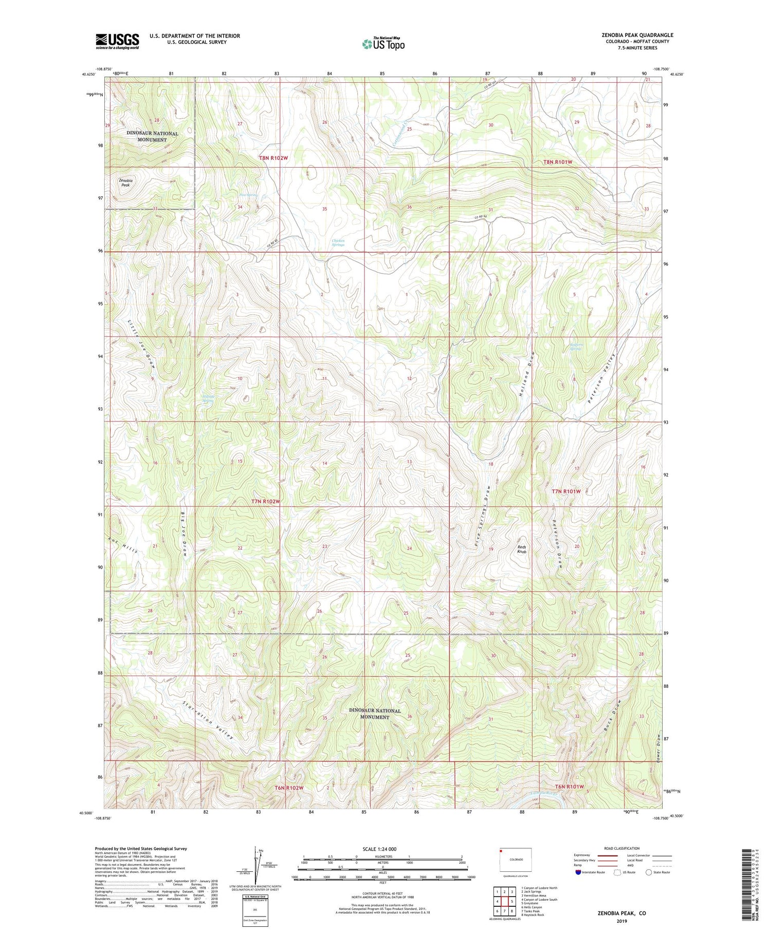
2022 topographic map quadrangle Zenobia Peak in the state of Colorado. Scale: 1:24000. Based on the newly updated USGS 7.5' US Topo map series, this map is in the following counties: Moffat. The map contains contour data, water features, and other items you are used to seeing on USGS maps, but also has updated roads and other features. This is the next generation of topographic maps. Printed on high-quality waterproof paper with UV fade-resistant inks.
Quads adjacent to this one:
West: Canyon of Lodore South
Northwest: Canyon of Lodore North
North: Jack Springs
Northeast: Vermillion Mesa
East: Greystone
Southeast: Haystack Rock
South: Tanks Peak
Southwest: Hells Canyon
This map covers the same area as the classic USGS quad with code o40108e7.
Contains the following named places: Ant Hills, Big Joe Draw, Browns Cabin, Buck Draw, Chicken Springs, Cove Dam, Cove Reservoir, Currant Springs Ranch, Douglas Mountain Mine, Five Spring, Five Springs Draw, Hillside Spring, Holland Draw, Little Joe Draw, Paint Iron Mine, Peterson Draw, Peterson Valley, Queen Anne and Black Sioux Mine, Redfern Spring, Reds Knob, Tisdels Place, Zenobia Peak


