MyTopo
Walden Colorado US Topo Map
Couldn't load pickup availability
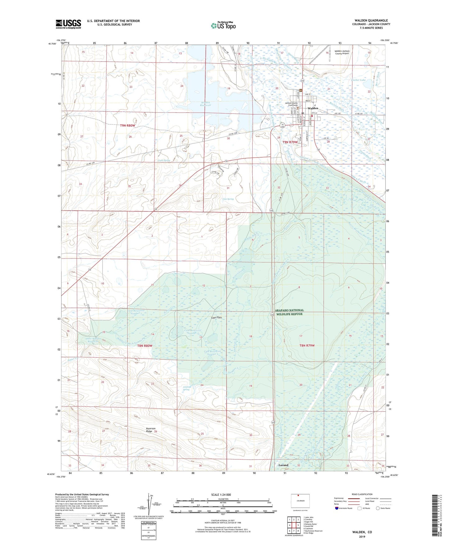
2022 topographic map quadrangle Walden in the state of Colorado. Scale: 1:24000. Based on the newly updated USGS 7.5' US Topo map series, this map is in the following counties: Jackson. The map contains contour data, water features, and other items you are used to seeing on USGS maps, but also has updated roads and other features. This is the next generation of topographic maps. Printed on high-quality waterproof paper with UV fade-resistant inks.
Quads adjacent to this one:
West: Delaney Butte
Northwest: Lake John
North: Cowdrey
Northeast: Eagle Hill
East: Gould NW
Southeast: Owl Ridge
South: MacFarlane Reservoir
Southwest: Coalmont
This map covers the same area as the classic USGS quad with code o40106f3.
Contains the following named places: Allard Ranch, Antelope Creek, Antelope Spring, Arapaho National Wildlife Refuge, Boyce Brothers Ditch, Canadian Coal Company Mine, Case Flats, Case Number 1 Dam, Case Number 3 Dam, Case Ranch, Case Reservoir Number 1, Case Reservoir Number 2, Case Reservoir Number 3, Case Spring, Dry Creek Ditch, Fischer Lake, Fischer Lake and Pumping Dam, Fischer Ranch, George Ward Ditch, Green Spring, Hampton Ranch, Home Ditch Number 2, Hubbard Ditch Number 1, Hubbard Ditch Number 2, Hubbard Ditch Number 3, Hubbard Ditch Number 4, Hunter Ditch Number 1, Hunter Ditch Number 2, Jackson County, Jackson Dam, North Park Ditch Number 4, North Park Ditch Number 6, North Park Fire Rescue / Walden Fire Department, North Park Hospital District Ambulance, Potter Creek, Potter Ditch Number 2, Richmond Ditch, Riddle Ditch, Ruction Ditch, State-Walden Reservoir, Town of Walden, Upland and Home Ditch Number 1, Walden, Walden Dam, Walden Division, Walden Post Office, Walden Reservoir, Walden-Jackson County Airport, Ward Ditch, Ward Ditch Number 3, ZIP Code: 80480