MyTopo
Coalmont Colorado US Topo Map
Couldn't load pickup availability
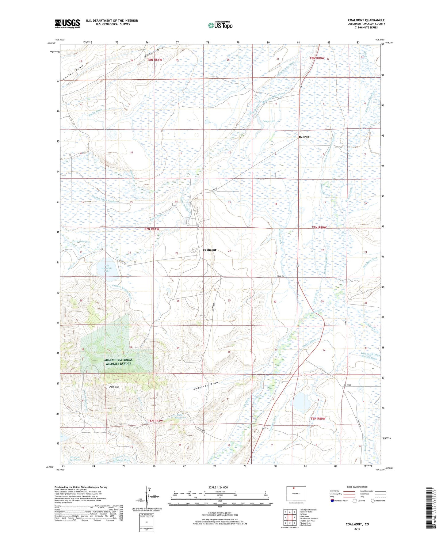
2022 topographic map quadrangle Coalmont in the state of Colorado. Scale: 1:24000. Based on the newly updated USGS 7.5' US Topo map series, this map is in the following counties: Jackson. The map contains contour data, water features, and other items you are used to seeing on USGS maps, but also has updated roads and other features. This is the next generation of topographic maps. Printed on high-quality waterproof paper with UV fade-resistant inks.
Quads adjacent to this one:
West: Teal Lake
Northwest: Pitchpine Mountain
North: Delaney Butte
Northeast: Walden
East: MacFarlane Reservoir
Southeast: Buffalo Peak
South: Spicer Peak
Southwest: Rabbit Ears Peak
This map covers the same area as the classic USGS quad with code o40106e4.
Contains the following named places: 969 Ditch, Anderson Draw, Brinker Ranch, Buffalo Creek, Castle Ditch, Chedsey Creek, Coalfire Mine, Coalmont, Cow Creek, Damfino Ditch, Darby Ditch, Fuller Ranch, Fuller Reservoir, Gamber Brinker Ditch, Grizzly Cattle Ranch, Grizzly Ditch, Grizzly Extension Ditch, Hebron, Homestead Ditch, Marr Ditch Number 1, Marr Ditch Number 2, Mellen Ranch, Mexican Ditch, Moore Mine, Moore Number Two Mine, Moore Strip Pit, Morley Draw, Murphy Ranch, Mutual Ditch, Nairn Ditch, New Ross Ditch, North Fork Mexican Creek, North Park Coal Company Strip Mine, Northern Colorado Coal Company Mine, Petry Dam, Petry Lake, Pole Mountain, Pole Mountain Dam, Pole Mountain Lake, Pony Creek, Rabbitear Mine, Rich Ranch, Rosebud Mine, Rosebud Number One Mine, Rosebud Number Two Mine, Soap Creek, Spicer Ditch, Spicer Mine, Spicer School, Stelbar Grizzly Creek Ranch, Taylor Mine, Trownsell Ranch, Turpen Ranch, Wamsley Cattle Ranch