MyTopo
Gould NW Colorado US Topo Map
Couldn't load pickup availability
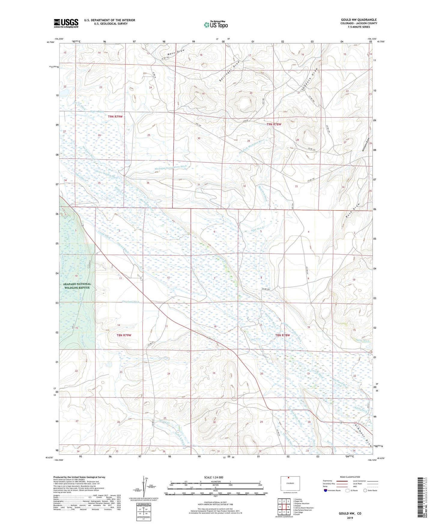
2022 topographic map quadrangle Gould NW in the state of Colorado. Scale: 1:24000. Based on the newly updated USGS 7.5' US Topo map series, this map is in the following counties: Jackson. The map contains contour data, water features, and other items you are used to seeing on USGS maps, but also has updated roads and other features. This is the next generation of topographic maps. Printed on high-quality waterproof paper with UV fade-resistant inks.
Quads adjacent to this one:
West: Walden
Northwest: Cowdrey
North: Eagle Hill
Northeast: Shipman Mountain
East: Johnny Moore Mountain
Southeast: Gould
South: Owl Ridge
Southwest: MacFarlane Reservoir
This map covers the same area as the classic USGS quad with code o40106f2.
Contains the following named places: Bostwick Ditch, Capron Mine, Carden Dagle Ditch, Cleveland Ditch, Conrad Coal Mine, Curtin Ditch, Dike Ditch, Dry Fork Michigan River, Edith Ditch, Hill and Crouter Ditch, Hugh Griffith Ditch, Hugh Griffith Ditch Number 2, Jackson Reservoir, Jakey Ditch, Kimmons Draw, Lower Walden Ditch, Mac Farlane Meadows Ditch, Manning Coal Mines, Martin Ditch, Mathews Ditch, Mathews Eastern Ditch, Meadow Creek, Meadow Creek Ditch, Michigan Association Ditch, Monolith Mine, Nancy Jane Ditch, Nellie E Ditch, Old S C Ditch, Owl Creek, Paul Ditch Number 1, Paul Ditch Number 2, Sage Hen Creek, Spring Creek, Sudduth Coal Mine, Terrel Ditch, Terrell Ditch, Three Rivers Ranch, Walden Ditch, Wales Ditch