MyTopo
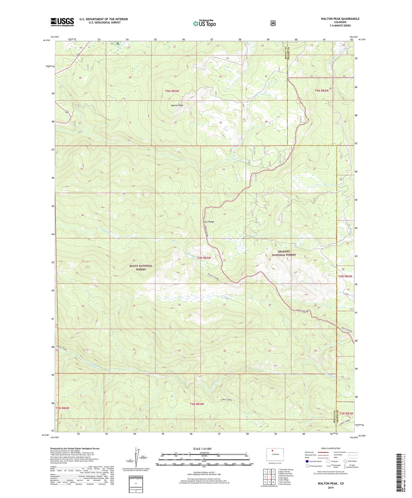
Walton Peak Colorado US Topo Map
Couldn't load pickup availability
Also explore the Walton Peak Forest Service Topo of this same quad for updated USFS data
2022 topographic map quadrangle Walton Peak in the state of Colorado. Scale: 1:24000. Based on the newly updated USGS 7.5' US Topo map series, this map is in the following counties: Routt, Grand. The map contains contour data, water features, and other items you are used to seeing on USGS maps, but also has updated roads and other features. This is the next generation of topographic maps. Printed on high-quality waterproof paper with UV fade-resistant inks.
Quads adjacent to this one:
West: Blacktail Mountain
Northwest: Steamboat Springs
North: Mount Werner
Northeast: Rabbit Ears Peak
East: Lake Agnes
Southeast: Tyler Mountain
South: Gore Mountain
Southwest: Green Ridge
This map covers the same area as the classic USGS quad with code o40106c6.
Contains the following named places: Buffalo Park Trail, Meadows Campground, Sarvis Creek Wilderness, Service Creek Trail, Walton Peak