MyTopo
Rabbit Ears Peak Colorado US Topo Map
Couldn't load pickup availability
Also explore the Rabbit Ears Peak Forest Service Topo of this same quad for updated USFS data
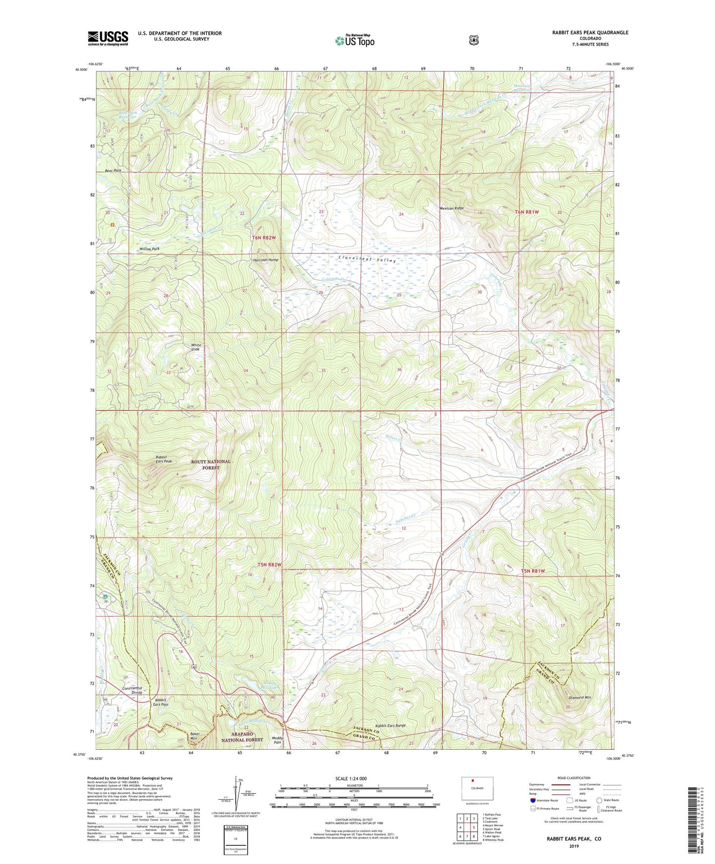
2022 topographic map quadrangle Rabbit Ears Peak in the state of Colorado. Scale: 1:24000. Based on the newly updated USGS 7.5' US Topo map series, this map is in the following counties: Jackson, Grand. The map contains contour data, water features, and other items you are used to seeing on USGS maps, but also has updated roads and other features. This is the next generation of topographic maps. Printed on high-quality waterproof paper with UV fade-resistant inks.
Quads adjacent to this one:
West: Mount Werner
Northwest: Buffalo Pass
North: Teal Lake
Northeast: Coalmont
East: Spicer Peak
Southeast: Whiteley Peak
South: Lake Agnes
Southwest: Walton Peak
This map covers the same area as the classic USGS quad with code o40106d5.
Contains the following named places: Baker Mountain, Bear Park, Bear Park Dam, Bear Park Reservoir, Black Bunny Mine, Bonanza Mine, Cloverleaf Valley, Colorado Creek, Diamond Mountain, Fancher Creek, Grizzly Helena Trail, Harrison Hump, McGowan Dam, McGowan Homestead, McGowan Reservoir, Muddy Pass, Muddy Pass Dam, Muddy Pass Lake, Rabbit Ears Manganese Deposits, Rabbit Ears Pass, Rabbit Ears Peak, White Slide, Willow Park, Wilset Creek